TopoQuest Logo
Do you find TopoQuest useful?
Help keep TopoQuest running and adding new maps/features by donating!
Bitcoin:  19c7KJd3qBynnjoSw5npx9KScwjBe4ifkT
Litecoin:  LXs6TkuXGGXo1vDsWCkWVdjQX94eUKd6ui
Home View Maps Find Maps Find Places Resources & Links


Murphys, California Topographic Map

USGS Map Title: Murphys, CA
USGS Map MRC: 38120B4
DRG (GeoTIFF) Download: o38120b4.tif


Neighboring USGS Topographic Map Quads:


  Rail Road Flat, CA  
38120C5
 

  Fort Mountain, CA  
38120C4
 

  Dorrington, CA  
38120C3
 

  Calaveritas, CA  
38120B5
 

  Murphys, CA  
38120B4
 

  Stanislaus, CA  
38120B3
 

  Angels Camp, CA  
38120A5
 

  Columbia, CA  
38120A4
 

  Columbia SE, CA  
38120A3


Map MRC Location:

N39°
W121°
N39°
W120°
H8 H7 H6 H5 H4 H3 H2 H1
G8 G7 G6 G5 G4 G3 G2 G1
F8 F7 F6 F5 F4 F3 F2 F1
E8 E7 E6 E5 E4 E3 E2 E1
D8 D7 D6 D5 D4 D3 D2 D1
C8 C7 C6 C5 C4 C3 C2 C1
B8 B7 B6 B5 B4 B3 B2 B1
A8 A7 A6 A5 A4 A3 A2 A1
N38°
W121°
N38°
W120°

Murphys, CA USGS 1:24K Topographic Map Preview:
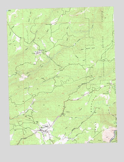
Murphys, CA USGS Topographic Map
Click on map above to begin viewing in our Map Viewer.

This topographic map contains these locations and features:
Feature Name Type Latitude Longitude GNIS ID View Map
Albert A Michelson Elementary SchoolSchoolN38.1332°W120.4540°1804861View Map
Avery Census Designated PlaceCensusN38.1939°W120.3791°2407784View Map
Bassella CreekStreamN38.2266°W120.4683°256583View Map
Big ValleyPopulated PlaceN38.1319°W120.4280°1804863View Map
Black Bart PlayhouseBuildingN38.1341°W120.4624°1804864View Map
Black Sheep VintersBuildingN38.1383°W120.4685°1804865View Map
Bret Harte CenterBuildingN38.1452°W120.4566°1804866View Map
Bret Harte SanatoriumBuildingN38.1413°W120.4591°257445View Map
Brownsville State Historic LandmarkParkN38.1291°W120.4391°1804867View Map
California Conservaton Corps AcademySchoolN38.1416°W120.4583°1804868View Map
California District Forest Fire StationLocaleN38.1374°W120.4655°1652898View Map
Cedar VistaPopulated PlaceN38.1694°W120.4080°1804870View Map
Central Calaveras Fire and Rescue Protection District Station 5BuildingN38.2094°W120.4641°2624475View Map
Church of ChristChurchN38.1369°W120.4577°1804871View Map
Cowell CreekStreamN38.2221°W120.4108°1655201View Map
Darby KnobSummitN38.1713°W120.3852°259045View Map
Darby Knob FirebreakTrailN38.1524°W120.3835°259046View Map
Department of Forestry and Fire Protection MurphysBuildingN38.1443°W120.4513°2624343View Map
Dunlap GulchValleyN38.2141°W120.4269°259615View Map
Faith Lutheran ChurchChurchN38.1371°W120.4596°1804873View Map
First Congregational ChurchChurchN38.1388°W120.4649°1804874View Map
Fisher PlacePopulated PlaceN38.2352°W120.4508°1658541View Map
Forest MeadowFlatN38.1699°W120.3855°1652897View Map
Forest MeadowsPopulated PlaceN38.1680°W120.4055°1804875View Map
Forest Meadows 1495 DamDamN38.1599°W120.4127°1664432View Map
Forest Meadows Census Designated PlaceCensusN38.1664°W120.4052°2408228View Map
Forest Meadows Golf CourseLocaleN38.1630°W120.4094°1804876View Map
Fricot DitchCanalN38.1933°W120.4705°260415View Map
Hanford HillPopulated PlaceN38.1744°W120.4035°1804877View Map
Indian Burying GulchValleyN38.2149°W120.4235°261713View Map
Indian CreekPopulated PlaceN38.1816°W120.4344°1804879View Map
Indian HillsPopulated PlaceN38.1735°W120.3774°1804880View Map
Indian Rock VineyardsLocaleN38.1271°W120.4408°1804881View Map
Macks GulchValleyN38.2210°W120.4713°263102View Map
Marjon MineMineN38.1871°W120.4452°263215View Map
Milliare WineryLocaleN38.1383°W120.4602°1804882View Map
Mineral MountainSummitN38.1891°W120.4502°1652900View Map
Mitchler HotelBuildingN38.1374°W120.4652°1804883View Map
Murphy's Community ChurchChurchN38.1356°W120.4637°2743565View Map
MurphysPopulated PlaceN38.1374°W120.4596°277560View Map
Murphys Afterbay 97-117 DamDamN38.1462°W120.4481°1663673View Map
Murphys Branch Calaveras County LibraryBuildingN38.1380°W120.4641°1804885View Map
Murphys Census Designated PlaceCensusN38.1447°W120.4348°2408892View Map
Murphys Fire Protection District Station 1 HeadquartersBuildingN38.1354°W120.4568°2624499View Map
Murphys Forebay 97-127 DamDamN38.1488°W120.4339°1663684View Map
Murphys ParkParkN38.1369°W120.4641°1804886View Map
Murphys Post OfficePost OfficeN38.1380°W120.4578°1804889View Map
Murphys RanchLocaleN38.1305°W120.4385°1804887View Map
Murphys State Historic LandmarkParkN38.1377°W120.4633°1804888View Map
Native Daughters HallBuildingN38.1377°W120.4596°1804890View Map
Neds GulchValleyN38.2138°W120.4333°264017View Map
Oak RIdgeRidgeN38.2349°W120.4969°1652899View Map
Old Timers MuseumBuildingN38.1380°W120.4663°1804891View Map
Oro Plata MineMineN38.1455°W120.4683°264401View Map
Pennsylvania GulchValleyN38.1308°W120.4399°264639View Map
Peppermint CreekStreamN38.1294°W120.4313°264645View Map
Quartz CreekStreamN38.1527°W120.4860°265096View Map
Red ApplePopulated PlaceN38.1788°W120.3816°265252View Map
Red Top MineMineN38.1535°W120.4024°265339View Map
Right Bower MineMineN38.1849°W120.4605°265420View Map
Rocky HillPopulated PlaceN38.1455°W120.4671°1804893View Map
Saint Patricks Catholic ChurchChurchN38.1399°W120.4663°1804894View Map
Sheep RanchPopulated PlaceN38.2094°W120.4641°266076View Map
Sheep Ranch Indian Reservation (historical)CivilN38.2058°W120.4685°1804895View Map
Sheep Ranch MineMineN38.2085°W120.4694°266077View Map
Sierra Covenant ChurchChurchN38.1371°W120.4621°1804896View Map
Skull RanchLocaleN38.2144°W120.4241°1652901View Map
Tanner 1490 DamDamN38.2316°W120.3777°1664331View Map
Timber TrailsPopulated PlaceN38.1969°W120.3996°1804898View Map
Timber TrailsTrailN38.2008°W120.3866°1652896View Map
Traver BuildingBuildingN38.1380°W120.4674°1804899View Map
Utica PowerhouseLocaleN38.1524°W120.4399°1654499View Map
Vallecito Union Elementary SchoolSchoolN38.1358°W120.4577°1804900View Map
WyldewoodPopulated PlaceN38.1458°W120.4541°1804901View Map

Note: Coordinates in the location and feature list above are referenced to NAD83 datum.


Copyright (C) 2008-2024 Ryan Niemi / Sunset Dynamics ... All Rights Reserved