TopoQuest Logo
Do you find TopoQuest useful?
Help keep TopoQuest running and adding new maps/features by donating!
Bitcoin:  19c7KJd3qBynnjoSw5npx9KScwjBe4ifkT
Litecoin:  LXs6TkuXGGXo1vDsWCkWVdjQX94eUKd6ui
Home View Maps Find Maps Find Places Resources & Links


Minden, Texas Topographic Map

USGS Map Title: Minden, TX
USGS Map MRC: 32094A6
DRG (GeoTIFF) Download: o32094a6.tif


Neighboring USGS Topographic Map Quads:


  Henderson, TX  
32094B7
 

  Church Hill, TX  
32094B6
 

  Fair Play, TX  
32094B5
 

  Berryhill Creek, TX  
32094A7
 

  Minden, TX  
32094A6
 

  Long Branch, TX  
32094A5
 

  Laneville, TX  
31094H7
 

  Mount Enterprise, TX  
31094H6
 

  Caledonia, TX  
31094H5


Map MRC Location:

N33°
W95°
N33°
W94°
H8 H7 H6 H5 H4 H3 H2 H1
G8 G7 G6 G5 G4 G3 G2 G1
F8 F7 F6 F5 F4 F3 F2 F1
E8 E7 E6 E5 E4 E3 E2 E1
D8 D7 D6 D5 D4 D3 D2 D1
C8 C7 C6 C5 C4 C3 C2 C1
B8 B7 B6 B5 B4 B3 B2 B1
A8 A7 A6 A5 A4 A3 A2 A1
N32°
W95°
N32°
W94°

Minden, TX USGS 1:24K Topographic Map Preview:
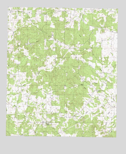
Minden, TX USGS Topographic Map
Click on map above to begin viewing in our Map Viewer.

This topographic map contains these locations and features:
Feature Name Type Latitude Longitude GNIS ID View Map
BrachfieldPopulated PlaceN32.0460°W94.6485°1378042View Map
Dry BranchStreamN32.1166°W94.6702°1334643View Map
Eastside Volunteer Fire DepartmentBuildingN32.0440°W94.6479°2655378View Map
Hughes CemeteryCemeteryN32.1199°W94.6999°1343167View Map
Hunt CemeteryCemeteryN32.1085°W94.7019°1338304View Map
Lake ManrReservoirN32.0902°W94.7255°1861214View Map
Lake Manr DamDamN32.0885°W94.7302°1861213View Map
Little Family CemeteryCemeteryN32.0904°W94.6699°1340094View Map
Lone Star ChurchChurchN32.0779°W94.7297°1340393View Map
Maple Grove ChurchChurchN32.0099°W94.6985°1340912View Map
Maxwell BranchStreamN32.0371°W94.6302°1341099View Map
McCann BranchStreamN32.0343°W94.6260°1341146View Map
MindenPopulated PlaceN32.0135°W94.7074°1341704View Map
Old Minden CemeteryCemeteryN32.0227°W94.6883°1343183View Map
Owens CreekStreamN32.0282°W94.7385°1329136View Map
Pine Grove ChurchChurchN32.0952°W94.6966°1344048View Map
Pine Grove ChurchChurchN32.1024°W94.6538°1344049View Map
Pinehill DivisionCivilN32.1082°W94.6570°1939089View Map
Pinehurst SchoolSchoolN32.1241°W94.7327°1344087View Map
Pleasant Springs ChurchChurchN32.0574°W94.6347°1344246View Map
Prospect ChurchChurchN32.0307°W94.6813°1344591View Map
Reese Shiloh ChurchChurchN32.1191°W94.7108°1345009View Map
Roquemore ChurchChurchN32.1221°W94.6883°1345548View Map
Welch CemeteryCemeteryN32.0616°W94.6702°1349617View Map
Welch Springs BranchStreamN32.0341°W94.6355°1349621View Map
Winfrey BranchStreamN32.0332°W94.6272°1350416View Map
Zion Hill ChurchChurchN32.0499°W94.6841°1350759View Map

Note: Coordinates in the location and feature list above are referenced to NAD83 datum.


Copyright (C) 2008-2024 Ryan Niemi / Sunset Dynamics ... All Rights Reserved