TopoQuest Logo
Do you find TopoQuest useful?
Help keep TopoQuest running and adding new maps/features by donating!
Bitcoin:  19c7KJd3qBynnjoSw5npx9KScwjBe4ifkT
Litecoin:  LXs6TkuXGGXo1vDsWCkWVdjQX94eUKd6ui
Home View Maps Find Maps Find Places Resources & Links


Meadows of Dan, Virginia Topographic Map

USGS Map Title: Meadows of Dan, VA
USGS Map MRC: 36080F4
DRG (GeoTIFF) Download: o36080f4.tif


Neighboring USGS Topographic Map Quads:


  Dugspur, VA  
36080G5
 

  Willis, VA  
36080G4
 

  Woolwine, VA  
36080G3
 

  Laurel Fork, VA  
36080F5
 

  Meadows of Dan, VA  
36080F4
 

  Stuart, VA  
36080F3
 

  Mount Airy North, NC  
36080E5
 

  Claudville, VA  
36080E4
 

  Stuart SE, VA  
36080E3


Map MRC Location:

N37°
W81°
N37°
W80°
H8 H7 H6 H5 H4 H3 H2 H1
G8 G7 G6 G5 G4 G3 G2 G1
F8 F7 F6 F5 F4 F3 F2 F1
E8 E7 E6 E5 E4 E3 E2 E1
D8 D7 D6 D5 D4 D3 D2 D1
C8 C7 C6 C5 C4 C3 C2 C1
B8 B7 B6 B5 B4 B3 B2 B1
A8 A7 A6 A5 A4 A3 A2 A1
N36°
W81°
N36°
W80°

Meadows of Dan, VA USGS 1:24K Topographic Map Preview:
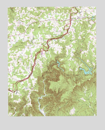
Meadows of Dan, VA USGS Topographic Map
Click on map above to begin viewing in our Map Viewer.

This topographic map contains these locations and features:
Feature Name Type Latitude Longitude GNIS ID View Map
Banks CemeteryCemeteryN36.6804°W80.4717°1738593View Map
Barnard CemeteryCemeteryN36.7118°W80.4645°1738416View Map
Barnard CreekStreamN36.6801°W80.4401°1462796View Map
Belair SpringsPopulated PlaceN36.6271°W80.4778°1495251View Map
Bell SpurLocaleN36.6571°W80.4723°1463029View Map
Bell Spur CemeteryCemeteryN36.6568°W80.4728°1738421View Map
Bell Spur ChurchChurchN36.6574°W80.4728°1497927View Map
Bell Spur School (historical)SchoolN36.6565°W80.4784°1497928View Map
Bent Springs BranchStreamN36.6501°W80.4273°1463084View Map
Big Bend of DanBendN36.6699°W80.3856°1463302View Map
Big Cherry CreekStreamN36.6799°W80.3795°1463337View Map
Bowman CemeteryCemeteryN36.6560°W80.4995°1738611View Map
Bowman CemeteryCemeteryN36.6687°W80.4940°1738612View Map
Buffalo School (historical)SchoolN36.7493°W80.4662°1498378View Map
Cedar BluffSummitN36.6709°W80.4526°1464583View Map
Cockram MillLocaleN36.7368°W80.3823°1497943View Map
Cockram MillpondReservoirN36.7366°W80.3819°1465043View Map
Cockram RidgeRidgeN36.7235°W80.3976°1497944View Map
Cocram Mill DamDamN36.7367°W80.3820°1490551View Map
Concord ChurchChurchN36.7335°W80.4023°1465155View Map
Coxes BranchStreamN36.6307°W80.4542°1465366View Map
Culler CemeteryCemeteryN36.6649°W80.4815°1738652View Map
Dam on Headwaters of Squall Creek DamDamN36.6585°W80.4631°1490549View Map
Danube CemeteryCemeteryN36.6287°W80.4487°1497952View Map
Danube ChurchChurchN36.6274°W80.4484°1465598View Map
Dickerson School (historical)SchoolN36.7287°W80.4712°1498379View Map
Dillard CemeteryCemeteryN36.7287°W80.4903°1738663View Map
East KnobSummitN36.7251°W80.4801°1466108View Map
Emmitt D Stanley CemeteryCemeteryN36.6660°W80.4878°1738680View Map
Free Union School (historical)SchoolN36.7051°W80.3770°1497958View Map
Great Falls of DanFallsN36.6854°W80.4367°1497966View Map
Greene KnobSummitN36.7099°W80.4720°1738710View Map
Groundhog Mountain AirportAirportN36.6633°W80.4991°2675577View Map
Haunted BranchStreamN36.6829°W80.4434°1467834View Map
Hickory CoveValleyN36.6469°W80.4338°1467978View Map
Hurricane KnobSummitN36.7076°W80.4531°1495734View Map
Ivy CreekStreamN36.6799°W80.3795°1468554View Map
James Bowman CemeteryCemeteryN36.6715°W80.4695°1738423View Map
James Webb CemeteryCemeteryN36.7379°W80.4995°1738742View Map
Jessup CemeteryCemeteryN36.6896°W80.4823°1738747View Map
Joes KnobSummitN36.6626°W80.3762°1495762View Map
Kibler School (historical)SchoolN36.6376°W80.4559°1497976View Map
Kibler ValleyValleyN36.6314°W80.4543°1468989View Map
Kibler ValleyPopulated PlaceN36.6310°W80.4528°1495789View Map
Little Stone MountainSummitN36.7090°W80.4812°1495852View Map
Maple Shade CemeteryCemeteryN36.7218°W80.4873°1738784View Map
Maple Shade ChurchChurchN36.7243°W80.4887°1470077View Map
Maple Swamp BranchStreamN36.7140°W80.4220°1470080View Map
Marshall-Bowman CemeteryCemeteryN36.6837°W80.4645°1738793View Map
Mayberry CemeteryCemeteryN36.7126°W80.4378°1497983View Map
Mayberry ChurchChurchN36.7124°W80.4378°1470207View Map
Mayberry CreekStreamN36.6929°W80.4278°1470208View Map
Mayberry School (historical)SchoolN36.7124°W80.4376°1497984View Map
Meadows of DanLocaleN36.7365°W80.3953°1470328View Map
Meadows of Dan CemeteryCemeteryN36.7354°W80.4098°1497986View Map
Meadows of Dan ChurchChurchN36.7357°W80.4090°1470329View Map
Meadows of Dan Elementary SchoolSchoolN36.7368°W80.4009°1497987View Map
Meadows of Dan Post OfficePost OfficeN36.7385°W80.3912°2766391View Map
Meadows of Dan Volunteer Fire DepartmentBuildingN36.7364°W80.4023°2086072View Map
Micro AirportAirportN36.7355°W80.4508°1498822View Map
Mill CreekStreamN36.6671°W80.4051°1470474View Map
New Bell Spur CemeteryCemeteryN36.6799°W80.4712°1738830View Map
New Bell Spur ChurchChurchN36.6796°W80.4712°1471385View Map
Oak KnobSummitN36.7262°W80.4573°1496031View Map
Otter ArmRidgeN36.6960°W80.4006°1471963View Map
Painter CemeteryCemeteryN36.6546°W80.4970°1738850View Map
Pike CityPopulated PlaceN36.7312°W80.4828°1496082View Map
Pine Knot School (historical)SchoolN36.6768°W80.4995°1738861View Map
Pinnacle View School (historical)SchoolN36.6910°W80.4545°1498007View Map
Pinnacles of DanSummitN36.6740°W80.4387°1472424View Map
Pinnacles PowerplantLocaleN36.6668°W80.4476°1491218View Map
Point LookoutSummitN36.6890°W80.4331°1496100View Map
Quaker Field BranchStreamN36.7349°W80.3837°1472887View Map
Raven RockPillarN36.6343°W80.4953°1473021View Map
Reed Island Springs CemeteryCemeteryN36.7062°W80.4695°1738871View Map
Reed Island Springs ChurchChurchN36.7054°W80.4692°1473091View Map
Roaring CreekStreamN36.6493°W80.4453°1473301View Map
Round Meadow CreekStreamN36.6868°W80.4292°1473584View Map
Round Meadow OverlookLocaleN36.7162°W80.4231°1473585View Map
Sal Hooker HollowBasinN36.6529°W80.3889°1473931View Map
Sawpit BranchStreamN36.6926°W80.4245°1474082View Map
SawteethRidgeN36.6623°W80.3953°1496185View Map
Silver Valley School (historical)SchoolN36.7201°W80.4915°1738899View Map
Sollie Alderman CemeteryCemeteryN36.7190°W80.4759°1738904View Map
Squall CreekStreamN36.6646°W80.4492°1475039View Map
Squall Creek PondReservoirN36.6585°W80.4631°1490550View Map
Squirrel SpurRidgeN36.6460°W80.4687°1475045View Map
Stanley CemeteryCemeteryN36.6660°W80.4834°1738906View Map
Stone MountainSummitN36.7046°W80.4781°1475180View Map
Talbott DamDamN36.6768°W80.3964°1490544View Map
Talbott DamDamN36.6780°W80.3972°1475439View Map
Talbott ReservoirReservoirN36.6768°W80.3964°1490545View Map
Terry CemeteryCemeteryN36.6768°W80.4915°1738920View Map
Terry-Barnard CemeteryCemeteryN36.6868°W80.4595°1738426View Map
The KnobSummitN36.7115°W80.4128°1475584View Map
Thompson CreekStreamN36.6290°W80.4892°1475657View Map
Tory Creek ChurchChurchN36.7262°W80.4573°1475791View Map
Townes DamDamN36.6863°W80.4304°1502146View Map
Townes DamDamN36.6854°W80.4303°1502318View Map
Townes ReservoirReservoirN36.6799°W80.4255°1490546View Map
Tuggle CreekStreamN36.7032°W80.3981°1475921View Map
Turkey Nest KnobSummitN36.7487°W80.4534°1496331View Map
Turman CemeteryCemeteryN36.6899°W80.4892°1738934View Map
Turnip Patch RidgeRidgeN36.7443°W80.4501°1475991View Map
Vesta Rescue SquadBuildingN36.7364°W80.4023°2721137View Map
Wildcat KnobSummitN36.6710°W80.4131°1496418View Map

Note: Coordinates in the location and feature list above are referenced to NAD83 datum.


Copyright (C) 2008-2024 Ryan Niemi / Sunset Dynamics ... All Rights Reserved