TopoQuest Logo
Do you find TopoQuest useful?
Help keep TopoQuest running and adding new maps/features by donating!
Bitcoin:  19c7KJd3qBynnjoSw5npx9KScwjBe4ifkT
Litecoin:  LXs6TkuXGGXo1vDsWCkWVdjQX94eUKd6ui
Home View Maps Find Maps Find Places Resources & Links


Leighton, Alabama Topographic Map

USGS Map Title: Leighton, AL
USGS Map MRC: 34087F5
DRG (GeoTIFF) Download: o34087f5.tif


Neighboring USGS Topographic Map Quads:


  Florence, AL  
34087G6
 

  Killen, AL  
34087G5
 

  Wheeler Dam, AL  
34087G4
 

  Tuscumbia, AL  
34087F6
 

  Leighton, AL  
34087F5
 

  Town Creek, AL  
34087F4
 

  Russellville, AL  
34087E6
 

  Old Bethel, AL  
34087E5
 

  Hatton, AL  
34087E4


Map MRC Location:

N35°
W88°
N35°
W87°
H8 H7 H6 H5 H4 H3 H2 H1
G8 G7 G6 G5 G4 G3 G2 G1
F8 F7 F6 F5 F4 F3 F2 F1
E8 E7 E6 E5 E4 E3 E2 E1
D8 D7 D6 D5 D4 D3 D2 D1
C8 C7 C6 C5 C4 C3 C2 C1
B8 B7 B6 B5 B4 B3 B2 B1
A8 A7 A6 A5 A4 A3 A2 A1
N34°
W88°
N34°
W87°

Leighton, AL USGS 1:24K Topographic Map Preview:
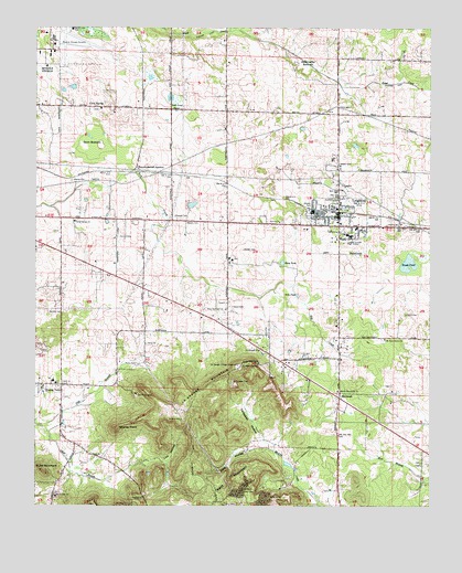
Leighton, AL USGS Topographic Map
Click on map above to begin viewing in our Map Viewer.

This topographic map contains these locations and features:
Feature Name Type Latitude Longitude GNIS ID View Map
Abernathy BottomFlatN34.7409°W87.5397°112893View Map
Adams CemeteryCemeteryN34.7101°W87.6139°112920View Map
Alcock PondLakeN34.6993°W87.6025°132806View Map
Aycock CemeteryCemeteryN34.6954°W87.5989°113318View Map
Bates Pond (historical)LakeN34.7359°W87.5689°132812View Map
Bickley CemeteryCemeteryN34.6756°W87.6209°114210View Map
Bickley PointSummitN34.6454°W87.5995°114211View Map
Blythe Memorial CemeteryCemeteryN34.6551°W87.5292°114625View Map
Blythe Memorial ChurchChurchN34.6579°W87.5292°158187View Map
Brickley Place (historical)LocaleN34.6540°W87.5995°132821View Map
Brush PondLakeN34.6884°W87.5070°115054View Map
Campbell HollowValleyN34.6418°W87.5520°115500View Map
Campbell Settlement (historical)Populated PlaceN34.6473°W87.5464°132827View Map
Cave SpringPopulated PlaceN34.7293°W87.6042°150844View Map
Cave Springs Missionary Baptist ChurchChurchN34.7290°W87.6048°132831View Map
Christian Home Church of ChristChurchN34.6673°W87.5903°153150View Map
Colbert County High SchoolSchoolN34.6956°W87.5250°116378View Map
Cole CemeteryCemeteryN34.7334°W87.6003°116404View Map
College SpringSpringN34.6616°W87.5593°116424View Map
Duke MountainSummitN34.6340°W87.6225°117643View Map
Emco-Listerhill JunctionPopulated PlaceN34.7137°W87.5934°156315View Map
Faith TabernacleChurchN34.6623°W87.5545°118168View Map
Ford City ChurchChurchN34.7015°W87.5170°132884View Map
Galilee ChurchChurchN34.6993°W87.5481°118788View Map
Gargis CemeteryCemeteryN34.6920°W87.5592°118833View Map
Glendale CemeteryCemeteryN34.7001°W87.5814°119034View Map
Glendale Presbyterian Church (historical)ChurchN34.7001°W87.5817°132896View Map
Gnat PondLakeN34.7427°W87.5458°132897View Map
Gnat PondSwampN34.7312°W87.5809°119062View Map
Gum BottomBasinN34.7193°W87.6048°119470View Map
Hackberry School (historical)SchoolN34.6990°W87.5897°132902View Map
Haw PondLakeN34.7370°W87.5888°141129View Map
Hunter (historical)Populated PlaceN34.6412°W87.6125°166019View Map
Hunter Post Office (historical)Post OfficeN34.6412°W87.6125°169266View Map
Isbell BranchStreamN34.6462°W87.6236°151865View Map
Jenkins CemeteryCemeteryN34.6473°W87.5789°120844View Map
Kent HollowValleyN34.6401°W87.5511°121158View Map
Kent MountainSummitN34.6301°W87.5567°121159View Map
La Grange (historical)Populated PlaceN34.6612°W87.5603°166021View Map
La Grange College (historical)SchoolN34.6612°W87.5606°132934View Map
La Grange Post Office (historical)Post OfficeN34.6612°W87.5603°169276View Map
LaGrange CemeteryCemeteryN34.6573°W87.5628°121292View Map
LaGrange ChurchChurchN34.6656°W87.5542°121293View Map
LaGrange College MonumentParkN34.6618°W87.5609°121294View Map
LaGrange MountainSummitN34.6501°W87.5756°151972View Map
Leigh CemeteryCemeteryN34.6984°W87.5136°121494View Map
LeightonPopulated PlaceN34.7009°W87.5289°152020View Map
Leighton City Police DepartmentBuildingN34.7029°W87.5284°2751975View Map
Leighton DivisionCivilN34.6996°W87.5244°165713View Map
Leighton Elementary SchoolSchoolN34.7020°W87.5372°132937View Map
Leighton Middle SchoolSchoolN34.7029°W87.5284°132938View Map
Leighton Post OfficePost OfficeN34.7039°W87.5295°2789059View Map
Leighton Volunteer Fire DepartmentBuildingN34.7019°W87.5299°2682782View Map
Lick HollowValleyN34.6356°W87.5950°121600View Map
Mayers CemeteryCemeteryN34.6990°W87.5775°122417View Map
McReynolds CrossroadsLocaleN34.7001°W87.6173°132955View Map
Mount Moriah Baptist ChurchChurchN34.6276°W87.6186°152450View Map
Mount New Home Baptist ChurchChurchN34.6687°W87.5145°152453View Map
Muscle Shoals Fire Department Station 2BuildingN34.7460°W87.6201°2682992View Map
New Sockwell ChurchChurchN34.6765°W87.5650°152681View Map
Newfound School (historical)SchoolN34.6687°W87.5136°132982View Map
Northwest Alabama Regional AirportAirportN34.7452°W87.6187°165645View Map
Poplar Pond (historical)LakeN34.7331°W87.5267°132998View Map
Preuit CemeteryCemeteryN34.6751°W87.5075°125259View Map
Rand CemeteryCemeteryN34.6768°W87.5631°125431View Map
Ricks CemeteryCemeteryN34.6620°W87.5931°125621View Map
Ricks School (historical)SchoolN34.6670°W87.5900°133008View Map
Riley PondLakeN34.6888°W87.5468°125642View Map
Sand RockPillarN34.6620°W87.5597°133021View Map
Sand SpringSpringN34.6570°W87.5547°133022View Map
Sink PondLakeN34.6801°W87.5422°126902View Map
Sockwell School (historical)SchoolN34.6765°W87.5631°133034View Map
Spring ValleyPopulated PlaceN34.6568°W87.6167°127269View Map
Spring Valley Elementary SchoolSchoolN34.6579°W87.6195°165594View Map
Spring Valley Volunteer Fire DepartmentBuildingN34.6317°W87.5940°2682673View Map
Town of LeightonCivilN34.6986°W87.5291°2406001View Map
Valley GrovePopulated PlaceN34.7001°W87.6125°133060View Map
Valley Grove Baptist ChurchChurchN34.6995°W87.6128°153830View Map
White Oak Volunteer Fire DepartmentBuildingN34.6558°W87.5290°2682950View Map
WhiteoakPopulated PlaceN34.6531°W87.5286°128904View Map
Whiteoak School (historical)SchoolN34.6543°W87.5278°133073View Map
Wilson CemeteryCemeteryN34.7145°W87.5289°129073View Map

Note: Coordinates in the location and feature list above are referenced to NAD83 datum.


Copyright (C) 2008-2024 Ryan Niemi / Sunset Dynamics ... All Rights Reserved