TopoQuest Logo
Do you find TopoQuest useful?
Help keep TopoQuest running and adding new maps/features by donating!
Bitcoin:  19c7KJd3qBynnjoSw5npx9KScwjBe4ifkT
Litecoin:  LXs6TkuXGGXo1vDsWCkWVdjQX94eUKd6ui
Home View Maps Find Maps Find Places Resources & Links


Lake Cameron, Montana Topographic Map

USGS Map Title: Lake Cameron, MT
USGS Map MRC: 45111B5
DRG (GeoTIFF) Download: o45111b5.tif


Neighboring USGS Topographic Map Quads:


  Ennis, MT  
45111C6
 

  Fan Mountain, MT  
45111C5
 

  Lone Mountain, MT  
45111C4
 

  Cameron, MT  
45111B6
 

  Lake Cameron, MT  
45111B5
 

  Sphinx Mountain, MT  
45111B4
 

  Bucks Nest, MT  
45111A6
 

  No Man Peak, MT  
45111A5
 

  Koch Peak, MT  
45111A4


Map MRC Location:

N46°
W112°
N46°
W111°
H8 H7 H6 H5 H4 H3 H2 H1
G8 G7 G6 G5 G4 G3 G2 G1
F8 F7 F6 F5 F4 F3 F2 F1
E8 E7 E6 E5 E4 E3 E2 E1
D8 D7 D6 D5 D4 D3 D2 D1
C8 C7 C6 C5 C4 C3 C2 C1
B8 B7 B6 B5 B4 B3 B2 B1
A8 A7 A6 A5 A4 A3 A2 A1
N45°
W112°
N45°
W111°

Lake Cameron, MT USGS 1:24K Topographic Map Preview:
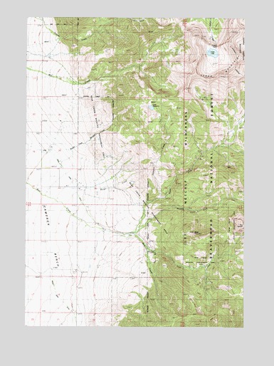
Lake Cameron, MT USGS Topographic Map
Click on map above to begin viewing in our Map Viewer.

This topographic map contains these locations and features:
Feature Name Type Latitude Longitude GNIS ID View Map
08S01E03CABB01 WellWellN45.1666°W111.5900°808265View Map
Bear Creek CemeteryCemeteryN45.1741°W111.5897°1797640View Map
Bear Creek DitchCanalN45.1730°W111.5919°779515View Map
Bear Creek Ranger StationLocaleN45.1563°W111.5536°779519View Map
Bear Creek Wildlife Management AreaParkN45.1824°W111.5636°801843View Map
Black MountainSummitN45.1633°W111.5294°780005View Map
Cameron Community ClubBuildingN45.1694°W111.5969°793693View Map
Cameron CreekStreamN45.1771°W111.5489°780821View Map
Cedar FallsFallsN45.2385°W111.5172°781106View Map
Cedar LakeReservoirN45.2359°W111.5193°781112View Map
Cedar Lake DamDamN45.2349°W111.5208°795935View Map
Cedar MountainSummitN45.2280°W111.5294°781117View Map
Indian Creek DitchCanalN45.1441°W111.6127°785260View Map
Lake CameronLakeN45.2136°W111.5543°780832View Map
Madison RangeRangeN45.2499°W111.5008°786769View Map
Madison Valley DivisionCivilN45.1445°W111.6028°1940665View Map
Middle Fork Bear CreekStreamN45.1630°W111.5633°787239View Map
North Fork Bear CreekStreamN45.1633°W111.5655°788093View Map
North Fork Burger CreekStreamN45.1968°W111.6092°793716View Map
Storey DitchCanalN45.2060°W111.6047°791559View Map
Storey RanchLocaleN45.1816°W111.5966°791560View Map
The HelmetSummitN45.1655°W111.5005°792035View Map
Trail Fork Bear CreekStreamN45.1574°W111.5566°806816View Map

Note: Coordinates in the location and feature list above are referenced to NAD83 datum.


Copyright (C) 2008-2024 Ryan Niemi / Sunset Dynamics ... All Rights Reserved