TopoQuest Logo
Do you find TopoQuest useful?
Help keep TopoQuest running and adding new maps/features by donating!
Bitcoin:  19c7KJd3qBynnjoSw5npx9KScwjBe4ifkT
Litecoin:  LXs6TkuXGGXo1vDsWCkWVdjQX94eUKd6ui
Home View Maps Find Maps Find Places Resources & Links


Iva, South Carolina Topographic Map

USGS Map Title: Iva, SC
USGS Map MRC: 34082C6
DRG (GeoTIFF) Download: o34082c6.tif


Neighboring USGS Topographic Map Quads:


  Hartwell NE, SC  
34082D7
 

  Anderson South, SC  
34082D6
 

  Saylors Crossroads, SC  
34082D5
 

  Hartwell Dam, GA  
34082C7
 

  Iva, SC  
34082C6
 

  Antreville, SC  
34082C5
 

  Rock Branch, GA  
34082B7
 

  Lowndesville, SC  
34082B6
 

  Latimer, SC  
34082B5


Map MRC Location:

N35°
W83°
N35°
W82°
H8 H7 H6 H5 H4 H3 H2 H1
G8 G7 G6 G5 G4 G3 G2 G1
F8 F7 F6 F5 F4 F3 F2 F1
E8 E7 E6 E5 E4 E3 E2 E1
D8 D7 D6 D5 D4 D3 D2 D1
C8 C7 C6 C5 C4 C3 C2 C1
B8 B7 B6 B5 B4 B3 B2 B1
A8 A7 A6 A5 A4 A3 A2 A1
N34°
W83°
N34°
W82°

Iva, SC USGS 1:24K Topographic Map Preview:
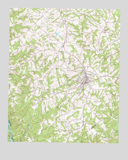
Iva, SC USGS Topographic Map
Click on map above to begin viewing in our Map Viewer.

This topographic map contains these locations and features:
Feature Name Type Latitude Longitude GNIS ID View Map
Anderson County Fire Protection Service StarrBuildingN34.3749°W82.6936°2578200View Map
Anderson County Fire Station GroveBuildingN34.3191°W82.7465°2578355View Map
Anderson County Fire Station IvaBuildingN34.3057°W82.6636°2578362View Map
Barnes ChurchChurchN34.2596°W82.6801°1234024View Map
Barnes School (historical)SchoolN34.2629°W82.6818°1234025View Map
Barnes StationPopulated PlaceN34.2593°W82.6807°1244961View Map
Baskin Pond Dam D-3120DamN34.3218°W82.7015°1239757View Map
Buck Nellis Church (historical)ChurchN34.3209°W82.6637°1233203View Map
Canoe CreekStreamN34.2679°W82.7262°1221329View Map
Craft Mill (historical)LocaleN34.2673°W82.7468°1236641View Map
Crescent High SchoolSchoolN34.3404°W82.6890°1221824View Map
Crooked CreekStreamN34.2501°W82.7140°1221836View Map
Cross Roads Methodist CemeteryCemeteryN34.2959°W82.6804°2052564View Map
Crossroads ChurchChurchN34.2965°W82.6796°1221855View Map
Deep Step CreekStreamN34.3426°W82.6251°1221985View Map
East Beards CreekStreamN34.2721°W82.6262°1222182View Map
East Prong Little Generostee CreekStreamN34.2854°W82.7315°1222192View Map
Generostee ChurchChurchN34.3073°W82.7121°1247884View Map
Generostee School (historical)SchoolN34.2882°W82.7146°1236706View Map
Good Hope Church (historical)ChurchN34.3212°W82.6965°1236711View Map
Good Hope School (historical)SchoolN34.3215°W82.6965°1236712View Map
Goodhope CemeteryCemeteryN34.3187°W82.6949°1245772View Map
Goodhope ChurchChurchN34.3351°W82.6932°1245773View Map
Hebrion CemeteryCemeteryN34.3559°W82.6424°1236734View Map
Hebrion ChurchChurchN34.3554°W82.6424°1245937View Map
Hog BranchStreamN34.3543°W82.6699°1236742View Map
Indian BranchStreamN34.3132°W82.7343°1236762View Map
IvaPopulated PlaceN34.3065°W82.6637°1246134View Map
Iva Baptist ChurchChurchN34.3059°W82.6612°1235832View Map
Iva DivisionCivilN34.3118°W82.6748°1938307View Map
Iva Elementary SchoolSchoolN34.3143°W82.6662°1236767View Map
Iva FieldAirportN34.2952°W82.6835°1251917View Map
Iva Police DepartmentBuildingN34.3048°W82.6633°2734248View Map
Iva Post OfficePost OfficeN34.3065°W82.6620°1252204View Map
Iva Rescue Squad Ambulance ServiceBuildingN34.3023°W82.6654°2739535View Map
Liberty Center School (historical)SchoolN34.3026°W82.6746°1236792View Map
Liberty School (historical)SchoolN34.2704°W82.6657°1236793View Map
MoffitsvillePopulated PlaceN34.2898°W82.7110°1236825View Map
Mount Vernon ChurchChurchN34.2687°W82.6415°1224806View Map
Pine Gap Holiness Church (historical)ChurchN34.2621°W82.7332°1233429View Map
Pleasant Grove Baptist ChurchChurchN34.3537°W82.6426°1250158View Map
Pleasant Grove School (historical)SchoolN34.3679°W82.6460°1233432View Map
Poplar Spring ChurchChurchN34.3126°W82.7496°1250217View Map
Sanders Ferry BridgeBridgeN34.2557°W82.7457°347903View Map
Sanders Ferry BridgeBridgeN34.2557°W82.7457°1233472View Map
Silver Hill School (historical)SchoolN34.2537°W82.6821°1233484View Map
Starr Post OfficePost OfficeN34.3697°W82.6930°1252122View Map
Town of IvaCivilN34.3070°W82.6636°2405896View Map
Union Baptist ChurchChurchN34.2618°W82.6818°1233534View Map
West Beards CreekStreamN34.2784°W82.6324°1229325View Map

Note: Coordinates in the location and feature list above are referenced to NAD83 datum.


Copyright (C) 2008-2024 Ryan Niemi / Sunset Dynamics ... All Rights Reserved