TopoQuest Logo
Do you find TopoQuest useful?
Help keep TopoQuest running and adding new maps/features by donating!
Bitcoin:  19c7KJd3qBynnjoSw5npx9KScwjBe4ifkT
Litecoin:  LXs6TkuXGGXo1vDsWCkWVdjQX94eUKd6ui
Home View Maps Find Maps Find Places Resources & Links


Howard, South Dakota Topographic Map

USGS Map Title: Howard, SD
USGS Map MRC: 44097A5
DRG (GeoTIFF) Download: o44097a5.tif


Neighboring USGS Topographic Map Quads:


  Carthage, SD  
44097B6
 

  Howard NE, SD  
44097B5
 

  Oldham NW, SD  
44097B4
 

  Roswell, SD  
44097A6
 

  Howard, SD  
44097A5
 

  Oldham SW, SD  
44097A4
 

  Bitter Lake, SD  
43097H6
 

  Canova West, SD  
43097H5
 

  Canova East, SD  
43097H4


Map MRC Location:

N45°
W98°
N45°
W97°
H8 H7 H6 H5 H4 H3 H2 H1
G8 G7 G6 G5 G4 G3 G2 G1
F8 F7 F6 F5 F4 F3 F2 F1
E8 E7 E6 E5 E4 E3 E2 E1
D8 D7 D6 D5 D4 D3 D2 D1
C8 C7 C6 C5 C4 C3 C2 C1
B8 B7 B6 B5 B4 B3 B2 B1
A8 A7 A6 A5 A4 A3 A2 A1
N44°
W98°
N44°
W97°

Howard, SD USGS 1:24K Topographic Map Preview:
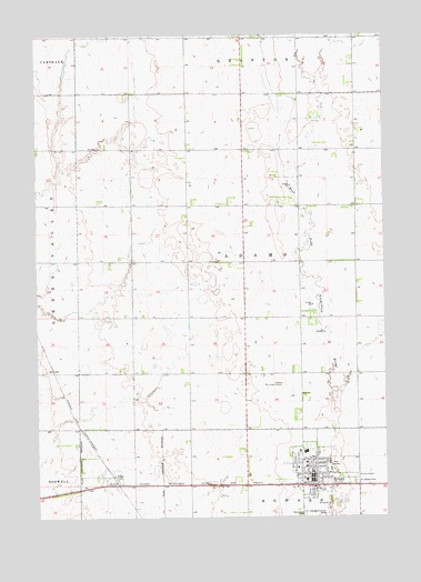
Howard, SD USGS Topographic Map
Click on map above to begin viewing in our Map Viewer.

This topographic map contains these locations and features:
Feature Name Type Latitude Longitude GNIS ID View Map
City of HowardCivilN44.0117°W97.5246°1267429View Map
Graceland CemeteryCemeteryN44.0002°W97.5292°1255318View Map
HowardPopulated PlaceN44.0108°W97.5267°1265656View Map
Howard Elementary SchoolSchoolN44.0130°W97.5290°2728814View Map
Howard Fire DepartmentBuildingN44.0087°W97.5231°2580706View Map
Howard High SchoolSchoolN44.0168°W97.5296°2728815View Map
Howard Junior High SchoolSchoolN44.0168°W97.5296°2728816View Map
Howard Municipal AirportAirportN44.0316°W97.5311°1260192View Map
Howard Municipal BuildingBuildingN44.0110°W97.5265°2725066View Map
Howard Post OfficePost OfficeN44.0113°W97.5265°2710042View Map
Howard Public LibraryBuildingN44.0110°W97.5265°2723589View Map
IOOF CemeteryCemeteryN44.0226°W97.5928°2779248View Map
Miner CountyCivilN44.0220°W97.6102°1265777View Map
Miner County Ambulance ServiceBuildingN44.0092°W97.5239°2659007View Map
Miner County CourthouseBuildingN44.0154°W97.5269°2712681View Map
Miner County Rural Life MuseumBuildingN44.0104°W97.5272°2729334View Map
Miner County Sheriff's OfficeBuildingN44.0154°W97.5269°2755473View Map
Saint John's CemeteryCemeteryN44.0105°W97.5109°1257618View Map
Saint Joseph's CemeteryCemeteryN44.0091°W97.5109°1257645View Map
Town of VilasCivilN44.0083°W97.5959°1267616View Map
Township of AdamsCivilN44.0662°W97.5504°1267727View Map
Township of Howard (historical)CivilN44.0153°W97.5403°1267717View Map
VilasPopulated PlaceN44.0105°W97.5973°1258758View Map

Note: Coordinates in the location and feature list above are referenced to NAD83 datum.


Copyright (C) 2008-2024 Ryan Niemi / Sunset Dynamics ... All Rights Reserved