TopoQuest Logo
Do you find TopoQuest useful?
Help keep TopoQuest running and adding new maps/features by donating!
Bitcoin:  19c7KJd3qBynnjoSw5npx9KScwjBe4ifkT
Litecoin:  LXs6TkuXGGXo1vDsWCkWVdjQX94eUKd6ui
Home View Maps Find Maps Find Places Resources & Links


Hillsboro, Iowa Topographic Map

USGS Map Title: Hillsboro, IA
USGS Map MRC: 40091G6
DRG (GeoTIFF) Download: o40091g6.tif


Neighboring USGS Topographic Map Quads:


  Lockridge West, IA  
40091H7
 

  Lockridge East, IA  
40091H6
 

  Mount Pleasant, IA  
40091H5
 

  Stockport, IA  
40091G7
 

  Hillsboro, IA  
40091G6
 

  Salem, IA  
40091G5
 

  Bonaparte, IA  
40091F7
 

  Farmington, IA  
40091F6
 

  Donnellson, IA  
40091F5


Map MRC Location:

N41°
W92°
N41°
W91°
H8 H7 H6 H5 H4 H3 H2 H1
G8 G7 G6 G5 G4 G3 G2 G1
F8 F7 F6 F5 F4 F3 F2 F1
E8 E7 E6 E5 E4 E3 E2 E1
D8 D7 D6 D5 D4 D3 D2 D1
C8 C7 C6 C5 C4 C3 C2 C1
B8 B7 B6 B5 B4 B3 B2 B1
A8 A7 A6 A5 A4 A3 A2 A1
N40°
W92°
N40°
W91°

Hillsboro, IA USGS 1:24K Topographic Map Preview:
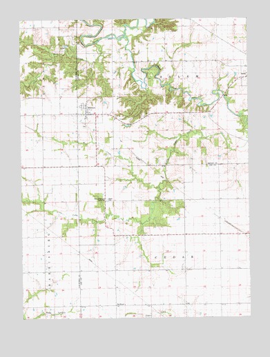
Hillsboro, IA USGS Topographic Map
Click on map above to begin viewing in our Map Viewer.

This topographic map contains these locations and features:
Feature Name Type Latitude Longitude GNIS ID View Map
Bayles CemeteryCemeteryN40.7998°W91.7027°1823543View Map
Big MoundPopulated PlaceN40.7556°W91.7002°1823542View Map
Big Mound Post Office (historical)Post OfficeN40.7556°W91.6993°1981090View Map
Cedar CreekStreamN40.8739°W91.7196°455227View Map
Central ParkParkN40.8361°W91.7135°1981587View Map
City of HillsboroCivilN40.8374°W91.7125°2394387View Map
Coleman Memorial County ParkParkN40.7998°W91.7032°1823544View Map
Cottonwood (historical)LocaleN40.7923°W91.6418°1981089View Map
Cottonwood CemeteryCemeteryN40.7917°W91.6502°1981347View Map
Cottonwood Post Office (historical)Post OfficeN40.7923°W91.6418°1981088View Map
HillsboroPopulated PlaceN40.8367°W91.7157°457502View Map
Hillsboro (historical)LocaleN40.8375°W91.7135°1981573View Map
Hillsboro Baptist ChurchChurchN40.8367°W91.7157°1981571View Map
Hillsboro CemeteryCemeteryN40.8303°W91.7152°1981568View Map
Hillsboro City HallBuildingN40.8367°W91.7157°1981570View Map
Hillsboro Fire and RescueBuildingN40.8357°W91.7133°2577237View Map
Hillsboro Post OfficePost OfficeN40.8367°W91.7157°1981572View Map
Hillsboro Public LibraryBuildingN40.8367°W91.7157°1981569View Map
Hoaglan Woods Recreation AreaParkN40.8570°W91.7002°1981390View Map
Little Cedar CreekStreamN40.8695°W91.6924°458451View Map
Mud CreekStreamN40.8042°W91.6746°1823548View Map
Old Military Road Historical MarkerParkN40.8361°W91.7135°1981588View Map
Rock CreekStreamN40.8650°W91.7077°1823550View Map
Russellville (historical)Populated PlaceN40.7828°W91.6454°465461View Map
Township of CedarCivilN40.7700°W91.6608°467556View Map
Township of SalemCivilN40.8574°W91.6607°468657View Map
Wallingford CemeteryCemeteryN40.7584°W91.7279°1981001View Map

Note: Coordinates in the location and feature list above are referenced to NAD83 datum.


Copyright (C) 2008-2024 Ryan Niemi / Sunset Dynamics ... All Rights Reserved