TopoQuest Logo
Do you find TopoQuest useful?
Help keep TopoQuest running and adding new maps/features by donating!
Bitcoin:  19c7KJd3qBynnjoSw5npx9KScwjBe4ifkT
Litecoin:  LXs6TkuXGGXo1vDsWCkWVdjQX94eUKd6ui
Home View Maps Find Maps Find Places Resources & Links


Henning, Minnesota Topographic Map

USGS Map Title: Henning, MN
USGS Map MRC: 46095C4
DRG (GeoTIFF) Download: o46095c4.tif


Neighboring USGS Topographic Map Quads:


  Ottertail, MN  
46095D5
 

  Heinola, MN  
46095D4
 

  Deer Creek, MN  
46095D3
 

  Vining, MN  
46095C5
 

  Henning, MN  
46095C4
 

  Henning SE, MN  
46095C3
 

  Inspiration Peak, MN  
46095B5
 

  Parkers Prairie NW, MN  
46095B4
 

  Parkers Prairie, MN  
46095B3


Map MRC Location:

N47°
W96°
N47°
W95°
H8 H7 H6 H5 H4 H3 H2 H1
G8 G7 G6 G5 G4 G3 G2 G1
F8 F7 F6 F5 F4 F3 F2 F1
E8 E7 E6 E5 E4 E3 E2 E1
D8 D7 D6 D5 D4 D3 D2 D1
C8 C7 C6 C5 C4 C3 C2 C1
B8 B7 B6 B5 B4 B3 B2 B1
A8 A7 A6 A5 A4 A3 A2 A1
N46°
W96°
N46°
W95°

Henning, MN USGS 1:24K Topographic Map Preview:
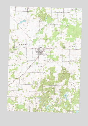
Henning, MN USGS Topographic Map
Click on map above to begin viewing in our Map Viewer.

This topographic map contains these locations and features:
Feature Name Type Latitude Longitude GNIS ID View Map
Black PeakSummitN46.2652°W95.4253°640224View Map
City of HenningCivilN46.3234°W95.4423°2394352View Map
County Ditch Number ThirtysixCanalN46.2769°W95.3900°642005View Map
First Baptist ChurchChurchN46.3236°W95.4456°2072859View Map
Good Shepherd Lutheran ChurchChurchN46.3194°W95.4406°2072863View Map
Grace CemeteryCemeteryN46.3472°W95.4692°644293View Map
Grace Lutheran ChurchChurchN46.3236°W95.4458°2072860View Map
HenningPopulated PlaceN46.3216°W95.4453°644879View Map
Henning AmbulanceBuildingN46.3204°W95.4439°2721289View Map
Henning CemeteryCemeteryN46.3255°W95.4492°2072728View Map
Henning Municipal AirportAirportN46.3048°W95.4413°660211View Map
Henning Police DepartmentBuildingN46.3207°W95.4459°2758595View Map
Henning Township CemeteryCemeteryN46.3472°W95.4486°2072686View Map
Henning Volunteer Fire DepartmentBuildingN46.3211°W95.4464°2666381View Map
Lakeland Christian SchoolSchoolN46.3267°W95.4308°2072869View Map
Norwegian Methodist Church CemeteryCemeteryN46.3514°W95.4319°2072685View Map
Oakwood Golf CourseLocaleN46.3264°W95.4681°2073077View Map
Saint Edward's Catholic ChurchChurchN46.3233°W95.4472°2072861View Map
Saint Paul CemeteryCemeteryN46.3119°W95.4384°650960View Map
Saint Paul's Lutheran ChurchChurchN46.3192°W95.4408°2072862View Map
Stony LakeLakeN46.2703°W95.3993°652685View Map
Township of HenningCivilN46.3258°W95.4722°664454View Map
Trinity Lutheran Church CemeteryCemeteryN46.3247°W95.4497°2072727View Map
United CemeteryCemeteryN46.3111°W95.4386°653523View Map
United Methodist ChurchChurchN46.3225°W95.4433°2072864View Map

Note: Coordinates in the location and feature list above are referenced to NAD83 datum.


Copyright (C) 2008-2024 Ryan Niemi / Sunset Dynamics ... All Rights Reserved