TopoQuest Logo
Do you find TopoQuest useful?
Help keep TopoQuest running and adding new maps/features by donating!
Bitcoin:  19c7KJd3qBynnjoSw5npx9KScwjBe4ifkT
Litecoin:  LXs6TkuXGGXo1vDsWCkWVdjQX94eUKd6ui
Home View Maps Find Maps Find Places Resources & Links


Hager Mountain, Oregon Topographic Map

USGS Map Title: Hager Mountain, OR
USGS Map MRC: 43121A1
DRG (GeoTIFF) Download: o43121a1.tif


Neighboring USGS Topographic Map Quads:


  Oatman Flat, OR  
43121B2
 

  Silver Lake, OR  
43121B1
 

  Tuff Butte, OR  
43120B8
 

  Bridge Creek Draw, OR  
43121A2
 

  Hager Mountain, OR  
43121A1
 

  Duncan Reservoir, OR  
43120A8
 

  Partin Butte, OR  
42121H2
 

  Thompson Reservoir, OR  
42121H1
 

  Foster Butte, OR  
42120H8


Map MRC Location:

N44°
W122°
N44°
W121°
H8 H7 H6 H5 H4 H3 H2 H1
G8 G7 G6 G5 G4 G3 G2 G1
F8 F7 F6 F5 F4 F3 F2 F1
E8 E7 E6 E5 E4 E3 E2 E1
D8 D7 D6 D5 D4 D3 D2 D1
C8 C7 C6 C5 C4 C3 C2 C1
B8 B7 B6 B5 B4 B3 B2 B1
A8 A7 A6 A5 A4 A3 A2 A1
N43°
W122°
N43°
W121°

Hager Mountain, OR USGS 1:24K Topographic Map Preview:
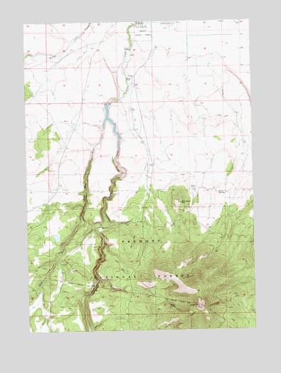
Hager Mountain, OR USGS Topographic Map
Click on map above to begin viewing in our Map Viewer.

This topographic map contains these locations and features:
Feature Name Type Latitude Longitude GNIS ID View Map
Airstrip ReservoirReservoirN43.1007°W121.0970°1153896View Map
Blow WaterholeReservoirN43.0743°W121.0265°1153894View Map
Bunyard Crossing Recreation SiteLocaleN43.0435°W121.0814°1952918View Map
Burn WaterholeReservoirN43.0835°W121.0962°1153886View Map
Chase Spring Administrative Study PlotAreaN43.0440°W121.1117°1156501View Map
Gowdy RanchLocaleN43.1021°W121.0675°1142890View Map
Hagadorn WaterholeReservoirN43.0687°W121.0235°1153893View Map
Hager MountainSummitN43.0093°W121.0317°1143196View Map
Hager Mountain LookoutTowerN43.0101°W121.0316°2548249View Map
Hager SpringSpringN43.0095°W121.0452°1143197View Map
Hager TrailTrailN43.0074°W121.0272°1156502View Map
Herder SpringSpringN43.0550°W121.0169°1143508View Map
Mahogany MountainSummitN43.0515°W121.0408°1145746View Map
Mahogany Mountain AirportAirportN43.0659°W121.0530°2650859View Map
Red and White AirportAirportN43.1235°W121.0469°1637949View Map
Rocky WaterholeLakeN43.0786°W121.1031°1153895View Map
Silver Creek ReservoirReservoirN43.0844°W121.0784°1161731View Map
Silver L CanalCanalN43.1054°W121.0622°1153864View Map
Silver Lake Forest Service StripAirportN43.1129°W121.0915°1154042View Map
Silver Lake Ranger StationBuildingN43.1225°W121.0621°1149503View Map
Thompson Valley Diversion DamDamN43.0915°W121.0794°1153943View Map
West Fork Silver CreekStreamN43.0857°W121.0814°1152113View Map

Note: Coordinates in the location and feature list above are referenced to NAD83 datum.


Copyright (C) 2008-2024 Ryan Niemi / Sunset Dynamics ... All Rights Reserved