TopoQuest Logo
Do you find TopoQuest useful?
Help keep TopoQuest running and adding new maps/features by donating!
Bitcoin:  19c7KJd3qBynnjoSw5npx9KScwjBe4ifkT
Litecoin:  LXs6TkuXGGXo1vDsWCkWVdjQX94eUKd6ui
Home View Maps Find Maps Find Places Resources & Links


Greenough Ridge, California Topographic Map

USGS Map Title: Greenough Ridge, CA
USGS Map MRC: 39123C4
DRG (GeoTIFF) Download: o39123c4.tif


Neighboring USGS Topographic Map Quads:


  Northspur, CA  
39123D5
 

  Burbeck, CA  
39123D4
 

  Willits, CA  
39123D3
 

  Comptche, CA  
39123C5
 

  Greenough Ridge, CA  
39123C4
 

  Laughlin Range, CA  
39123C3
 

  Navarro, CA  
39123B5
 

  Bailey Ridge, CA  
39123B4
 

  Orrs Springs, CA  
39123B3


Map MRC Location:

N40°
W124°
N40°
W123°
H8 H7 H6 H5 H4 H3 H2 H1
G8 G7 G6 G5 G4 G3 G2 G1
F8 F7 F6 F5 F4 F3 F2 F1
E8 E7 E6 E5 E4 E3 E2 E1
D8 D7 D6 D5 D4 D3 D2 D1
C8 C7 C6 C5 C4 C3 C2 C1
B8 B7 B6 B5 B4 B3 B2 B1
A8 A7 A6 A5 A4 A3 A2 A1
N39°
W124°
N39°
W123°

Greenough Ridge, CA USGS 1:24K Topographic Map Preview:
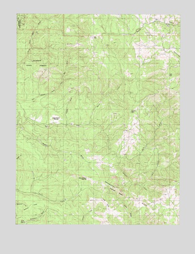
Greenough Ridge, CA USGS Topographic Map
Click on map above to begin viewing in our Map Viewer.

This topographic map contains these locations and features:
Feature Name Type Latitude Longitude GNIS ID View Map
Boardman GulchValleyN39.2513°W123.4972°219557View Map
Bowman RidgeRidgeN39.2616°W123.4886°233541View Map
Fordice RanchLocaleN39.3732°W123.4236°1653027View Map
Greenough RidgeRidgeN39.2718°W123.4225°224590View Map
Greenough RoughsRidgeN39.2682°W123.4242°224591View Map
Hans Ottoson OpeningGapN39.2774°W123.4464°224881View Map
Irene PeakSummitN39.3391°W123.3867°225966View Map
Johnson Dam (historical)DamN39.2954°W123.3995°1724204View Map
Long PointRidgeN39.2591°W123.4325°227589View Map
Martin CreekStreamN39.3099°W123.4461°228167View Map
Pigpen GulchValleyN39.3093°W123.4636°230648View Map
Rice CreekStreamN39.2957°W123.4028°231526View Map
Two RockSummitN39.3613°W123.4456°236731View Map
Upper Ranch OpeningFlatN39.3110°W123.4717°236913View Map
Valentine CreekStreamN39.2891°W123.4228°236954View Map
Williams PeakSummitN39.3174°W123.4156°237849View Map
Williams RanchLocaleN39.3021°W123.4133°1653130View Map

Note: Coordinates in the location and feature list above are referenced to NAD83 datum.


Copyright (C) 2008-2024 Ryan Niemi / Sunset Dynamics ... All Rights Reserved