TopoQuest Logo
Do you find TopoQuest useful?
Help keep TopoQuest running and adding new maps/features by donating!
Bitcoin:  19c7KJd3qBynnjoSw5npx9KScwjBe4ifkT
Litecoin:  LXs6TkuXGGXo1vDsWCkWVdjQX94eUKd6ui
Home View Maps Find Maps Find Places Resources & Links


Canal Fulton, Ohio Topographic Map

USGS Map Title: Canal Fulton, OH
USGS Map MRC: 40081H5
DRG (GeoTIFF) Download: o40081h5.tif


Neighboring USGS Topographic Map Quads:


  Wadsworth, OH  
41081A6
 

  Akron West, OH  
41081A5
 

  Akron East, OH  
41081A4
 

  Doylestown, OH  
40081H6
 

  Canal Fulton, OH  
40081H5
 

  North Canton, OH  
40081H4
 

  Dalton, OH  
40081G6
 

  Massillon, OH  
40081G5
 

  Canton West, OH  
40081G4


Map MRC Location:

N41°
W82°
N41°
W81°
H8 H7 H6 H5 H4 H3 H2 H1
G8 G7 G6 G5 G4 G3 G2 G1
F8 F7 F6 F5 F4 F3 F2 F1
E8 E7 E6 E5 E4 E3 E2 E1
D8 D7 D6 D5 D4 D3 D2 D1
C8 C7 C6 C5 C4 C3 C2 C1
B8 B7 B6 B5 B4 B3 B2 B1
A8 A7 A6 A5 A4 A3 A2 A1
N40°
W82°
N40°
W81°

Canal Fulton, OH USGS 1:24K Topographic Map Preview:
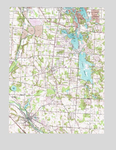
Canal Fulton, OH USGS Topographic Map
Click on map above to begin viewing in our Map Viewer.

This topographic map contains these locations and features:
Feature Name Type Latitude Longitude GNIS ID View Map
Aldawood HillsPopulated PlaceN40.9700°W81.5264°2778150View Map
Bay Side Picnic AreaLocaleN40.9684°W81.5507°1961323View Map
Big Oaks Picnic AreaLocaleN40.9634°W81.5601°1961324View Map
Brimestone Corners (historical)Populated PlaceN40.8773°W81.6054°1057440View Map
Camelot HillsPopulated PlaceN40.9549°W81.5019°2778156View Map
Camp Y NoahLocaleN40.9126°W81.5129°1038771View Map
Canal FeederCanalN40.9084°W81.5971°1038791View Map
Canal FultonPopulated PlaceN40.8898°W81.5976°1060923View Map
Canal Fulton AirportAirportN40.9006°W81.5360°1082538View Map
Canal Fulton Elementary SchoolSchoolN40.8917°W81.5971°1057441View Map
Canal Fulton Fire Department Station 1BuildingN40.8867°W81.5862°2550294View Map
Canal Fulton Fire Department Station 2BuildingN40.8838°W81.6037°2549288View Map
Canal Fulton Historic DistrictParkN40.8901°W81.5976°1071661View Map
Canal Fulton Police DepartmentBuildingN40.8860°W81.5867°2732501View Map
Canal Fulton Post OfficePost OfficeN40.8903°W81.5971°2057300View Map
City of Canal FultonCivilN40.8896°W81.5887°2393726View Map
City of New FranklinCivilN40.9525°W81.5839°2395193View Map
Clardale FarmLocaleN40.8931°W81.5528°2706024View Map
CometPopulated PlaceN40.9226°W81.5257°1039285View Map
Comet LakeReservoirN40.9206°W81.5221°1078452View Map
Comet Lake DamDamN40.9226°W81.5259°1078451View Map
Comet Post Office (historical)Post OfficeN40.9223°W81.5262°2057338View Map
Comet Trailer ParkPopulated PlaceN40.9206°W81.5331°2542492View Map
Cornerstone ChurchChurchN40.9970°W81.5027°2680676View Map
Cottage GrovePopulated PlaceN40.9887°W81.5121°1048634View Map
Cottage Grove Elementary SchoolSchoolN40.9937°W81.5087°1081172View Map
Cottage Grove LakeReservoirN40.9876°W81.5218°1058497View Map
Country Place EstatesPopulated PlaceN40.8973°W81.5048°2778066View Map
Deer Valley EstatesPopulated PlaceN40.9147°W81.5291°2778165View Map
Ellis EstatesPopulated PlaceN40.9707°W81.5022°2778151View Map
Elson ParkParkN40.9964°W81.5998°1058502View Map
Flight Path FarmsLocaleN40.9006°W81.5747°2706025View Map
ForestwoodPopulated PlaceN40.9752°W81.5247°2778148View Map
Franklin Township Police DepartmentBuildingN40.9527°W81.5654°2732685View Map
Grape LakeLakeN40.9915°W81.5428°1041056View Map
Green Fire Department - Station 2BuildingN40.9758°W81.5107°2549120View Map
Hearthstone EstatesPopulated PlaceN40.9473°W81.5177°2778160View Map
Hemlock Green EstatesPopulated PlaceN40.9101°W81.5048°2778169View Map
Hidden LakeLakeN40.9119°W81.5247°2778167View Map
High Point Picnic AreaLocaleN40.9703°W81.5487°1961325View Map
Hill FarmsLocaleN40.9064°W81.5406°2706026View Map
Hillcrest HighlandsPopulated PlaceN40.9804°W81.5084°2778146View Map
Infant of Prague VillaPopulated PlaceN40.9937°W81.5204°1062824View Map
K and S Greenhouse and Plant FarmLocaleN40.9614°W81.5100°2651473View Map
Kings RidgePopulated PlaceN40.9560°W81.5082°2778157View Map
Lake LucernReservoirN40.9035°W81.6013°1078045View Map
Lake Lucern DamDamN40.8985°W81.6033°1078044View Map
Lake NoahLakeN40.9116°W81.5129°1043886View Map
Lake Noah DamDamN40.9138°W81.5153°1078450View Map
LakeviewPopulated PlaceN40.9981°W81.5235°1042392View Map
Latham BayBayN40.9681°W81.5521°1961326View Map
Latham Lane Picnic AreaLocaleN40.9667°W81.5485°1961327View Map
Lawrence Township Fire DepartmentBuildingN40.8970°W81.5795°2549268View Map
Lockwood CornersPopulated PlaceN40.9978°W81.5576°1061434View Map
Luna LakeLakeN40.9193°W81.6185°1042835View Map
Lyons Den Golf CourseLocaleN40.8770°W81.6093°1057442View Map
ManchesterPopulated PlaceN40.9370°W81.5693°1061466View Map
Manchester CemeteryCemeteryN40.9353°W81.5707°1042915View Map
Manchester High SchoolSchoolN40.9412°W81.5507°1058499View Map
Manchester Middle SchoolSchoolN40.9373°W81.5613°1058501View Map
Merestead FarmsPopulated PlaceN40.9732°W81.5123°2778149View Map
Miller LakeLakeN40.9817°W81.5246°1061154View Map
Mud LakeLakeN40.9701°W81.5315°1043695View Map
New FranklinPopulated PlaceN40.9417°W81.5415°1777352View Map
New Franklin Fire Department Station 1BuildingN40.9526°W81.5667°2549855View Map
New Franklin Fire Department Station 2BuildingN40.9526°W81.5667°2549075View Map
Nimisila CreekStreamN40.8976°W81.6032°1066862View Map
Nimisila Mobile Home ParkPopulated PlaceN40.9525°W81.5178°2542449View Map
Nimisila ReservoirReservoirN40.9395°W81.5255°1043876View Map
Nimisila Sunset HeightsPopulated PlaceN40.9581°W81.5177°2778162View Map
Nolley Elementary SchoolSchoolN40.9420°W81.5532°1058500View Map
North ReservoirReservoirN40.9949°W81.5481°1043909View Map
Northwest High SchoolSchoolN40.9106°W81.6165°1043993View Map
Northwest Intermediate SchoolSchoolN40.9103°W81.6171°1057444View Map
Ohnoname 10 DamDamN40.8784°W81.5632°1078046View Map
Ohnoname 10 ReservoirReservoirN40.8790°W81.5621°1078047View Map
Old Methodist CemeteryCemeteryN40.8867°W81.6015°1730939View Map
Old Park Picnic AreaLocaleN40.9748°W81.5393°1961328View Map
Pancake CreekStreamN40.9428°W81.6160°1044291View Map
Pancake LakeReservoirN40.9451°W81.6232°1078449View Map
Pancake Lake DamDamN40.9434°W81.6215°1078448View Map
Pine Knoll EstatesPopulated PlaceN40.9132°W81.5222°2778166View Map
Pleasant Hills EstatesPopulated PlaceN40.9140°W81.5013°2778168View Map
Portage LakesLakeN40.9817°W81.5242°1044703View Map
Portage Lakes State ParkParkN40.9692°W81.5571°1044705View Map
Portage Lakes Wetland State Nature PreserveParkN40.9998°W81.5335°1961449View Map
Rex Hill Mobile Home ParkPopulated PlaceN40.9831°W81.5633°2542487View Map
Rex LakeLakeN40.9689°W81.5400°1044956View Map
Robins TracePopulated PlaceN40.9855°W81.5031°2778147View Map
Rolling Green Golf CourseLocaleN40.8903°W81.5151°1057439View Map
Saint Francis de Sales SchoolSchoolN40.9934°W81.5575°1045460View Map
Saint Phillips CemeteryCemeteryN40.8937°W81.5990°1730940View Map
Sandy Beach Trailer ParkPopulated PlaceN40.9839°W81.5203°2542451View Map
Sherylton HillsPopulated PlaceN40.9486°W81.5075°2778158View Map
Solar EstatesPopulated PlaceN40.9497°W81.5113°2778159View Map
Summit County Sheriff's OfficeBuildingN40.9759°W81.5106°2780620View Map
Tamarack HighlandsPopulated PlaceN40.9629°W81.5189°2778164View Map
Tamarack Lake EstatesPopulated PlaceN40.9581°W81.5236°2778163View Map
Township of FranklinCivilN40.9573°W81.5762°1087002View Map
Turkeyfoot BeachBeachN40.9689°W81.5454°1961329View Map
Turkeyfoot Elementary SchoolSchoolN40.9807°W81.5409°1081968View Map
Turkeyfoot Golf CourseLocaleN40.9767°W81.5301°1058498View Map
Turkeyfoot HeightsPopulated PlaceN40.9861°W81.5283°2778145View Map
Turkeyfoot IslandIslandN40.9731°W81.5398°1047214View Map
Turkeyfoot Junction (historical)LocaleN40.9789°W81.6076°1058503View Map
Turkeyfoot LakeLakeN40.9689°W81.5400°1061221View Map
Union CemeteryCemeteryN40.8906°W81.6060°1047289View Map
Washington SchoolSchoolN40.9992°W81.6023°1047601View Map
West FultonPopulated PlaceN40.8889°W81.6032°1063136View Map
West ReservoirReservoirN40.9933°W81.5313°1078640View Map
West Reservoir DamDamN40.9901°W81.5382°1078639View Map
William S Stinson Elementary SchoolSchoolN40.9078°W81.6140°1057443View Map
Withering HeightsPopulated PlaceN40.9505°W81.5202°2778161View Map
Wonder LakeLakeN40.9842°W81.5104°1048061View Map

Note: Coordinates in the location and feature list above are referenced to NAD83 datum.


Copyright (C) 2008-2024 Ryan Niemi / Sunset Dynamics ... All Rights Reserved