TopoQuest Logo
Do you find TopoQuest useful?
Help keep TopoQuest running and adding new maps/features by donating!
Bitcoin:  19c7KJd3qBynnjoSw5npx9KScwjBe4ifkT
Litecoin:  LXs6TkuXGGXo1vDsWCkWVdjQX94eUKd6ui
Home View Maps Find Maps Find Places Resources & Links


Dingus, Kentucky Topographic Map

USGS Map Title: Dingus, KY
USGS Map MRC: 37083H1
DRG (GeoTIFF) Download: o37083h1.tif


Neighboring USGS Topographic Map Quads:


  Sandy Hook, KY  
38083A2
 

  Isonville, KY  
38083A1
 

  Mazie, KY  
38082A8
 

  Lenox, KY  
37083H2
 

  Dingus, KY  
37083H1
 

  Redbush, KY  
37082H8
 

  White Oak, KY  
37083G2
 

  Salyersville North, KY  
37083G1
 

  Oil Springs, KY  
37082G8


Map MRC Location:

N38°
W84°
N38°
W83°
H8 H7 H6 H5 H4 H3 H2 H1
G8 G7 G6 G5 G4 G3 G2 G1
F8 F7 F6 F5 F4 F3 F2 F1
E8 E7 E6 E5 E4 E3 E2 E1
D8 D7 D6 D5 D4 D3 D2 D1
C8 C7 C6 C5 C4 C3 C2 C1
B8 B7 B6 B5 B4 B3 B2 B1
A8 A7 A6 A5 A4 A3 A2 A1
N37°
W84°
N37°
W83°

Dingus, KY USGS 1:24K Topographic Map Preview:
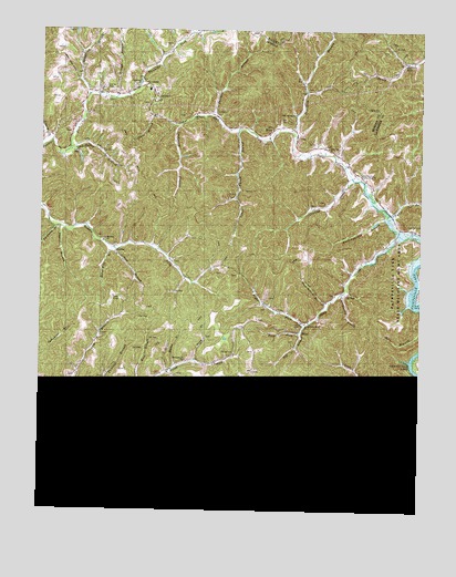
Dingus, KY USGS Topographic Map
Click on map above to begin viewing in our Map Viewer.

This topographic map contains these locations and features:
Feature Name Type Latitude Longitude GNIS ID View Map
Bear BranchStreamN37.9048°W83.1168°486536View Map
Beculhimer CemeteryCemeteryN37.9081°W83.1054°509982View Map
Birch ForkStreamN37.9079°W83.0910°487330View Map
Buck BranchStreamN37.9079°W83.0918°488196View Map
Church of ChristChurchN37.8887°W83.0671°509977View Map
Cindas CreekStreamN37.9615°W83.0221°489517View Map
Cindas CreekPopulated PlaceN37.9546°W83.0308°2362573View Map
Cindas Creek ChurchChurchN37.9626°W83.0191°509978View Map
Coffee CreekStreamN37.9059°W83.0999°489772View Map
Coffee Creek (historical)Populated PlaceN37.8877°W83.0661°2362574View Map
Cold Iron CemeteryCemeteryN37.9492°W83.0013°489793View Map
Conley CemeteryCemeteryN37.9845°W83.1043°489968View Map
CrockettPopulated PlaceN37.9856°W83.0907°507784View Map
Crockett Community ChurchChurchN37.9862°W83.0916°509981View Map
Crockett SchoolSchoolN37.9846°W83.0896°2362691View Map
Daniel CemeteryCemeteryN37.9084°W83.0499°490561View Map
Daniel CemeteryCemeteryN37.9167°W83.0607°490562View Map
Deadling BranchStreamN37.9834°W83.1093°490730View Map
DingusPopulated PlaceN37.9081°W83.1021°507856View Map
Dingus Post Office (historical)Post OfficeN37.9083°W83.1025°2362609View Map
Doc Ison BranchStreamN37.9737°W83.0418°490945View Map
Elkfork-Ophir DivisionCivilN37.9397°W83.1018°1937187View Map
Faith Hills Mennonite ChurchChurchN37.9826°W83.0866°509980View Map
Fergerson CemeteryCemeteryN37.9210°W83.1045°2362536View Map
Ferguson BranchStreamN37.9487°W83.1202°492028View Map
Ferguson CemeteryCemeteryN37.9626°W83.0193°492032View Map
Fyffe BranchStreamN37.9526°W83.0107°510092View Map
Fyffe Post Office (historical)Post OfficeN37.9684°W83.0801°2362620View Map
Gillam BranchStreamN37.9431°W83.0993°492836View Map
Gray BranchStreamN37.9143°W83.0735°493190View Map
Gum Bottom BranchStreamN37.9295°W83.0299°493475View Map
Hinson BranchStreamN37.9823°W83.1002°494299View Map
Hog BranchStreamN37.9231°W83.0377°494340View Map
Horse Mill BranchStreamN37.9434°W83.1013°494582View Map
Ison CemeteryCemeteryN37.9765°W83.0421°495054View Map
JepthaPopulated PlaceN37.9423°W83.0999°508334View Map
Jeptha Post Office (historical)Post OfficeN37.9426°W83.1004°2362630View Map
Jeptha School (historical)SchoolN37.9453°W83.1046°2362700View Map
Laurel BranchStreamN37.9487°W83.1182°496015View Map
Laurel ForkStreamN37.9693°W83.1246°496047View Map
Lebanon Church of United BaptistChurchN37.9073°W83.0491°509973View Map
Lepton Church (historical)ChurchN37.9031°W83.0377°510120View Map
Lick BranchStreamN37.9065°W83.1132°496435View Map
Little Caney BranchStreamN37.9740°W83.0585°496655View Map
Long BranchStreamN37.9065°W83.0160°497049View Map
Lost Creek (historical)Populated PlaceN37.8835°W83.0156°2362581View Map
Lower Sandlick (historical)Populated PlaceN37.8946°W83.0162°2362582View Map
Martha Enterprise Baptist ChurchChurchN37.9456°W83.1035°497591View Map
Meetinghouse BranchStreamN37.9515°W83.0110°498035View Map
Middle Fork (historical)Populated PlaceN37.9478°W83.1082°2362583View Map
MimaPopulated PlaceN37.9206°W83.0366°508612View Map
Mima Post Office (historical)Post OfficeN37.9214°W83.0389°2362645View Map
MoonPopulated PlaceN37.9734°W83.0488°508633View Map
Moon Post Office (historical)Post OfficeN37.9737°W83.0492°2362647View Map
New Salem ChurchChurchN37.9784°W83.0407°499396View Map
Old House BranchStreamN37.8934°W83.0779°499839View Map
Old House BranchStreamN37.9690°W83.1149°499840View Map
Old Paint Primitive Baptist ChurchChurchN37.9784°W83.0721°509979View Map
Open Fork ChurchChurchN37.9693°W83.0307°499952View Map
OphirPopulated PlaceN37.9073°W83.0143°508754View Map
Ophir Enterprize Baptist ChurchChurchN37.8909°W83.0341°509974View Map
Ophir Post Office (historical)Post OfficeN37.9074°W83.0138°2362655View Map
Paint Creek ChurchChurchN37.9512°W83.0110°500115View Map
Pasture BranchStreamN37.9776°W83.0668°500231View Map
Paulina BranchStreamN37.9079°W83.1035°500277View Map
Peddler GapGapN37.9026°W83.0414°2362562View Map
Peddler Gap 172 Volunteer Fire DepartmentBuildingN37.9835°W83.1059°2637264View Map
Peddler Gap School (historical)SchoolN37.9020°W83.0418°510151View Map
Peddler Gap Volunteer Fire DepartmentBuildingN37.9152°W83.0632°2637414View Map
Peddler HillSummitN37.9067°W83.0442°2362728View Map
Pelfry BranchStreamN37.9318°W83.0252°509984View Map
Pendelton ChurchChurchN37.8879°W83.0643°509976View Map
Peter Cave BranchStreamN37.9012°W83.0938°500463View Map
Piney BranchStreamN37.9776°W83.0874°509983View Map
Powder Spring BranchStreamN37.9023°W83.0404°501231View Map
Relief Post Office (historical)Post OfficeN37.9490°W83.0068°2362664View Map
Right Fork Smith CreekStreamN37.9231°W83.0377°501928View Map
Road ForkStreamN37.9215°W83.0385°502025View Map
SilverhillPopulated PlaceN37.8823°W83.0491°509061View Map
Silverhill Post Office (historical)Post OfficeN37.8821°W83.0489°2362668View Map
Silverhill School (historical)SchoolN37.8819°W83.0532°2124543View Map
Skaggs CemeteryCemeteryN37.9780°W83.0778°2362546View Map
Smith CreekStreamN37.9470°W83.0071°503780View Map
Smith Creek SchoolSchoolN37.9243°W83.0363°510168View Map
Smith Creek Valley ChurchChurchN37.9237°W83.0363°509972View Map
Sow BranchStreamN37.9708°W83.1217°2126253View Map
Splitwood BranchStreamN37.9756°W83.0779°504082View Map
Stingy ForkStreamN37.8876°W83.0721°504429View Map
Sulphur Spring ChurchChurchN37.9845°W83.0885°504759View Map
The Bertha ChurchChurchN37.8865°W83.0599°509975View Map
Turpentine BranchStreamN37.9037°W83.0293°505679View Map
Union ChurchChurchN37.9087°W83.1049°505786View Map
Upper Sandlick (historical)Populated PlaceN37.9060°W83.0154°2362594View Map
White Oak BranchStreamN37.9059°W83.0996°506599View Map
White Oak School (historical)SchoolN37.9081°W83.0902°510179View Map
Williams Creek ChurchChurchN37.9143°W83.0768°506819View Map
Willie BranchStreamN37.9123°W83.0810°506840View Map

Note: Coordinates in the location and feature list above are referenced to NAD83 datum.


Copyright (C) 2008-2024 Ryan Niemi / Sunset Dynamics ... All Rights Reserved