TopoQuest Logo
Do you find TopoQuest useful?
Help keep TopoQuest running and adding new maps/features by donating!
Bitcoin:  19c7KJd3qBynnjoSw5npx9KScwjBe4ifkT
Litecoin:  LXs6TkuXGGXo1vDsWCkWVdjQX94eUKd6ui
Home View Maps Find Maps Find Places Resources & Links


Cranberry Lake, Wisconsin Topographic Map

USGS Map Title: Cranberry Lake, WI
USGS Map MRC: 45090F3
DRG (GeoTIFF) Download: o45090f3.tif


Neighboring USGS Topographic Map Quads:


  Priest Lake, WI  
45090G4
 

  Gates Lake, WI  
45090G3
 

  Pike Lake SW, WI  
45090G2
 

  Phillips, WI  
45090F4
 

  Cranberry Lake, WI  
45090F3
 

  Dover, WI  
45090F2
 

  Pennington, WI  
45090E4
 

  Prentice, WI  
45090E3
 

  Big Briens Lake, WI  
45090E2


Map MRC Location:

N46°
W91°
N46°
W90°
H8 H7 H6 H5 H4 H3 H2 H1
G8 G7 G6 G5 G4 G3 G2 G1
F8 F7 F6 F5 F4 F3 F2 F1
E8 E7 E6 E5 E4 E3 E2 E1
D8 D7 D6 D5 D4 D3 D2 D1
C8 C7 C6 C5 C4 C3 C2 C1
B8 B7 B6 B5 B4 B3 B2 B1
A8 A7 A6 A5 A4 A3 A2 A1
N45°
W91°
N45°
W90°

Cranberry Lake, WI USGS 1:24K Topographic Map Preview:
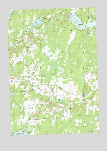
Cranberry Lake, WI USGS Topographic Map
Click on map above to begin viewing in our Map Viewer.

This topographic map contains these locations and features:
Feature Name Type Latitude Longitude GNIS ID View Map
Bass LakeLakeN45.7286°W90.3481°1561280View Map
Big Dardis LakeLakeN45.7363°W90.3342°1561705View Map
Chase CreekStreamN45.7472°W90.2790°1578981View Map
Cramer CreekStreamN45.6844°W90.3674°1563473View Map
Cranberry LakePopulated PlaceN45.6402°W90.3474°1563494View Map
Donavan LakeLakeN45.7194°W90.3638°1564052View Map
East Highland School (historical)SchoolN45.6572°W90.2607°1840275View Map
Hoffman CreekStreamN45.7322°W90.3260°1579465View Map
Little Dardis LakeLakeN45.7284°W90.3479°1568237View Map
Little Elk Church (historical)ChurchN45.6669°W90.2949°1840291View Map
Little Elk RiverStreamN45.6841°W90.3671°1579680View Map
Little Elk School (historical)SchoolN45.6716°W90.3088°1840292View Map
Lost LakeLakeN45.7088°W90.3098°1568681View Map
Mount Hope School (historical)SchoolN45.6552°W90.3199°1840295View Map
Murphy LakeLakeN45.6588°W90.3056°1570046View Map
Musser 2WP235 DamDamN45.7416°W90.2868°1792004View Map
Musser CreekStreamN45.7241°W90.2624°1579982View Map
Musser DamDamN45.7408°W90.2888°1570078View Map
Musser LakeReservoirN45.7312°W90.2633°1579983View Map
Pine Grove School (historical)SchoolN45.7119°W90.3507°1840299View Map
Popple CreekStreamN45.7375°W90.2568°1580188View Map
Price CountyCivilN45.6804°W90.3614°1581110View Map
Town of WorcesterCivilN45.7353°W90.3194°1584482View Map
Worcester SchoolSchoolN45.6813°W90.3529°1577047View Map

Note: Coordinates in the location and feature list above are referenced to NAD83 datum.


Copyright (C) 2008-2024 Ryan Niemi / Sunset Dynamics ... All Rights Reserved