TopoQuest Logo
Do you find TopoQuest useful?
Help keep TopoQuest running and adding new maps/features by donating!
Bitcoin:  19c7KJd3qBynnjoSw5npx9KScwjBe4ifkT
Litecoin:  LXs6TkuXGGXo1vDsWCkWVdjQX94eUKd6ui
Home View Maps Find Maps Find Places Resources & Links


Centerville, North Carolina Topographic Map

USGS Map Title: Centerville, NC
USGS Map MRC: 36078B1
DRG (GeoTIFF) Download: o36078b1.tif


Neighboring USGS Topographic Map Quads:


  Afton, NC  
36078C2
 

  Inez, NC  
36078C1
 

  Hollister, NC  
36077C8
 

  Gold Sand, NC  
36078B2
 

  Centerville, NC  
36078B1
 

  Essex, NC  
36077B8
 

  Justice, NC  
36078A2
 

  Castalia, NC  
36078A1
 

  Red Oak, NC  
36077A8


Map MRC Location:

N37°
W79°
N37°
W78°
H8 H7 H6 H5 H4 H3 H2 H1
G8 G7 G6 G5 G4 G3 G2 G1
F8 F7 F6 F5 F4 F3 F2 F1
E8 E7 E6 E5 E4 E3 E2 E1
D8 D7 D6 D5 D4 D3 D2 D1
C8 C7 C6 C5 C4 C3 C2 C1
B8 B7 B6 B5 B4 B3 B2 B1
A8 A7 A6 A5 A4 A3 A2 A1
N36°
W79°
N36°
W78°

Centerville, NC USGS 1:24K Topographic Map Preview:
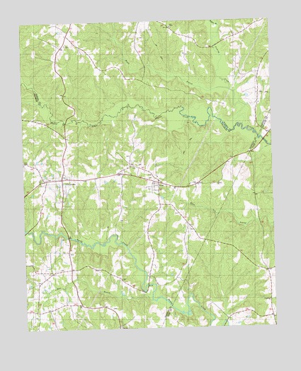
Centerville, NC USGS Topographic Map
Click on map above to begin viewing in our Map Viewer.

This topographic map contains these locations and features:
Feature Name Type Latitude Longitude GNIS ID View Map
Argo (historical)LocaleN36.1282°W78.0005°1006910View Map
Arrington BridgeBridgeN36.1274°W78.0247°1006911View Map
Bass BridgeBridgeN36.1627°W78.1028°1008364View Map
Boling BridgeBridgeN36.1652°W78.1236°1008365View Map
CentervillePopulated PlaceN36.1863°W78.1055°982946View Map
Centerville Census Designated PlaceCensusN36.1854°W78.1089°2791522View Map
Centerville Fire and RescueBuildingN36.1866°W78.1061°2639605View Map
Community ChurchChurchN36.1360°W78.0025°1024702View Map
Deer BranchStreamN36.1368°W78.0614°984110View Map
Fork ChapelChurchN36.2479°W78.0500°985293View Map
Gilfield ChurchChurchN36.1835°W78.0278°1024701View Map
Harpers StoreLocaleN36.1482°W78.0030°1006909View Map
Harrison School (historical)SchoolN36.1482°W78.0030°1951143View Map
Hogpen BranchStreamN36.2482°W78.0253°986909View Map
Maple BranchStreamN36.2218°W78.0200°989301View Map
Mayflower School (historical)SchoolN36.2421°W78.1000°1007014View Map
Mount Hebron Church (historical)ChurchN36.1615°W78.0367°1008387View Map
Perry ChapelChurchN36.1935°W78.1242°1024700View Map
Ransoms BridgeBridgeN36.2015°W78.0042°1006908View Map
Red Bud ChurchChurchN36.1254°W78.0772°1022188View Map
Serepta ChurchChurchN36.1860°W78.1147°1008402View Map
Shelley BranchStreamN36.1271°W78.0255°1005245View Map
Shocco BridgeBridgeN36.2093°W78.1030°1008403View Map
Shocco CreekStreamN36.2074°W78.0144°1024300View Map
Town of Centerville (historical)CivilN36.1854°W78.1089°2406245View Map
Township of Gold MineCivilN36.1778°W78.0934°1026692View Map
WoodPopulated PlaceN36.1843°W78.0572°1024413View Map
Young School (historical)SchoolN36.2202°W78.0372°1007013View Map

Note: Coordinates in the location and feature list above are referenced to NAD83 datum.


Copyright (C) 2008-2024 Ryan Niemi / Sunset Dynamics ... All Rights Reserved