TopoQuest Logo
Do you find TopoQuest useful?
Help keep TopoQuest running and adding new maps/features by donating!
Bitcoin:  19c7KJd3qBynnjoSw5npx9KScwjBe4ifkT
Litecoin:  LXs6TkuXGGXo1vDsWCkWVdjQX94eUKd6ui
Home View Maps Find Maps Find Places Resources & Links


Bonds Corner, California Topographic Map

USGS Map Title: Bonds Corner, CA
USGS Map MRC: 32115F3
DRG (GeoTIFF) Download: o32115f3.tif


Neighboring USGS Topographic Map Quads:


  Holtville West, CA  
32115G4
 

  Holtville East, CA  
32115G3
 

  Glamis SW, CA  
32115G2
 

  Calexico, CA  
32115F4
 

  Bonds Corner, CA  
32115F3
 

  Midway Well NW, CA  
32115F2


Map MRC Location:

N33°
W116°
N33°
W115°
H8 H7 H6 H5 H4 H3 H2 H1
G8 G7 G6 G5 G4 G3 G2 G1
F8 F7 F6 F5 F4 F3 F2 F1
E8 E7 E6 E5 E4 E3 E2 E1
D8 D7 D6 D5 D4 D3 D2 D1
C8 C7 C6 C5 C4 C3 C2 C1
B8 B7 B6 B5 B4 B3 B2 B1
A8 A7 A6 A5 A4 A3 A2 A1
N32°
W116°
N32°
W115°

Bonds Corner, CA USGS 1:24K Topographic Map Preview:
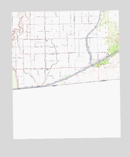
Bonds Corner, CA USGS Topographic Map
Click on map above to begin viewing in our Map Viewer.

This topographic map contains these locations and features:
Feature Name Type Latitude Longitude GNIS ID View Map
All American Drain FiveCanalN32.6762°W115.3561°255259View Map
All American Drain FourCanalN32.6787°W115.3325°255258View Map
All American Drain TwoCanalN32.7064°W115.2611°255257View Map
All American Drain TwoCanalN32.7034°W115.2839°238525View Map
Bonds CornerPopulated PlaceN32.6937°W115.3372°239550View Map
Bonds Corner DrainCanalN32.7376°W115.3380°239552View Map
Bonds Corner Drain FiveCanalN32.7301°W115.3433°255368View Map
Bonds Corner Drain FourCanalN32.7081°W115.3253°255367View Map
Bonds Corner Drain OneCanalN32.7009°W115.3250°239551View Map
Bonds Corner Drain SixCanalN32.7298°W115.3325°255369View Map
Bonds Corner Drain ThreeCanalN32.7151°W115.3264°255366View Map
Bonds Corner Drain TwoCanalN32.6864°W115.3286°255365View Map
East Highline Lateral OneCanalN32.7367°W115.3039°254063View Map
East Highline Side Main OneCanalN32.7098°W115.2878°254074View Map
Hemlock CanalCanalN32.7034°W115.3628°243352View Map
Hemlock DrainCanalN32.6937°W115.3453°243353View Map
Hemlock Drain OneCanalN32.6906°W115.3461°243354View Map
Hemlock Lateral Four WasteCanalN32.7470°W115.3550°243356View Map
Hemlock Lateral Two BCanalN32.7187°W115.3689°243355View Map
Hemlock Sluice DrainCanalN32.6853°W115.3528°243358View Map
Hemlock Three DrainCanalN32.7223°W115.3486°243351View Map
Holt CanalCanalN32.6973°W115.3294°243561View Map
Holt CanalCanalN32.7359°W115.3294°243562View Map
Lateral Five BCanalN32.7014°W115.2791°255589View Map
Lateral FourCanalN32.7445°W115.2808°255581View Map
Lateral OneCanalN32.6939°W115.3583°244643View Map
Lateral OneCanalN32.6812°W115.3242°255550View Map
Lateral OneCanalN32.6939°W115.3394°255552View Map
Lateral ThreeCanalN32.7264°W115.3461°255574View Map
Lateral ThreeCanalN32.7373°W115.2811°255576View Map
Lateral TwoCanalN32.7081°W115.3580°255565View Map
Lateral TwoCanalN32.7084°W115.3275°255566View Map
Lateral Two ACanalN32.7048°W115.3647°255571View Map
Mesa Drain SevenCanalN32.7234°W115.2847°245798View Map
Mesa Lateral FiveCanalN32.7037°W115.2758°245804View Map
Mesa Lateral ThreeCanalN32.7292°W115.3125°245800View Map
Mesa Lateral Three ACanalN32.7089°W115.3072°245801View Map
Mesa Lateral Three CCanalN32.7162°W115.3164°245802View Map
Mesa Lateral Three DCanalN32.7264°W115.3078°245803View Map
Mesa Lateral TwoCanalN32.6873°W115.3205°245799View Map
Mesa Six DrainCanalN32.7089°W115.2750°245796View Map
Mesa Three DrainCanalN32.7284°W115.3083°245794View Map
Mesa Three DrainCanalN32.7187°W115.3122°245795View Map
Schenk Two DrainCanalN32.7048°W115.3714°254224View Map
Toland DrainCanalN32.6862°W115.3669°250518View Map
Verde DrainCanalN32.7389°W115.3080°250989View Map
Verde Drain FourCanalN32.7003°W115.2855°255846View Map
Verde Drain OneCanalN32.7334°W115.3169°255839View Map
Verde Drain ThreeCanalN32.7228°W115.2947°255845View Map
Verde Drain TwoCanalN32.7323°W115.2805°255840View Map
Verde Drain Two ACanalN32.7450°W115.3033°255841View Map
Verde Drain Two BCanalN32.7442°W115.2950°255842View Map
Verde Drain Two CCanalN32.7414°W115.2869°255843View Map
Verde SchoolSchoolN32.7223°W115.3369°250990View Map
Whitcomb CanalCanalN32.6973°W115.3380°251460View Map
Whitcomb Drain Two ACanalN32.7045°W115.3503°255867View Map
Whitcomb Three DrainCanalN32.7153°W115.3450°255866View Map
Whitcomb Two DrainCanalN32.7081°W115.3453°255865View Map

Note: Coordinates in the location and feature list above are referenced to NAD83 datum.


Copyright (C) 2008-2024 Ryan Niemi / Sunset Dynamics ... All Rights Reserved