TopoQuest Logo
Do you find TopoQuest useful?
Help keep TopoQuest running and adding new maps/features by donating!
Bitcoin:  19c7KJd3qBynnjoSw5npx9KScwjBe4ifkT
Litecoin:  LXs6TkuXGGXo1vDsWCkWVdjQX94eUKd6ui
Home View Maps Find Maps Find Places Resources & Links


Banquete, Texas Topographic Map

USGS Map Title: Banquete, TX
USGS Map MRC: 27097G7
DRG (GeoTIFF) Download: o27097g7.tif


Neighboring USGS Topographic Map Quads:


  Orange Grove, TX  
27097H8
 

  San Patricio, TX  
27097H7
 

  Edroy, TX  
27097H6
 

  Agua Dulce, TX  
27097G8
 

  Banquete, TX  
27097G7
 

  Robstown, TX  
27097G6
 

  Kingsville NW, TX  
27097F8
 

  Driscoll West, TX  
27097F7
 

  Driscoll East, TX  
27097F6


Map MRC Location:

N28°
W98°
N28°
W97°
H8 H7 H6 H5 H4 H3 H2 H1
G8 G7 G6 G5 G4 G3 G2 G1
F8 F7 F6 F5 F4 F3 F2 F1
E8 E7 E6 E5 E4 E3 E2 E1
D8 D7 D6 D5 D4 D3 D2 D1
C8 C7 C6 C5 C4 C3 C2 C1
B8 B7 B6 B5 B4 B3 B2 B1
A8 A7 A6 A5 A4 A3 A2 A1
N27°
W98°
N27°
W97°

Banquete, TX USGS 1:24K Topographic Map Preview:
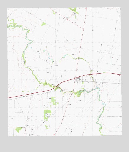
Banquete, TX USGS Topographic Map
Click on map above to begin viewing in our Map Viewer.

This topographic map contains these locations and features:
Feature Name Type Latitude Longitude GNIS ID View Map
Agua Dulce CreekStreamN27.7970°W97.7775°1329255View Map
BanquetePopulated PlaceN27.8061°W97.7961°1330012View Map
Banquete Census Designated PlaceCensusN27.8006°W97.7972°2586909View Map
Banquete CreekStreamN27.7970°W97.7775°1330013View Map
Banquete Elementary SchoolSchoolN27.8054°W97.7963°2434291View Map
Banquete Fire StationBuildingN27.8066°W97.7992°2552316View Map
Banquete High SchoolSchoolN27.8078°W97.7948°2434269View Map
Banquete Junior High SchoolSchoolN27.8050°W97.7961°2434297View Map
Banquete Post OfficePost OfficeN27.8080°W97.7929°2731108View Map
Corpus Christi West DivisionCivilN27.8609°W97.7874°1938649View Map
Old Hoppe Place AirportAirportN27.7968°W97.8498°2675855View Map
Quinta CreekStreamN27.8578°W97.8678°1344669View Map
RabbPopulated PlaceN27.8006°W97.7503°1378924View Map
Rancho BanquetePopulated PlaceN27.8100°W97.8336°1852756View Map
Rancho Banquete Census Designated PlaceCensusN27.8094°W97.8455°2409133View Map
Sablatura ParkParkN27.7972°W97.8206°1345809View Map
Violet MuseumBuildingN27.7814°W97.7561°2014513View Map

Note: Coordinates in the location and feature list above are referenced to NAD83 datum.


Copyright (C) 2008-2024 Ryan Niemi / Sunset Dynamics ... All Rights Reserved