TopoQuest Logo
Do you find TopoQuest useful?
Help keep TopoQuest running and adding new maps/features by donating!
Bitcoin:  19c7KJd3qBynnjoSw5npx9KScwjBe4ifkT
Litecoin:  LXs6TkuXGGXo1vDsWCkWVdjQX94eUKd6ui
Home View Maps Find Maps Find Places Resources & Links


Calamity Butte, Oregon Topographic Map

USGS Map Title: Calamity Butte, OR
USGS Map MRC: 43118H7
DRG (GeoTIFF) Download: o43118h7.tif


Neighboring USGS Topographic Map Quads:


  Silvies, OR  
44118A8
 

  Jump-off Joe Mountain, OR  
44118A7
 

  Magpie Table, OR  
44118A6
 

  Trout Creek, OR  
43118H8
 

  Calamity Butte, OR  
43118H7
 

  Van, OR  
43118H6
 

  Devine Ridge North, OR  
43118G8
 

  Telephone Butte, OR  
43118G7
 

  Craft Point, OR  
43118G6


Map MRC Location:

N44°
W119°
N44°
W118°
H8 H7 H6 H5 H4 H3 H2 H1
G8 G7 G6 G5 G4 G3 G2 G1
F8 F7 F6 F5 F4 F3 F2 F1
E8 E7 E6 E5 E4 E3 E2 E1
D8 D7 D6 D5 D4 D3 D2 D1
C8 C7 C6 C5 C4 C3 C2 C1
B8 B7 B6 B5 B4 B3 B2 B1
A8 A7 A6 A5 A4 A3 A2 A1
N43°
W119°
N43°
W118°

Calamity Butte, OR USGS 1:24K Topographic Map Preview:
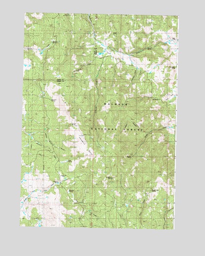
Calamity Butte, OR USGS Topographic Map
Click on map above to begin viewing in our Map Viewer.

This topographic map contains these locations and features:
Feature Name Type Latitude Longitude GNIS ID View Map
Alkali SpringSpringN43.8778°W118.7568°1154157View Map
Beaverdam CreekStreamN43.9807°W118.8091°1137856View Map
Brandon SpringSpringN43.8963°W118.8360°1138570View Map
Calamity ButteSummitN43.9290°W118.8272°1139143View Map
Calamity Butte Lookout TowerTowerN43.9281°W118.8254°1167266View Map
Crane FlatFlatN43.9818°W118.8108°1154160View Map
Dry GulchValleyN43.9835°W118.7516°1154159View Map
Elbow CanyonValleyN43.9318°W118.7722°1141712View Map
Elk Wallow SpringSpringN43.9043°W118.8013°1141803View Map
Fortynine SpringSpringN43.9513°W118.7679°1142329View Map
Goodwater SpringSpringN43.9695°W118.7522°1142847View Map
H and Y CabinLocaleN43.8843°W118.8194°1143179View Map
Ithema SpringSpringN43.9805°W118.7752°1144145View Map
Jackknife FlatFlatN43.9043°W118.8419°1144188View Map
Jackknife SpringSpringN43.9010°W118.8444°1122345View Map
Jungle SpringSpringN43.9889°W118.8000°1144443View Map
McBride CreekStreamN43.9768°W118.8124°1145910View Map
Mountain SpringSpringN43.9510°W118.8584°1146547View Map
Oard SpringSpringN43.9137°W118.8370°1147124View Map
Potts FieldFlatN43.9526°W118.7554°1154158View Map
Ragged Rock SpringSpringN43.8976°W118.7690°1148136View Map
Rock SpringsSpringN43.9988°W118.8404°1148638View Map
Rock Springs CampgroundLocaleN43.9988°W118.8385°1156462View Map
Rosewood GulchValleyN43.9763°W118.7913°1148734View Map
Stewart SpringSpringN43.9169°W118.7862°1150421View Map
Sunshine SpringSpringN43.9828°W118.8520°1150694View Map
Tin Can SpringSpringN43.9339°W118.8381°1151261View Map
Wade RanchLocaleN43.9860°W118.7547°1133905View Map
Willow Spring BrookStreamN43.9288°W118.8710°1152444View Map

Note: Coordinates in the location and feature list above are referenced to NAD83 datum.


Copyright (C) 2008-2024 Ryan Niemi / Sunset Dynamics ... All Rights Reserved