TopoQuest Logo
Do you find TopoQuest useful?
Help keep TopoQuest running and adding new maps/features by donating!
Bitcoin:  19c7KJd3qBynnjoSw5npx9KScwjBe4ifkT
Litecoin:  LXs6TkuXGGXo1vDsWCkWVdjQX94eUKd6ui
Home View Maps Find Maps Find Places Resources & Links


Alma Center, Wisconsin Topographic Map

USGS Map Title: Alma Center, WI
USGS Map MRC: 44090D8
DRG (GeoTIFF) Download: o44090d8.tif


Neighboring USGS Topographic Map Quads:


  Price, WI  
44091E1
 

  Fairchild, WI  
44090E8
 

  Wildcat Mound, WI  
44090E7
 

  Hixton, WI  
44091D1
 

  Alma Center, WI  
44090D8
 

  Merrillan, WI  
44090D7
 

  Taylor, WI  
44091C1
 

  Stenulson Coulee, WI  
44090C8
 

  Black River Falls, WI  
44090C7


Map MRC Location:

N45°
W91°
N45°
W90°
H8 H7 H6 H5 H4 H3 H2 H1
G8 G7 G6 G5 G4 G3 G2 G1
F8 F7 F6 F5 F4 F3 F2 F1
E8 E7 E6 E5 E4 E3 E2 E1
D8 D7 D6 D5 D4 D3 D2 D1
C8 C7 C6 C5 C4 C3 C2 C1
B8 B7 B6 B5 B4 B3 B2 B1
A8 A7 A6 A5 A4 A3 A2 A1
N44°
W91°
N44°
W90°

Alma Center, WI USGS 1:24K Topographic Map Preview:
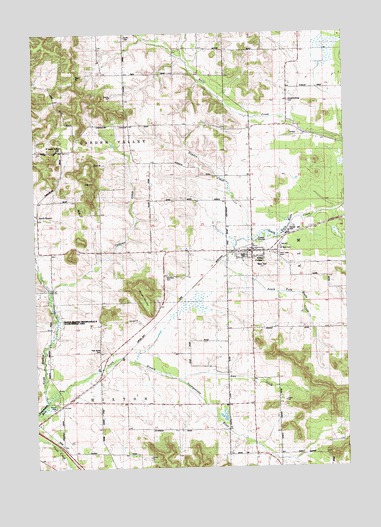
Alma Center, WI USGS Topographic Map
Click on map above to begin viewing in our Map Viewer.

This topographic map contains these locations and features:
Feature Name Type Latitude Longitude GNIS ID View Map
Alma CenterPopulated PlaceN44.4372°W90.9113°1560797View Map
Alma Center Volunteer Fire DepartmentBuildingN44.4379°W90.9132°2697591View Map
Amo CreekStreamN44.4005°W90.9426°1560842View Map
Avon Road Jersey FarmLocaleN44.4300°W90.8969°2611492View Map
Curtis CemeteryCemeteryN44.4986°W90.9635°1563633View Map
East Lawn CemeteryCemeteryN44.4361°W90.9004°1564347View Map
Hayden CreekStreamN44.4402°W90.9118°1566212View Map
Hixton ParkParkN44.3947°W90.9924°1566492View Map
Houghtonburg CemeteryCemeteryN44.4802°W90.8954°1566760View Map
Houghtonburg School (historical)SchoolN44.4989°W90.8932°1845464View Map
Judkins CreekStreamN44.4264°W90.9935°1567305View Map
Judkins School (historical)SchoolN44.4375°W90.9585°1845470View Map
Leverett School (historical)SchoolN44.4844°W90.9638°1845475View Map
Lincoln High SchoolSchoolN44.4357°W90.9161°1845478View Map
Lincoln Junior and Senior High SchoolSchoolN44.4359°W90.9167°2715813View Map
Lower North Branch School (historical)SchoolN44.4147°W90.9940°1845481View Map
North BranchPopulated PlaceN44.4475°W90.9990°1570361View Map
North Branch Trempealeau RiverStreamN44.3939°W90.9957°1570397View Map
Pole Grove CemeteryCemeteryN44.4086°W90.9740°1571735View Map
Pole Grove School (historical)SchoolN44.3977°W90.9751°1845495View Map
Pomroy School (historical)SchoolN44.4700°W90.9135°1845497View Map
Saddle MoundSummitN44.4102°W90.9101°1845503View Map
Saint Mary CemeteryCemeteryN44.4375°W90.9004°1573297View Map
Silver MoundSummitN44.4266°W90.9596°1574158View Map
South Alma School (historical)SchoolN44.3933°W90.9232°1845514View Map
South Branch Trempealeau RiverStreamN44.3939°W90.9960°1574417View Map
Stanford CemeteryCemeteryN44.4297°W90.9471°1574788View Map
Town of Garden ValleyCivilN44.4663°W90.9836°1583255View Map
Town of HixtonCivilN44.3787°W90.9827°1583397View Map
Village of Alma CenterCivilN44.4370°W90.9128°1582678View Map
West Garden Valley CemeteryCemeteryN44.4666°W90.9890°1845532View Map
West Garden Valley ChurchChurchN44.4658°W90.9993°1576507View Map

Note: Coordinates in the location and feature list above are referenced to NAD83 datum.


Copyright (C) 2008-2024 Ryan Niemi / Sunset Dynamics ... All Rights Reserved