TopoQuest Logo
Do you find TopoQuest useful?
Help keep TopoQuest running and adding new maps/features by donating!
Bitcoin:  19c7KJd3qBynnjoSw5npx9KScwjBe4ifkT
Litecoin:  LXs6TkuXGGXo1vDsWCkWVdjQX94eUKd6ui
Home View Maps Find Maps Find Places Resources & Links


Bynum, Montana Topographic Map

USGS Map Title: Bynum, MT
USGS Map MRC: 47112H3
DRG (GeoTIFF) Download: o47112h3.tif


Neighboring USGS Topographic Map Quads:


  Soap Creek, MT  
48112A4
 

  Pendroy, MT  
48112A3
 

  Agawam North, MT  
48112A2
 

  Bynum Reservoir, MT  
47112H4
 

  Bynum, MT  
47112H3
 

  Agawam South, MT  
47112H2
 

  Watson Flats, MT  
47112G4
 

  Teton Buttes, MT  
47112G3
 

  Choteau, MT  
47112G2


Map MRC Location:

N48°
W113°
N48°
W112°
H8 H7 H6 H5 H4 H3 H2 H1
G8 G7 G6 G5 G4 G3 G2 G1
F8 F7 F6 F5 F4 F3 F2 F1
E8 E7 E6 E5 E4 E3 E2 E1
D8 D7 D6 D5 D4 D3 D2 D1
C8 C7 C6 C5 C4 C3 C2 C1
B8 B7 B6 B5 B4 B3 B2 B1
A8 A7 A6 A5 A4 A3 A2 A1
N47°
W113°
N47°
W112°

Bynum, MT USGS 1:24K Topographic Map Preview:
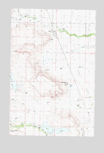
Bynum, MT USGS Topographic Map
Click on map above to begin viewing in our Map Viewer.

This topographic map contains these locations and features:
Feature Name Type Latitude Longitude GNIS ID View Map
25N05W05D___01 WellWellN47.9463°W112.2720°825254View Map
26N05W20____01 WellWellN47.9933°W112.2756°825398View Map
26N05W30____01 WellWellN47.9788°W112.2973°825334View Map
Armstrong RanchLocaleN47.9044°W112.2725°768340View Map
Black RanchLocaleN47.8830°W112.3289°768977View Map
Blixrud RanchLocaleN47.9169°W112.3539°769030View Map
BynumLocaleN47.9786°W112.3100°1762132View Map
BynumPopulated PlaceN47.9791°W112.3117°769461View Map
Bynum CemeteryCemeteryN47.9713°W112.3073°1761983View Map
Bynum Census Designated PlaceCensusN47.9681°W112.3165°2583794View Map
Bynum Elementary SchoolSchoolN47.9772°W112.3156°1761968View Map
Bynum Post OfficePost OfficeN47.9783°W112.3128°1762142View Map
D CanalCanalN47.9855°W112.2809°770415View Map
Eldorado DitchCanalN47.9119°W112.2639°771167View Map
Erickson RanchLocaleN47.9416°W112.2989°771237View Map
Eureka ReservoirReservoirN47.8820°W112.3108°771249View Map
Eureka Reservoir DamDamN47.8783°W112.3175°796482View Map
Eureka Reservoir Fishing Access SiteLocaleN47.8802°W112.2884°1744314View Map
Fabrick RanchLocaleN47.9927°W112.3564°806775View Map
Farmers Coop Canal Company DamDamN47.9300°W112.3725°796148View Map
Farmers DitchCanalN47.8986°W112.3384°771312View Map
Farmers ReservoirReservoirN47.9287°W112.3742°796149View Map
Farmers ReservoirReservoirN47.9205°W112.3664°771313View Map
KoylPopulated PlaceN47.9002°W112.2628°773129View Map
Koyl (historical)LocaleN47.9002°W112.2628°1762067View Map
Koyl Post Office (historical)Post OfficeN47.9002°W112.2628°1762066View Map
Larson RanchLocaleN47.9430°W112.2684°773236View Map
McDonald CreekStreamN47.8827°W112.3603°787029View Map
Methodist Episcopal Church (historical)ChurchN47.9791°W112.3117°1761980View Map
Miller ColonyPopulated PlaceN47.9263°W112.2900°806959View Map
Miller Colony SchoolSchoolN47.9255°W112.2909°1761959View Map
Miller CreekStreamN47.9883°W112.3375°774244View Map
Monkman RanchLocaleN47.9413°W112.3242°774336View Map
North Fork Muddy CreekStreamN47.9917°W112.3564°767979View Map
Pelzman RanchLocaleN47.9094°W112.3689°806802View Map
Perkins RanchLocaleN47.9794°W112.2995°775161View Map
Ralston GapGapN47.9058°W112.3064°775541View Map
Rowland School (historical)SchoolN47.9430°W112.3078°1761955View Map
S CanalCanalN47.9788°W112.3303°807034View Map
Saint Patricks Church (historical)ChurchN47.9791°W112.3117°1761982View Map
The Church of Jesus Christ of Latter Day Saints (historical)ChurchN47.9791°W112.3117°1761981View Map
Trexler RanchLocaleN47.9705°W112.3161°777755View Map

Note: Coordinates in the location and feature list above are referenced to NAD83 datum.


Copyright (C) 2008-2024 Ryan Niemi / Sunset Dynamics ... All Rights Reserved