TopoQuest Logo
Do you find TopoQuest useful?
Help keep TopoQuest running and adding new maps/features by donating!
Bitcoin:  19c7KJd3qBynnjoSw5npx9KScwjBe4ifkT
Litecoin:  LXs6TkuXGGXo1vDsWCkWVdjQX94eUKd6ui
Home View Maps Find Maps Find Places Resources & Links


Byhalia NW, Mississippi Topographic Map

USGS Map Title: Byhalia NW, MS
USGS Map MRC: 34089H6
DRG (GeoTIFF) Download: o34089h6.tif


Neighboring USGS Topographic Map Quads:


  Germantown, TN  
35089A7
 

  Collierville, TN  
35089A6
 

  Rossville, TN  
35089A5
 

  Olive Branch, MS  
34089H7
 

  Byhalia NW, MS  
34089H6
 

  Mount Pleasant, MS  
34089H5
 

  Lewisburg, MS  
34089G7
 

  Byhalia, MS  
34089G6
 

  Red Banks, MS  
34089G5


Map MRC Location:

N35°
W90°
N35°
W89°
H8 H7 H6 H5 H4 H3 H2 H1
G8 G7 G6 G5 G4 G3 G2 G1
F8 F7 F6 F5 F4 F3 F2 F1
E8 E7 E6 E5 E4 E3 E2 E1
D8 D7 D6 D5 D4 D3 D2 D1
C8 C7 C6 C5 C4 C3 C2 C1
B8 B7 B6 B5 B4 B3 B2 B1
A8 A7 A6 A5 A4 A3 A2 A1
N34°
W90°
N34°
W89°

Byhalia NW, MS USGS 1:24K Topographic Map Preview:
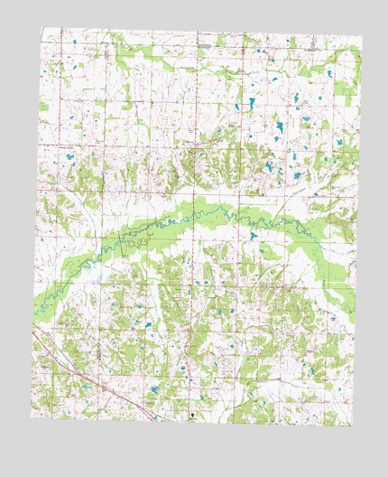
Byhalia NW, MS USGS Topographic Map
Click on map above to begin viewing in our Map Viewer.

This topographic map contains these locations and features:
Feature Name Type Latitude Longitude GNIS ID View Map
BartonPopulated PlaceN34.9640°W89.6893°691685View Map
Barton CemeteryCemeteryN34.9609°W89.6884°683784View Map
Barton ChurchChurchN34.9609°W89.6893°666552View Map
Barton Volunteer Fire DepartmentBuildingN34.9621°W89.7155°2425270View Map
Byhalia SchoolSchoolN34.8773°W89.6870°706303View Map
Byhalia Volunteer Fire Department Station 2BuildingN34.8754°W89.6878°2665958View Map
Center Hill Baptist ChurchChurchN34.9884°W89.7431°690243View Map
Center Hill CemeteryCemeteryN34.9890°W89.7440°690479View Map
Centre Hill (historical)LocaleN34.9890°W89.7493°690480View Map
Church of ChristChurchN34.8995°W89.6904°668451View Map
Coldwater CemeteryCemeteryN34.9704°W89.6742°683795View Map
Coldwater ChurchChurchN34.9704°W89.6756°668667View Map
Colonial Air ParkAirportN34.9982°W89.7315°2675478View Map
Eason CemeteryCemeteryN34.9187°W89.6537°1959768View Map
Eason ChurchChurchN34.9193°W89.6526°669556View Map
Eason School (historical)SchoolN34.9181°W89.6537°683799View Map
Fair Haven Volunteer Fire DepartmentBuildingN34.9205°W89.7439°2666026View Map
Halliburton CemeteryCemeteryN34.9765°W89.7326°690512View Map
Halliburton ChurchChurchN34.9765°W89.7331°690290View Map
Halliburton School (historical)SchoolN34.9748°W89.7329°690513View Map
Handy CornerPopulated PlaceN34.9623°W89.7420°690291View Map
Hearn Grove ChurchChurchN34.9040°W89.6487°671055View Map
Hearn Grove School (historical)SchoolN34.9040°W89.6490°683808View Map
Hopeville (historical)LocaleN34.9543°W89.7062°683810View Map
Irons School (historical)SchoolN34.9040°W89.6895°683814View Map
Lee CreekStreamN34.9323°W89.6390°672381View Map
McGehee CemeteryCemeteryN34.9645°W89.7276°690333View Map
Meadow Brook Baptist ChurchChurchN34.9054°W89.7359°690334View Map
Mount Carmel Associate Reformed Presbyterian Church (historical)ChurchN34.9509°W89.6359°706316View Map
Mount Carmel CemeteryCemeteryN34.9512°W89.6359°673951View Map
Mount Pisgah CemeteryCemeteryN34.9404°W89.6279°683834View Map
New Hardy Church (historical)ChurchN34.9329°W89.6617°683837View Map
Reynolds Box (historical)LocaleN34.9079°W89.7034°683850View Map
Saint Mathis CemeteryCemeteryN34.8818°W89.7053°683853View Map
Saint Matthew ChurchChurchN34.8809°W89.7056°677167View Map
Shiloh Baptist ChurchChurchN34.9651°W89.6804°677708View Map
Shiloh CemeteryCemeteryN34.9645°W89.6804°683856View Map
Supervisor District 3CivilN34.9185°W89.6681°711984View Map
WMSO-AM (Collierville)TowerN34.9890°W89.6859°1639805View Map

Note: Coordinates in the location and feature list above are referenced to NAD83 datum.


Copyright (C) 2008-2024 Ryan Niemi / Sunset Dynamics ... All Rights Reserved