TopoQuest Logo
Do you find TopoQuest useful?
Help keep TopoQuest running and adding new maps/features by donating!
Bitcoin:  19c7KJd3qBynnjoSw5npx9KScwjBe4ifkT
Litecoin:  LXs6TkuXGGXo1vDsWCkWVdjQX94eUKd6ui
Home View Maps Find Maps Find Places Resources & Links


Buzzard Roost, Idaho Topographic Map

USGS Map Title: Buzzard Roost, ID
USGS Map MRC: 46115H6
DRG (GeoTIFF) Download: o46115h6.tif


Neighboring USGS Topographic Map Quads:


  Monumental Buttes, ID  
47115A7
 

  Montana Peak, ID  
47115A6
 

  Bathtub Mountain, ID  
47115A5
 

  Little Goat Mountains, ID  
46115H7
 

  Buzzard Roost, ID  
46115H6
 

  Mallard Peak, ID  
46115H5
 

  Bertha Hill, ID  
46115G7
 

  Thompson Point, ID  
46115G6
 

  Sheep Mountain, ID  
46115G5


Map MRC Location:

N47°
W116°
N47°
W115°
H8 H7 H6 H5 H4 H3 H2 H1
G8 G7 G6 G5 G4 G3 G2 G1
F8 F7 F6 F5 F4 F3 F2 F1
E8 E7 E6 E5 E4 E3 E2 E1
D8 D7 D6 D5 D4 D3 D2 D1
C8 C7 C6 C5 C4 C3 C2 C1
B8 B7 B6 B5 B4 B3 B2 B1
A8 A7 A6 A5 A4 A3 A2 A1
N46°
W116°
N46°
W115°

Buzzard Roost, ID USGS 1:24K Topographic Map Preview:
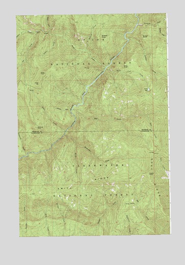
Buzzard Roost, ID USGS Topographic Map
Click on map above to begin viewing in our Map Viewer.

This topographic map contains these locations and features:
Feature Name Type Latitude Longitude GNIS ID View Map
Bear CreekStreamN46.9463°W115.7060°377093View Map
Brush CreekStreamN46.9902°W115.7238°378332View Map
Buzzard CreekStreamN46.9791°W115.6943°378621View Map
Buzzard RoostSummitN46.9877°W115.6815°378622View Map
Calipeen CreekStreamN46.9457°W115.7074°378730View Map
Chicadee CabinLocaleN46.9907°W115.7340°379247View Map
Cobbler CreekStreamN46.9888°W115.7177°379480View Map
Crescendo CreekStreamN46.9205°W115.7432°380056View Map
Delate CreekStreamN46.9341°W115.7118°380487View Map
Devils Club CreekStreamN46.9688°W115.6782°380529View Map
Devils LakeLakeN46.9569°W115.6417°380545View Map
Devils PulpitSummitN46.9705°W115.6629°380546View Map
Dip CreekStreamN46.9905°W115.7346°380600View Map
Foehl CreekStreamN46.9702°W115.6774°399876View Map
Getaway PointSummitN46.9366°W115.7349°382256View Map
Grassy PointSummitN46.9091°W115.6421°396582View Map
Grizzley LakeLakeN46.9583°W115.6256°2652054View Map
Honey CreekStreamN46.9257°W115.7027°383282View Map
Indian DipSummitN46.9616°W115.7329°383673View Map
Joker PeakSummitN46.9663°W115.7288°384005View Map
Larkins CreekStreamN46.9855°W115.6579°384441View Map
Minnesaka CreekStreamN46.9324°W115.7121°387028View Map
Mulligan CreekStreamN46.9938°W115.6338°387400View Map
Mulligan HumpSummitN46.9871°W115.6468°396936View Map
Pitchfork CreekStreamN46.9902°W115.7443°388572View Map
Salmon RidgeRidgeN46.8794°W115.6685°389856View Map
Sawtooth CreekStreamN46.9938°W115.6504°389993View Map
Trappers CabinLocaleN46.9977°W115.6482°398469View Map

Note: Coordinates in the location and feature list above are referenced to NAD83 datum.


Copyright (C) 2008-2024 Ryan Niemi / Sunset Dynamics ... All Rights Reserved