TopoQuest Logo
Do you find TopoQuest useful?
Help keep TopoQuest running and adding new maps/features by donating!
Bitcoin:  19c7KJd3qBynnjoSw5npx9KScwjBe4ifkT
Litecoin:  LXs6TkuXGGXo1vDsWCkWVdjQX94eUKd6ui
Home View Maps Find Maps Find Places Resources & Links


Button Mesa North, New Mexico Topographic Map

USGS Map Title: Button Mesa North, NM
USGS Map MRC: 33103F6
DRG (GeoTIFF) Download: o33103f6.tif


Neighboring USGS Topographic Map Quads:


  Kenna, NM  
33103G7
 

  Schram Lake, NM  
33103G6
 

  Elida SE, NM  
33103G5
 

  Lone Wolf, NM  
33103F7
 

  Button Mesa North, NM  
33103F6
 

  Button Mesa NE, NM  
33103F5
 

  Curlew Lake SE, NM  
33103E7
 

  Button Mesa South, NM  
33103E6
 

  Flying M Ranch, NM  
33103E5


Map MRC Location:

N34°
W104°
N34°
W103°
H8 H7 H6 H5 H4 H3 H2 H1
G8 G7 G6 G5 G4 G3 G2 G1
F8 F7 F6 F5 F4 F3 F2 F1
E8 E7 E6 E5 E4 E3 E2 E1
D8 D7 D6 D5 D4 D3 D2 D1
C8 C7 C6 C5 C4 C3 C2 C1
B8 B7 B6 B5 B4 B3 B2 B1
A8 A7 A6 A5 A4 A3 A2 A1
N33°
W104°
N33°
W103°

Button Mesa North, NM USGS 1:24K Topographic Map Preview:
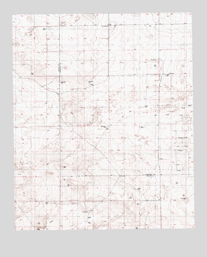
Button Mesa North, NM USGS Topographic Map
Click on map above to begin viewing in our Map Viewer.

This topographic map contains these locations and features:
Feature Name Type Latitude Longitude GNIS ID View Map
06175 Water WellWellN33.7448°W103.6461°926330View Map
06176 Water WellWellN33.7476°W103.6405°926331View Map
06205 Water WellWellN33.7412°W103.6819°926328View Map
06206 Water WellWellN33.7273°W103.7158°926324View Map
06209 Water WellWellN33.7145°W103.6402°926319View Map
06210 Water WellWellN33.6968°W103.6569°926238View Map
06212 Water WellWellN33.6857°W103.6847°926309View Map
06213 Water WellWellN33.6582°W103.6750°926307View Map
Baliff WellLocaleN33.7104°W103.6977°886022View Map
Blackstock WellLocaleN33.6843°W103.6861°886472View Map
Boatwright WellLocaleN33.7104°W103.7172°886549View Map
Button MesaSummitN33.6254°W103.7333°886996View Map
Corner WellPopulated PlaceN33.6423°W103.6311°898536View Map
First West WellLocaleN33.7429°W103.6836°889040View Map
Forseyth WellWellN33.7145°W103.6419°889145View Map
Gallina WellLocaleN33.6562°W103.6766°889300View Map
Jones WellLocaleN33.6959°W103.6588°890555View Map
McLorn WellLocaleN33.6837°W103.6602°891794View Map
South WellLocaleN33.7145°W103.6419°895153View Map
Terrill WellLocaleN33.6482°W103.6644°895593View Map
Vest LakeLakeN33.6410°W103.7270°896127View Map
Vest WellsPopulated PlaceN33.6354°W103.7000°898705View Map
West WellLocaleN33.7412°W103.7275°896423View Map

Note: Coordinates in the location and feature list above are referenced to NAD83 datum.


Copyright (C) 2008-2024 Ryan Niemi / Sunset Dynamics ... All Rights Reserved