TopoQuest Logo
Do you find TopoQuest useful?
Help keep TopoQuest running and adding new maps/features by donating!
Bitcoin:  19c7KJd3qBynnjoSw5npx9KScwjBe4ifkT
Litecoin:  LXs6TkuXGGXo1vDsWCkWVdjQX94eUKd6ui
Home View Maps Find Maps Find Places Resources & Links


Butman, Michigan Topographic Map

USGS Map Title: Butman, MI
USGS Map MRC: 44084B4
DRG (GeoTIFF) Download: o44084b4.tif


Neighboring USGS Topographic Map Quads:


  Backus Lake, MI  
44084C5
 

  Saint Helen, MI  
44084C4
 

  Ogemaw Springs, MI  
44084C3
 

  Meredith, MI  
44084B5
 

  Butman, MI  
44084B4
 

  Edwards, MI  
44084B3
 

  Skeels, MI  
44084A5
 

  Wagarville, MI  
44084A4
 

  Secord Lake, MI  
44084A3


Map MRC Location:

N45°
W85°
N45°
W84°
H8 H7 H6 H5 H4 H3 H2 H1
G8 G7 G6 G5 G4 G3 G2 G1
F8 F7 F6 F5 F4 F3 F2 F1
E8 E7 E6 E5 E4 E3 E2 E1
D8 D7 D6 D5 D4 D3 D2 D1
C8 C7 C6 C5 C4 C3 C2 C1
B8 B7 B6 B5 B4 B3 B2 B1
A8 A7 A6 A5 A4 A3 A2 A1
N44°
W85°
N44°
W84°

Butman, MI USGS 1:24K Topographic Map Preview:
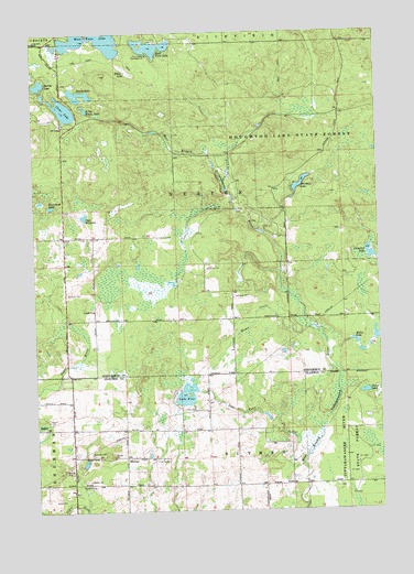
Butman, MI USGS Topographic Map
Click on map above to begin viewing in our Map Viewer.

This topographic map contains these locations and features:
Feature Name Type Latitude Longitude GNIS ID View Map
ButmanPopulated PlaceN44.1392°W84.4675°622373View Map
Butman CemeteryCemeteryN44.1397°W84.4792°622374View Map
Butman Post Office (historical)Post OfficeN44.1392°W84.4675°2515970View Map
Campbell LakeLakeN44.1919°W84.3781°622662View Map
Clear LakeLakeN44.2300°W84.4884°623420View Map
Coan MillpondLakeN44.2022°W84.4817°623512View Map
Dunham LakeLakeN44.2100°W84.4031°624993View Map
East Twin LakeLakeN44.2462°W84.4581°625267View Map
Eddy LakeLakeN44.2397°W84.4656°625347View Map
Knowland LakeLakeN44.2047°W84.4936°629826View Map
Lake FourLakeN44.1542°W84.4464°626336View Map
Lake Four OutletStreamN44.1389°W84.4022°1623474View Map
Little Woods LakeLakeN44.2299°W84.4805°630826View Map
Lost CreekStreamN44.2492°W84.4031°631076View Map
Mikes LakeReservoirN44.1692°W84.3843°632298View Map
Muma CreekStreamN44.1728°W84.3989°633113View Map
Nester Township CemeteryCemeteryN44.2397°W84.4893°2774409View Map
Nester Township Fire DepartmentBuildingN44.1995°W84.4895°2626879View Map
Nester Township HallBuildingN44.2367°W84.4894°2508877View Map
Nolan CemeteryCemeteryN44.1961°W84.4780°2509032View Map
Nolan Post Office (historical)Post OfficeN44.1972°W84.4781°2508851View Map
Nolan Station (historical)LocaleN44.1975°W84.4781°2508850View Map
Noren CreekStreamN44.1936°W84.3781°633457View Map
Perch LakeLakeN44.1557°W84.3808°634630View Map
Spring LakeLakeN44.2366°W84.4973°638584View Map
Sugar Springs AirparkAirportN44.1401°W84.4418°1623918View Map
Sugar Springs CampgroundLocaleN44.1319°W84.4250°2515886View Map
Sugar Springs Country ClubLocaleN44.1319°W84.4494°2515887View Map
Township of NesterCivilN44.2039°W84.4891°1626793View Map
Twin Lakes CampgroundLocaleN44.2442°W84.4586°1615278View Map
West Twin LakeLakeN44.2488°W84.4739°1616185View Map
Woods LakeLakeN44.2327°W84.4824°1616793View Map

Note: Coordinates in the location and feature list above are referenced to NAD83 datum.


Copyright (C) 2008-2024 Ryan Niemi / Sunset Dynamics ... All Rights Reserved