TopoQuest Logo
Do you find TopoQuest useful?
Help keep TopoQuest running and adding new maps/features by donating!
Bitcoin:  19c7KJd3qBynnjoSw5npx9KScwjBe4ifkT
Litecoin:  LXs6TkuXGGXo1vDsWCkWVdjQX94eUKd6ui
Home View Maps Find Maps Find Places Resources & Links


Butler West, Indiana Topographic Map

USGS Map Title: Butler West, IN
USGS Map MRC: 41084D8
DRG (GeoTIFF) Download: o41084d8.tif


Neighboring USGS Topographic Map Quads:


  Ashley, IN  
41085E1
 

  Hamilton, IN  
41084E8
 

  Edon, OH  
41084E7
 

  Waterloo, IN  
41085D1
 

  Butler West, IN  
41084D8
 

  Butler East, IN  
41084D7
 

  Auburn, IN  
41085C1
 

  Saint Joe, IN  
41084C8
 

  Hicksville, OH  
41084C7


Map MRC Location:

N42°
W85°
N42°
W84°
H8 H7 H6 H5 H4 H3 H2 H1
G8 G7 G6 G5 G4 G3 G2 G1
F8 F7 F6 F5 F4 F3 F2 F1
E8 E7 E6 E5 E4 E3 E2 E1
D8 D7 D6 D5 D4 D3 D2 D1
C8 C7 C6 C5 C4 C3 C2 C1
B8 B7 B6 B5 B4 B3 B2 B1
A8 A7 A6 A5 A4 A3 A2 A1
N41°
W85°
N41°
W84°

Butler West, IN USGS 1:24K Topographic Map Preview:
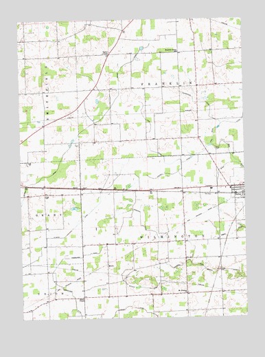
Butler West, IN USGS Topographic Map
Click on map above to begin viewing in our Map Viewer.

This topographic map contains these locations and features:
Feature Name Type Latitude Longitude GNIS ID View Map
DeKalb CountyCivilN41.3976°W84.9991°450346View Map
Donnell DitchCanalN41.4384°W84.9100°433635View Map
Franklin Center SchoolSchoolN41.4864°W84.9111°434767View Map
Harrold Airport (historical)AirportN41.4928°W84.9055°449119View Map
Harwood DitchCanalN41.3987°W84.9205°435857View Map
Haverstock DitchCanalN41.4623°W84.8933°435892View Map
Hoodelmier DitchCanalN41.3859°W84.9725°436402View Map
King DitchCanalN41.4473°W84.9280°437324View Map
Krontz CemeteryCemeteryN41.3945°W84.8897°437464View Map
Lutz CemeteryCemeteryN41.4409°W84.9958°438420View Map
Mason DitchCanalN41.4092°W84.8830°438695View Map
Matson DitchCanalN41.4542°W84.9641°438726View Map
Metcalf DitchCanalN41.3914°W84.9041°439047View Map
MoorePopulated PlaceN41.3970°W84.9525°439389View Map
Mount Pleasant ChurchChurchN41.3853°W84.9077°439687View Map
Norris ChapelChurchN41.3839°W84.9664°440206View Map
Ridge CemeteryCemeteryN41.4262°W84.9866°441992View Map
Rude CemeteryCemeteryN41.4456°W84.8907°442381View Map
Taylor CornerPopulated PlaceN41.4856°W84.9494°444589View Map
Teutsch DitchCanalN41.4303°W84.8900°444656View Map
Township of FranklinCivilN41.4856°W84.9104°453300View Map
Township of WilmingtonCivilN41.3992°W84.9083°454061View Map
Varner DitchCanalN41.3764°W84.9269°445234View Map
W Smith DitchCanalN41.4114°W84.9730°445325View Map
Walker/Rowe Waterloo AirportAirportN41.4319°W84.9769°449378View Map

Note: Coordinates in the location and feature list above are referenced to NAD83 datum.


Copyright (C) 2008-2024 Ryan Niemi / Sunset Dynamics ... All Rights Reserved