TopoQuest Logo
Do you find TopoQuest useful?
Help keep TopoQuest running and adding new maps/features by donating!
Bitcoin:  19c7KJd3qBynnjoSw5npx9KScwjBe4ifkT
Litecoin:  LXs6TkuXGGXo1vDsWCkWVdjQX94eUKd6ui
Home View Maps Find Maps Find Places Resources & Links


Butler, Missouri Topographic Map

USGS Map Title: Butler, MO
USGS Map MRC: 38094C3
DRG (GeoTIFF) Download: o38094c3.tif


Neighboring USGS Topographic Map Quads:


  Main City, MO  
38094D4
 

  Adrian, MO  
38094D3
 

  Dayton, MO  
38094D2
 

  Virginia, MO  
38094C4
 

  Butler, MO  
38094C3
 

  Spruce, MO  
38094C2
 

  New Home, MO  
38094B4
 

  Butler South, MO  
38094B3
 

  Pleasant Gap, MO  
38094B2


Map MRC Location:

N39°
W95°
N39°
W94°
H8 H7 H6 H5 H4 H3 H2 H1
G8 G7 G6 G5 G4 G3 G2 G1
F8 F7 F6 F5 F4 F3 F2 F1
E8 E7 E6 E5 E4 E3 E2 E1
D8 D7 D6 D5 D4 D3 D2 D1
C8 C7 C6 C5 C4 C3 C2 C1
B8 B7 B6 B5 B4 B3 B2 B1
A8 A7 A6 A5 A4 A3 A2 A1
N38°
W95°
N38°
W94°

Butler, MO USGS 1:24K Topographic Map Preview:
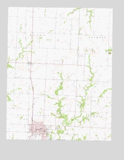
Butler, MO USGS Topographic Map
Click on map above to begin viewing in our Map Viewer.

This topographic map contains these locations and features:
Feature Name Type Latitude Longitude GNIS ID View Map
Bates CountyCivilN38.2573°W94.3400°758461View Map
Bates County Sheriff's OfficeBuildingN38.2568°W94.3324°2752509View Map
Bobcat ForkStreamN38.2767°W94.2708°2740526View Map
ButlerPopulated PlaceN38.2586°W94.3305°715118View Map
Butler Academy (historical)SchoolN38.2635°W94.3375°745635View Map
Butler Elementary SchoolSchoolN38.2585°W94.3408°2743780View Map
Butler Fire DepartmentBuildingN38.2609°W94.3444°2620376View Map
Butler High SchoolSchoolN38.2513°W94.3368°2743781View Map
Butler Memorial AirportAirportN38.2892°W94.3414°758612View Map
Butler Police DepartmentBuildingN38.2608°W94.3351°2752288View Map
Butler Post OfficePost OfficeN38.2588°W94.3341°2779521View Map
Church of ChristChurchN38.2875°W94.2741°715835View Map
City of ButlerCivilN38.2598°W94.3393°2393483View Map
Collins LakeReservoirN38.3667°W94.2602°763443View Map
Collins Lake DamDamN38.3667°W94.2602°763442View Map
Daisys CreekStreamN38.2908°W94.2650°2710670View Map
Dillon School (historical)SchoolN38.3506°W94.3086°746018View Map
East Mound BranchStreamN38.2644°W94.3037°717325View Map
Glass BranchStreamN38.2733°W94.2786°2740414View Map
Glass CemeteryCemeteryN38.2697°W94.2799°718487View Map
Herrell School (historical)SchoolN38.2886°W94.2741°746020View Map
Little Deer Creek School (historical)SchoolN38.3745°W94.2719°746017View Map
Long MoundSummitN38.3350°W94.2730°721552View Map
Mount Olivet ChurchChurchN38.3500°W94.2897°722835View Map
Mount Zion School (historical)SchoolN38.3514°W94.3455°746015View Map
Nichols CemeteryCemeteryN38.3714°W94.2808°723356View Map
Oak Hill CemeteryCemeteryN38.2614°W94.3155°723616View Map
PassaicPopulated PlaceN38.3220°W94.3483°724068View Map
Passaic School (historical)SchoolN38.3220°W94.3513°746022View Map
Patty School (historical)SchoolN38.2711°W94.3172°746021View Map
Powell LakeReservoirN38.2984°W94.2552°763281View Map
Powell Lake DamDamN38.2984°W94.2552°763280View Map
Round MoundSummitN38.3325°W94.2530°725606View Map
Seelinger BranchStreamN38.2786°W94.2675°2740445View Map
Shady Dell School (historical)SchoolN38.2889°W94.3488°746016View Map
Town of PassaicCivilN38.3220°W94.3486°2396849View Map
Township of MoundCivilN38.3510°W94.3463°766300View Map
Township of Mount PleasantCivilN38.2644°W94.3489°766301View Map
WeMott School (historical)SchoolN38.3259°W94.2736°746019View Map
Westgate Shopping CenterLocaleN38.2561°W94.3438°736105View Map
Willow BranchStreamN38.2703°W94.2938°728930View Map

Note: Coordinates in the location and feature list above are referenced to NAD83 datum.


Copyright (C) 2008-2024 Ryan Niemi / Sunset Dynamics ... All Rights Reserved