TopoQuest Logo
Do you find TopoQuest useful?
Help keep TopoQuest running and adding new maps/features by donating!
Bitcoin:  19c7KJd3qBynnjoSw5npx9KScwjBe4ifkT
Litecoin:  LXs6TkuXGGXo1vDsWCkWVdjQX94eUKd6ui
Home View Maps Find Maps Find Places Resources & Links


Burt Lake, Michigan Topographic Map

USGS Map Title: Burt Lake, MI
USGS Map MRC: 45084D6
DRG (GeoTIFF) Download: o45084d6.tif


Neighboring USGS Topographic Map Quads:


  Burt Lake, MI  
45084D6
 

  Indian River, MI  
45084D5


  Wildwood, MI  
45084C6
 

  Wolverine, MI  
45084C5


Map MRC Location:

N46°
W85°
N46°
W84°
H8 H7 H6 H5 H4 H3 H2 H1
G8 G7 G6 G5 G4 G3 G2 G1
F8 F7 F6 F5 F4 F3 F2 F1
E8 E7 E6 E5 E4 E3 E2 E1
D8 D7 D6 D5 D4 D3 D2 D1
C8 C7 C6 C5 C4 C3 C2 C1
B8 B7 B6 B5 B4 B3 B2 B1
A8 A7 A6 A5 A4 A3 A2 A1
N45°
W85°
N45°
W84°

Burt Lake, MI USGS 1:24K Topographic Map Preview:
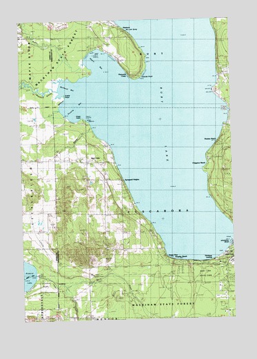
Burt Lake, MI USGS Topographic Map
Click on map above to begin viewing in our Map Viewer.

This topographic map contains these locations and features:
Feature Name Type Latitude Longitude GNIS ID View Map
Berry CreekStreamN45.3942°W84.7425°621168View Map
Bullhead BayBayN45.4739°W84.7214°622226View Map
Burt LakePopulated PlaceN45.4408°W84.7112°1617468View Map
Burt LakeLakeN45.4699°W84.6671°1618893View Map
Burt Lake Christian ChurchChurchN45.4406°W84.7106°2369275View Map
Burt Lake Post Office (historical)Post OfficeN45.4408°W84.7112°1926647View Map
Burt Lake SpringSpringN45.4958°W84.6861°2100369View Map
Burt Lake State ParkParkN45.3961°W84.6345°622332View Map
Cedar CreekStreamN45.3892°W84.7250°622903View Map
Cheboygan Life Support SystemsBuildingN45.3856°W84.6296°2661891View Map
Chippewa BeachPopulated PlaceN45.4403°W84.6392°623213View Map
Colonial PointCapeN45.4761°W84.6787°623626View Map
Cooperation ParkParkN45.3839°W84.6328°2369364View Map
Crooked RiverStreamN45.4706°W84.7273°624112View Map
Cross of the Woods ChurchChurchN45.3975°W84.6311°2369382View Map
ElmhurstPopulated PlaceN45.4961°W84.6887°625522View Map
Grand ViewPopulated PlaceN45.4003°W84.6642°627118View Map
Harmon GraveCemeteryN45.4489°W84.6311°2369431View Map
Hasler CreekStreamN45.4547°W84.7075°627918View Map
Indian River Catholic ShrineChurchN45.3989°W84.6319°2369381View Map
Inland Lakes SchoolSchoolN45.3986°W84.6258°2369374View Map
Inland Lakes SchoolSchoolN45.3986°W84.6270°629043View Map
Kings PointCapeN45.4586°W84.7125°629718View Map
Kingsley BeachPopulated PlaceN45.3986°W84.6567°2100368View Map
Littlefield ChurchChurchN45.4425°W84.7492°630830View Map
Maple BayBayN45.4817°W84.7028°631420View Map
Maple Bay State Forest CampgroundLocaleN45.4881°W84.7083°2369243View Map
Maple RiverStreamN45.4811°W84.7123°631492View Map
Michigan Department of Natural Resources Indian River Field OfficeBuildingN45.3972°W84.6282°2626867View Map
Northern Michigan Bible ChurchChurchN45.4361°W84.7000°2369276View Map
Northern Michigan Christian AcademySchoolN45.4361°W84.7000°2369277View Map
Ohioville CemeteryCemeteryN45.4164°W84.6923°633965View Map
Ohioville SchoolSchoolN45.4050°W84.6900°633966View Map
Peter L Brisbine House Historical MarkerParkN45.4000°W84.6344°2369359View Map
Pinewood CampLocaleN45.4761°W84.6842°635009View Map
Pittsburg LandingPopulated PlaceN45.3992°W84.6431°2100195View Map
Poverty BayBayN45.4611°W84.7148°635364View Map
Saint Mary's Indian CemeteryCemeteryN45.4889°W84.7028°2369429View Map
Snake PointCapeN45.4689°W84.7231°638190View Map
Springwell HeightsPopulated PlaceN45.4336°W84.6900°638634View Map
Township of TuscaroraCivilN45.4196°W84.6587°1627179View Map
Transfiguration Episcopal ChurchChurchN45.3967°W84.6519°2369383View Map
Tuscarora Township Fire DepartmentBuildingN45.3930°W84.6282°2626862View Map
United Methodist ChurchChurchN45.4761°W84.6258°2369379View Map
Wauban BeachPopulated PlaceN45.4489°W84.6334°1615887View Map

Note: Coordinates in the location and feature list above are referenced to NAD83 datum.


Copyright (C) 2008-2024 Ryan Niemi / Sunset Dynamics ... All Rights Reserved