TopoQuest Logo
Do you find TopoQuest useful?
Help keep TopoQuest running and adding new maps/features by donating!
Bitcoin:  19c7KJd3qBynnjoSw5npx9KScwjBe4ifkT
Litecoin:  LXs6TkuXGGXo1vDsWCkWVdjQX94eUKd6ui
Home View Maps Find Maps Find Places Resources & Links


Burrsville, Maryland Topographic Map

USGS Map Title: Burrsville, MD
USGS Map MRC: 38075H6
DRG (GeoTIFF) Download: o38075h6.tif


Neighboring USGS Topographic Map Quads:


  Goldsboro, MD  
39075A7
 

  Marydel, MD  
39075A6
 

  Wyoming, DE  
39075A5
 

  Denton, MD  
38075H7
 

  Burrsville, MD  
38075H6
 

  Harrington, DE  
38075H5
 

  Hobbs, MD  
38075G7
 

  Hickman, DE  
38075G6
 

  Greenwood, DE  
38075G5


Map MRC Location:

N39°
W76°
N39°
W75°
H8 H7 H6 H5 H4 H3 H2 H1
G8 G7 G6 G5 G4 G3 G2 G1
F8 F7 F6 F5 F4 F3 F2 F1
E8 E7 E6 E5 E4 E3 E2 E1
D8 D7 D6 D5 D4 D3 D2 D1
C8 C7 C6 C5 C4 C3 C2 C1
B8 B7 B6 B5 B4 B3 B2 B1
A8 A7 A6 A5 A4 A3 A2 A1
N38°
W76°
N38°
W75°

Burrsville, MD USGS 1:24K Topographic Map Preview:
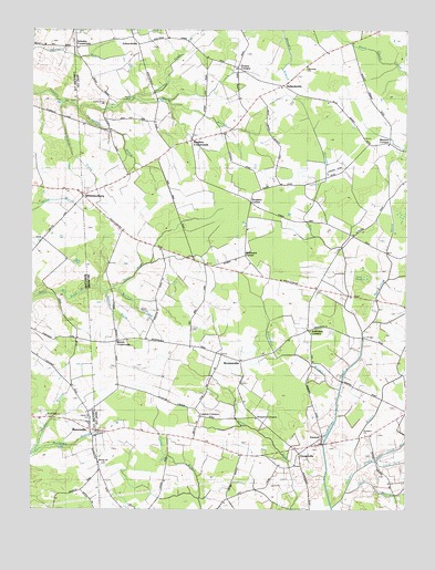
Burrsville, MD USGS Topographic Map
Click on map above to begin viewing in our Map Viewer.

This topographic map contains these locations and features:
Feature Name Type Latitude Longitude GNIS ID View Map
Anthonys CornersLocaleN38.9221°W75.6577°213567View Map
Beaverdam BranchStreamN38.9062°W75.6463°213618View Map
Black Arm ProngStreamN38.9351°W75.6305°213667View Map
Bright Haines Glade BranchStreamN38.8854°W75.6405°213542View Map
BrownsvillePopulated PlaceN38.9137°W75.6797°216052View Map
Bullock ProngStreamN38.9323°W75.7227°213727View Map
BurrsvillePopulated PlaceN38.8940°W75.7288°583498View Map
Burrsville BranchStreamN38.8898°W75.7477°213731View Map
Burrsville Church of GodChurchN38.8993°W75.7449°591733View Map
Cahall BridgeBridgeN38.9084°W75.6461°2378624View Map
Cedar Grove ChurchChurchN38.9809°W75.7249°213774View Map
Drapers CornersLocaleN38.8990°W75.6747°213903View Map
Dyke PondLakeN38.9357°W75.6371°216697View Map
EdwardsvillePopulated PlaceN38.9965°W75.7138°216086View Map
Greenlees DitchStreamN38.9823°W75.7158°214032View Map
Greens CornerPopulated PlaceN38.9904°W75.6816°216696View Map
Greens CornersLocaleN38.9904°W75.6816°217666View Map
GreenvillePopulated PlaceN38.8862°W75.6619°216698View Map
Gut BridgeBridgeN38.9196°W75.6385°214047View Map
HollandsvillePopulated PlaceN38.9854°W75.6660°216113View Map
Hopkins CornersPopulated PlaceN38.9551°W75.6766°216118View Map
Hopkins ProngStreamN38.9312°W75.7244°214118View Map
Horsepen ArmStreamN38.9215°W75.6394°214123View Map
Hughes CrossroadsPopulated PlaceN38.9712°W75.6969°216120View Map
Ingram BranchStreamN38.9332°W75.7310°214146View Map
Layton CornersPopulated PlaceN38.8990°W75.6930°216135View Map
Manship ChurchChurchN38.9901°W75.6583°214267View Map
Marshyhope DitchStreamN38.9215°W75.6394°214277View Map
McKnatt CornersPopulated PlaceN38.9409°W75.6785°216151View Map
Melvin CrossroadsPopulated PlaceN38.9187°W75.7210°216152View Map
Minners CornersPopulated PlaceN38.9707°W75.6302°216157View Map
Mispillion HundredCivilN38.9501°W75.6663°217257View Map
Point BranchStreamN38.8796°W75.6438°214467View Map
Price ProngStreamN38.9315°W75.7249°214489View Map
Prong Number TwoStreamN38.8868°W75.6291°215632View Map
Prong Number TwoStreamN38.8879°W75.6341°214500View Map
Prospect BranchStreamN38.8757°W75.6488°214501View Map
Prospect ChurchChurchN38.8943°W75.6380°214502View Map
Sangston ProngStreamN38.9804°W75.7349°214614View Map
Schultie CrossroadsPopulated PlaceN38.9954°W75.7349°216207View Map
Shields ProngStreamN38.9807°W75.7391°214639View Map
Union ChurchChurchN38.8987°W75.7297°587957View Map
Union CornersPopulated PlaceN38.9004°W75.7305°595925View Map
Union Memorial CemeteryCemeteryN38.8987°W75.7294°595927View Map
VernonPopulated PlaceN38.8934°W75.6527°216238View Map
Webber BranchStreamN38.8901°W75.7477°217657View Map
Wesley ChurchChurchN38.8873°W75.7269°217673View Map
White Marsh BranchStreamN38.9804°W75.7347°214837View Map
WhiteleysburgPopulated PlaceN38.9576°W75.7316°216249View Map
WhiteleysburgPopulated PlaceN38.9568°W75.7324°591550View Map
Whites Church (historical)ChurchN38.9321°W75.6544°217658View Map

Note: Coordinates in the location and feature list above are referenced to NAD83 datum.


Copyright (C) 2008-2024 Ryan Niemi / Sunset Dynamics ... All Rights Reserved