TopoQuest Logo
Do you find TopoQuest useful?
Help keep TopoQuest running and adding new maps/features by donating!
Bitcoin:  19c7KJd3qBynnjoSw5npx9KScwjBe4ifkT
Litecoin:  LXs6TkuXGGXo1vDsWCkWVdjQX94eUKd6ui
Home View Maps Find Maps Find Places Resources & Links


Burney, California Topographic Map

USGS Map Title: Burney, CA
USGS Map MRC: 40121H6
DRG (GeoTIFF) Download: o40121h6.tif


Neighboring USGS Topographic Map Quads:


  Skunk Ridge, CA  
41121A7
 

  Burney Falls, CA  
41121A6
 

  Dana, CA  
41121A5
 

  Chalk Mountain, CA  
40121H7
 

  Burney, CA  
40121H6
 

  Cassel, CA  
40121H5
 

  Hatchet Mountain Pass, CA  
40121G7
 

  Burney Mountain West, CA  
40121G6
 

  Burney Mountain East, CA  
40121G5


Map MRC Location:

N41°
W122°
N41°
W121°
H8 H7 H6 H5 H4 H3 H2 H1
G8 G7 G6 G5 G4 G3 G2 G1
F8 F7 F6 F5 F4 F3 F2 F1
E8 E7 E6 E5 E4 E3 E2 E1
D8 D7 D6 D5 D4 D3 D2 D1
C8 C7 C6 C5 C4 C3 C2 C1
B8 B7 B6 B5 B4 B3 B2 B1
A8 A7 A6 A5 A4 A3 A2 A1
N40°
W122°
N40°
W121°

Burney, CA USGS 1:24K Topographic Map Preview:
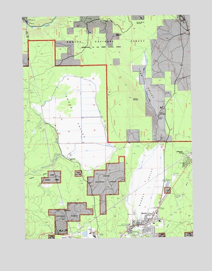
Burney, CA USGS Topographic Map
Click on map above to begin viewing in our Map Viewer.

This topographic map contains these locations and features:
Feature Name Type Latitude Longitude GNIS ID View Map
Albion SchoolSchoolN40.9988°W121.6314°256152View Map
Aubrey Place (historical)LocaleN40.8924°W121.7228°1682359View Map
Aubrey RidgeRidgeN40.9074°W121.7497°256374View Map
Black RanchLocaleN40.9477°W121.6450°257151View Map
BurneyPopulated PlaceN40.8824°W121.6608°277481View Map
Burney Branch Shasta County LibraryBuildingN40.8849°W121.6700°1682364View Map
Burney CemeteryCemeteryN40.8842°W121.6559°1682365View Map
Burney Census Designated PlaceCensusN40.8847°W121.6691°2407926View Map
Burney Civic ParkParkN40.8807°W121.6742°1682366View Map
Burney Elementary Community Day SchoolSchoolN40.8797°W121.6717°1682384View Map
Burney Elementary SchoolSchoolN40.8829°W121.6554°1682376View Map
Burney Fire Protection District Station 17BuildingN40.8822°W121.6675°2621798View Map
Burney Fire Protection District Station 18BuildingN40.9192°W121.6262°2622080View Map
Burney Junior / Senior High SchoolSchoolN40.8842°W121.6510°1682368View Map
Burney Post OfficePost OfficeN40.8893°W121.6522°1661780View Map
Burney Service Center HeliportAirportN40.8943°W121.6508°1653294View Map
Burney Spring MountainSummitN40.9954°W121.6647°1658177View Map
Four CornersPopulated PlaceN40.9985°W121.6317°260293View Map
Goose CreekStreamN40.9240°W121.6530°260704View Map
Goose ValleyValleyN40.9238°W121.6528°260710View Map
Goose Valley RanchLocaleN40.9202°W121.7194°260711View Map
Johnson ParkPopulated PlaceN40.9177°W121.6272°1661815View Map
Johnson Park Census Designated PlaceCensusN40.9143°W121.6307°2611438View Map
KAVA-AM (Burney)TowerN40.8754°W121.6628°1662578View Map
Las Colinas Mobile Home ParkPopulated PlaceN40.8764°W121.6800°2508630View Map
Long ValleyValleyN40.9777°W121.6628°262884View Map
Long Valley MountainSummitN40.9896°W121.6814°1659003View Map
Lookout MountainSummitN40.9532°W121.6697°262902View Map
Pit Three PowerhouseBuildingN40.9974°W121.7480°1661850View Map
Shasta County Sheriff's Office BurneyBuildingN40.8849°W121.6703°2751007View Map
Washburn Bue ParkParkN40.8768°W121.6650°1661877View Map

Note: Coordinates in the location and feature list above are referenced to NAD83 datum.


Copyright (C) 2008-2024 Ryan Niemi / Sunset Dynamics ... All Rights Reserved