TopoQuest Logo
Do you find TopoQuest useful?
Help keep TopoQuest running and adding new maps/features by donating!
Bitcoin:  19c7KJd3qBynnjoSw5npx9KScwjBe4ifkT
Litecoin:  LXs6TkuXGGXo1vDsWCkWVdjQX94eUKd6ui
Home View Maps Find Maps Find Places Resources & Links


Burlington, North Dakota Topographic Map

USGS Map Title: Burlington, ND
USGS Map MRC: 48101C4
DRG (GeoTIFF) Download: o48101c4.tif


Neighboring USGS Topographic Map Quads:


  Carpio NE, ND  
48101D5
 

  Burlington NW, ND  
48101D4
 

  Burlington NE, ND  
48101D3
 

  Des Lacs, ND  
48101C5
 

  Burlington, ND  
48101C4
 

  Burlington SE, ND  
48101C3
 

  Mork Lake, ND  
48101B5
 

  Minot NW, ND  
48101B4
 

  Minot, ND  
48101B3


Map MRC Location:

N49°
W102°
N49°
W101°
H8 H7 H6 H5 H4 H3 H2 H1
G8 G7 G6 G5 G4 G3 G2 G1
F8 F7 F6 F5 F4 F3 F2 F1
E8 E7 E6 E5 E4 E3 E2 E1
D8 D7 D6 D5 D4 D3 D2 D1
C8 C7 C6 C5 C4 C3 C2 C1
B8 B7 B6 B5 B4 B3 B2 B1
A8 A7 A6 A5 A4 A3 A2 A1
N48°
W102°
N48°
W101°

Burlington, ND USGS 1:24K Topographic Map Preview:
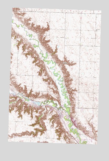
Burlington, ND USGS Topographic Map
Click on map above to begin viewing in our Map Viewer.

This topographic map contains these locations and features:
Feature Name Type Latitude Longitude GNIS ID View Map
Behrens AirstripAirportN48.2704°W101.3970°2646299View Map
BurlingtonPopulated PlaceN48.2753°W101.4288°1034752View Map
Burlington City HallBuildingN48.2773°W101.4321°2744088View Map
Burlington City Police DepartmentBuildingN48.2772°W101.4320°2734370View Map
Burlington Dam Number 1DamN48.2917°W101.4504°1033271View Map
Burlington Dam Number 2DamN48.2983°W101.4971°1033272View Map
Burlington Fire DepartmentBuildingN48.2760°W101.4292°2637635View Map
Burlington Post OfficePost OfficeN48.2752°W101.4294°2741747View Map
Burlington-Des Lacs Elementary SchoolSchoolN48.2726°W101.4283°2747661View Map
City of BurlingtonCivilN48.2762°W101.4249°1035947View Map
Dakota Memorial SchoolSchoolN48.2537°W101.3844°2748095View Map
Des Lacs RiverStreamN48.2797°W101.4188°1028667View Map
Evangelical ChurchChurchN48.3564°W101.3824°1028917View Map
Graham SchoolSchoolN48.3447°W101.4774°1029195View Map
Larsons CouleeValleyN48.2845°W101.4513°1029843View Map
Lloyds CouleeValleyN48.2914°W101.4863°1029956View Map
Minot Country ClubLocaleN48.2586°W101.4007°1030250View Map
Pietschtree AirstripAirportN48.2970°W101.4305°2443499View Map
School Number 2SchoolN48.3483°W101.3832°1031698View Map
School Number 4SchoolN48.3486°W101.4266°1031938View Map
Township of KirkelieCivilN48.3278°W101.4688°1759683View Map

Note: Coordinates in the location and feature list above are referenced to NAD83 datum.


Copyright (C) 2008-2024 Ryan Niemi / Sunset Dynamics ... All Rights Reserved