TopoQuest Logo
Do you find TopoQuest useful?
Help keep TopoQuest running and adding new maps/features by donating!
Bitcoin:  19c7KJd3qBynnjoSw5npx9KScwjBe4ifkT
Litecoin:  LXs6TkuXGGXo1vDsWCkWVdjQX94eUKd6ui
Home View Maps Find Maps Find Places Resources & Links


Burlington, Wisconsin Topographic Map

USGS Map Title: Burlington, WI
USGS Map MRC: 42088F3
DRG (GeoTIFF) Download: o42088f3.tif


Neighboring USGS Topographic Map Quads:


  East Troy, WI  
42088G4
 

  Mukwonago, WI  
42088G3
 

  Waterford, WI  
42088G2
 

  Springfield, WI  
42088F4
 

  Burlington, WI  
42088F3
 

  Rochester, WI  
42088F2
 

  Lake Geneva, WI  
42088E4
 

  Genoa City, WI  
42088E3
 

  Silver Lake, WI  
42088E2


Map MRC Location:

N43°
W89°
N43°
W88°
H8 H7 H6 H5 H4 H3 H2 H1
G8 G7 G6 G5 G4 G3 G2 G1
F8 F7 F6 F5 F4 F3 F2 F1
E8 E7 E6 E5 E4 E3 E2 E1
D8 D7 D6 D5 D4 D3 D2 D1
C8 C7 C6 C5 C4 C3 C2 C1
B8 B7 B6 B5 B4 B3 B2 B1
A8 A7 A6 A5 A4 A3 A2 A1
N42°
W89°
N42°
W88°

Burlington, WI USGS 1:24K Topographic Map Preview:
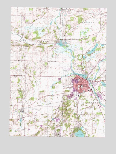
Burlington, WI USGS Topographic Map
Click on map above to begin viewing in our Map Viewer.

This topographic map contains these locations and features:
Feature Name Type Latitude Longitude GNIS ID View Map
Aurora Memorial Hospital of BurlingtonHospitalN42.6730°W88.2809°1850970View Map
Beaumont FieldParkN42.6834°W88.2729°1850914View Map
Benson ParkParkN42.6814°W88.2715°1850916View Map
Bethel Baptist ChurchChurchN42.6784°W88.2840°1850917View Map
Bohner LakeLakeN42.6277°W88.2829°1562027View Map
Brock LakeLakeN42.7141°W88.2555°1562226View Map
Browns Lake Golf CourseLocaleN42.6897°W88.2556°1850918View Map
BurlingtonPopulated PlaceN42.6781°W88.2762°1562427View Map
Burlington 2WP311 DamDamN42.6817°W88.2768°1792793View Map
Burlington CemeteryCemeteryN42.6831°W88.2582°1562428View Map
Burlington City HallBuildingN42.6786°W88.2751°1850919View Map
Burlington Fire DepartmentBuildingN42.6776°W88.2797°2697926View Map
Burlington High SchoolSchoolN42.6706°W88.2556°2716318View Map
Burlington Municipal AirportAirportN42.6916°W88.3008°1581906View Map
Burlington Police DepartmentBuildingN42.6789°W88.2747°2759382View Map
Burlington Post OfficePost OfficeN42.6767°W88.2738°1850922View Map
Burlington Public LibraryBuildingN42.6786°W88.2754°1850923View Map
Burlington Rescue SquadBuildingN42.6776°W88.2798°2698373View Map
Burlington Township Police DepartmentBuildingN42.6747°W88.2661°2759575View Map
Burlington Township Volunteer Fire DepartmentBuildingN42.6746°W88.2662°2697902View Map
Burlington Water WorksLocaleN42.6817°W88.2781°1850924View Map
Bushnell ParkParkN42.6703°W88.2626°1850925View Map
Camp MacLeanLocaleN42.6795°W88.2523°1562634View Map
Catholic Central High SchoolSchoolN42.6750°W88.2818°2716395View Map
City of BurlingtonCivilN42.6746°W88.2726°1582888View Map
Cooper Elementary SchoolSchoolN42.6778°W88.2834°1563379View Map
Cornerstone Christian AcademySchoolN42.6490°W88.3610°2716553View Map
Cross Evangelical Lutheran ChurchChurchN42.6778°W88.2773°1850931View Map
Delmonte LakeReservoirN42.7136°W88.3051°1563893View Map
Devor ParkParkN42.6803°W88.2854°1850933View Map
Doctor Edward G Dyer SchoolSchoolN42.6728°W88.2936°1850921View Map
Echo LakeReservoirN42.6849°W88.2813°1792794View Map
Echo Veterans Memorial ParkParkN42.6834°W88.2737°1564431View Map
First Church of Christ ScientistChurchN42.6772°W88.2781°1850950View Map
First Methodist ChurchChurchN42.6761°W88.2754°1850951View Map
German Settlement CemeteryCemeteryN42.7414°W88.3623°2002804View Map
German Settlement ChurchChurchN42.7414°W88.3620°1565483View Map
Grove Street ParkParkN42.6856°W88.2762°1850947View Map
Highridge ParkParkN42.6781°W88.2959°1850955View Map
Honey CreekPopulated PlaceN42.7483°W88.3079°1566649View Map
Honey CreekStreamN42.6867°W88.2898°1566650View Map
Honey Creek CemeteryCemeteryN42.7478°W88.3056°2002686View Map
Honey LakePopulated PlaceN42.7158°W88.3059°1566657View Map
Honey LakeReservoirN42.7149°W88.3103°1566658View Map
Honey Lake WP276 DamDamN42.7136°W88.3065°1792274View Map
Hudson CemeteryCemeteryN42.6575°W88.3588°1566788View Map
Leda LakeLakeN42.7024°W88.2791°1567920View Map
Limestone Quarry Number 3MineN42.6639°W88.2564°2633856View Map
Lincoln SchoolSchoolN42.6767°W88.2756°1568089View Map
Long LakeLakeN42.7100°W88.2674°1568534View Map
Luther HallBuildingN42.6781°W88.2762°1850965View Map
LyonsPopulated PlaceN42.6511°W88.3584°1568851View Map
Lyons Center SchoolSchoolN42.6462°W88.3589°1851295View Map
Lyons Fire DepartmentBuildingN42.6538°W88.3709°2698005View Map
McCanna ParkParkN42.6784°W88.2576°1850967View Map
Medix Ambulance ServiceBuildingN42.6445°W88.2563°2698356View Map
Meinhardt ParkParkN42.6797°W88.2712°1850968View Map
Motors Mobile Home ParkPopulated PlaceN42.6642°W88.3203°2508617View Map
Nestles ParkParkN42.6667°W88.2654°1850971View Map
Nettie E Karcher SchoolSchoolN42.6705°W88.2727°1850920View Map
Ore CreekStreamN42.6481°W88.3537°1570853View Map
Our Savior Lutheran ChurchChurchN42.6709°W88.2770°1850978View Map
Pleasant View SchoolSchoolN42.7442°W88.2587°1571669View Map
Plymouth Congregational ChurchChurchN42.6786°W88.2790°1850980View Map
Riverside ParkParkN42.6820°W88.2662°1850995View Map
Rockland LakeLakeN42.6766°W88.2527°1572485View Map
Rooker CemeteryCemeteryN42.6975°W88.2926°1572563View Map
Saint Charles Catholic ChurchChurchN42.6806°W88.2976°1850998View Map
Saint Charles CemeteryCemeteryN42.6738°W88.3010°1572890View Map
Saint Charles SchoolSchoolN42.6809°W88.2807°1572895View Map
Saint John's Lutheran SchoolSchoolN42.6760°W88.2941°1851002View Map
Saint Johns Episcopal ChurchChurchN42.6753°W88.2748°1851000View Map
Saint Johns Evangelical Lutheran ChurchChurchN42.6775°W88.2743°1851001View Map
Saint Joseph CemeteryCemeteryN42.6375°W88.3669°1573145View Map
Saint Mary CemeteryCemeteryN42.6743°W88.2858°1573262View Map
Saint Mary's SchoolSchoolN42.6756°W88.2808°1573330View Map
Saint Marys Catholic ChurchChurchN42.6759°W88.2815°1851009View Map
Schamling ParkParkN42.6686°W88.2870°1851019View Map
Spring BrookStreamN42.6639°W88.2606°1574596View Map
Steinhoff ParkParkN42.6889°W88.2765°1851027View Map
Sugar CreekStreamN42.7100°W88.3023°1575019View Map
Sunset ParkParkN42.6692°W88.2890°1851028View Map
Tahoe LakeLakeN42.7159°W88.3030°1575224View Map
Town of LyonsCivilN42.6267°W88.3628°1583618View Map
Town of Spring PrairieCivilN42.7127°W88.3661°1584200View Map
Vienna CemeteryCemeteryN42.7047°W88.3218°2002812View Map
Wag-Aero AirportAirportN42.6588°W88.3671°1581033View Map
Wagner ParkParkN42.6853°W88.2884°1851043View Map
Waller Elementary SchoolSchoolN42.6699°W88.2790°1576172View Map
Warren PitMineN42.6656°W88.2964°2712564View Map
Water Tower ParkParkN42.6822°W88.2856°1851046View Map
WBSD-FM (Burlington)TowerN42.6706°W88.2718°1582584View Map
Wehmhoff Jucker ParkParkN42.6814°W88.2720°1851047View Map
Wehmhoff SquareParkN42.6789°W88.2762°1851048View Map
White RiverStreamN42.6806°W88.2729°1576654View Map
Winkler Elementary SchoolSchoolN42.6360°W88.2874°1576868View Map

Note: Coordinates in the location and feature list above are referenced to NAD83 datum.


Copyright (C) 2008-2024 Ryan Niemi / Sunset Dynamics ... All Rights Reserved