TopoQuest Logo
Do you find TopoQuest useful?
Help keep TopoQuest running and adding new maps/features by donating!
Bitcoin:  19c7KJd3qBynnjoSw5npx9KScwjBe4ifkT
Litecoin:  LXs6TkuXGGXo1vDsWCkWVdjQX94eUKd6ui
Home View Maps Find Maps Find Places Resources & Links


Bug Creek, Montana Topographic Map

USGS Map Title: Bug Creek, MT
USGS Map MRC: 47106F2
DRG (GeoTIFF) Download: o47106f2.tif


Neighboring USGS Topographic Map Quads:


  Spring Creek Bay, MT  
47106G3
 

  Sand Arroyo, MT  
47106G2
 

  Willis Buttes, MT  
47106G1
 

  Ash Creek East, MT  
47106F3
 

  Bug Creek, MT  
47106F2
 

  Crow Springs, MT  
47106F1
 

  Short Creek, MT  
47106E3
 

  Nelson Creek Bay, MT  
47106E2
 

  Rodgers Hall, MT  
47106E1


Map MRC Location:

N48°
W107°
N48°
W106°
H8 H7 H6 H5 H4 H3 H2 H1
G8 G7 G6 G5 G4 G3 G2 G1
F8 F7 F6 F5 F4 F3 F2 F1
E8 E7 E6 E5 E4 E3 E2 E1
D8 D7 D6 D5 D4 D3 D2 D1
C8 C7 C6 C5 C4 C3 C2 C1
B8 B7 B6 B5 B4 B3 B2 B1
A8 A7 A6 A5 A4 A3 A2 A1
N47°
W107°
N47°
W106°

Bug Creek, MT USGS 1:24K Topographic Map Preview:
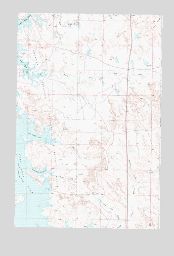
Bug Creek, MT USGS Topographic Map
Click on map above to begin viewing in our Map Viewer.

This topographic map contains these locations and features:
Feature Name Type Latitude Longitude GNIS ID View Map
22N43E03ACAD01 WellWellN47.6958°W106.1853°824571View Map
22N44E18BB__01 WellWellN47.6708°W106.1303°824431View Map
23N43E21AAAB01 WellWellN47.7458°W106.1997°824786View Map
23N43E34BABC01 WellWellN47.7161°W106.1920°824663View Map
Black Spring CouleeValleyN47.6564°W106.2200°780025View Map
Black Spring Coulee BayBayN47.6567°W106.2292°768984View Map
Bug CreekStreamN47.6753°W106.2161°769362View Map
Bug Creek BayBayN47.6778°W106.2347°769363View Map
Bug DamDamN47.6417°W106.1772°797724View Map
Daniels PointCapeN47.6422°W106.2464°770451View Map
John Ball DamDamN47.7203°W106.1386°772840View Map
John Ball ReservoirReservoirN47.7211°W106.1391°795502View Map
John Ball Reservoir DamDamN47.7217°W106.1389°795501View Map
Lone Tree CouleeValleyN47.6286°W106.1592°773582View Map
Lonnies BenchBenchN47.6922°W106.2284°773665View Map
Lyle Nelson Number 1 DamDamN47.7383°W106.2189°798108View Map
Lyle Nelson Number 3 DamDamN47.7433°W106.1972°798109View Map
Lyle Nelson Number 5 DamDamN47.7267°W106.1872°798114View Map
Lyle Nelson Number 6 DamDamN47.7217°W106.1622°795504View Map
Nelson Reservoir Number 2 DamDamN47.7283°W106.1506°795503View Map
Nomland DamDamN47.7367°W106.1472°798110View Map
Nomland DamDamN47.7370°W106.1472°774663View Map
North Fork Rock CreekStreamN47.7453°W106.2253°774793View Map
Robinson CouleeValleyN47.6506°W106.1447°775831View Map
South Fork Rock CreekStreamN47.7133°W106.2286°776863View Map
Towe Farms Number 1 DamDamN47.7100°W106.1756°798111View Map
Towe Farms Number 2 DamDamN47.7050°W106.1622°798112View Map
Wild Horse PassGapN47.6453°W106.1842°778479View Map

Note: Coordinates in the location and feature list above are referenced to NAD83 datum.


Copyright (C) 2008-2024 Ryan Niemi / Sunset Dynamics ... All Rights Reserved