TopoQuest Logo
Do you find TopoQuest useful?
Help keep TopoQuest running and adding new maps/features by donating!
Bitcoin:  19c7KJd3qBynnjoSw5npx9KScwjBe4ifkT
Litecoin:  LXs6TkuXGGXo1vDsWCkWVdjQX94eUKd6ui
Home View Maps Find Maps Find Places Resources & Links


Buffalo, Wyoming Topographic Map

USGS Map Title: Buffalo, WY
USGS Map MRC: 44106C6
DRG (GeoTIFF) Download: o44106c6.tif


Neighboring USGS Topographic Map Quads:


  Lake De Smet West, WY  
44106D7
 

  Lake De Smet East, WY  
44106D6
 

  Buffalo NE, WY  
44106D5
 

  North Ridge, WY  
44106C7
 

  Buffalo, WY  
44106C6
 

  Buffalo SE, WY  
44106C5
 

  Klondike Ranch, WY  
44106B7
 

  T A Ranch, WY  
44106B6
 

  T A Ranch NE, WY  
44106B5


Map MRC Location:

N45°
W107°
N45°
W106°
H8 H7 H6 H5 H4 H3 H2 H1
G8 G7 G6 G5 G4 G3 G2 G1
F8 F7 F6 F5 F4 F3 F2 F1
E8 E7 E6 E5 E4 E3 E2 E1
D8 D7 D6 D5 D4 D3 D2 D1
C8 C7 C6 C5 C4 C3 C2 C1
B8 B7 B6 B5 B4 B3 B2 B1
A8 A7 A6 A5 A4 A3 A2 A1
N44°
W107°
N44°
W106°

Buffalo, WY USGS 1:24K Topographic Map Preview:
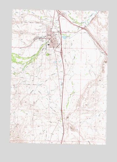
Buffalo, WY USGS Topographic Map
Click on map above to begin viewing in our Map Viewer.

This topographic map contains these locations and features:
Feature Name Type Latitude Longitude GNIS ID View Map
Amie Holt Care CenterHospitalN44.3483°W106.6989°1794902View Map
Arno PitMineN44.3455°W106.7295°1704091View Map
Bighorn National Forest Powder River Ranger District Fire Engine CrewBuildingN44.3418°W106.7248°2673539View Map
Billy Creek SchoolSchoolN44.3483°W106.6989°1795533View Map
BuffaloPopulated PlaceN44.3483°W106.6989°1586043View Map
Buffalo - Johnson County Emergency Medical ServicesBuildingN44.3512°W106.7001°2673697View Map
Buffalo High SchoolSchoolN44.3483°W106.6989°1795531View Map
Buffalo MineMineN44.3694°W106.6403°1704073View Map
Buffalo Police DepartmentBuildingN44.3479°W106.7077°2752682View Map
Buffalo Post OfficePost OfficeN44.3449°W106.6976°2767873View Map
Buffalo Sand and Gravel PitMineN44.2694°W106.7009°1704071View Map
Buffalo Volunteer Fire DepartmentBuildingN44.3480°W106.7060°2673448View Map
Bull CreekStreamN44.3511°W106.6753°1598486View Map
Carter Pit MineMineN44.2719°W106.6609°1704072View Map
City of BuffaloCivilN44.3426°W106.7137°2409934View Map
Clear Creek Middle SchoolSchoolN44.3483°W106.6989°1795532View Map
Clear Creek MineMineN44.3703°W106.6262°1704075View Map
Clear Creek SchoolSchoolN44.3483°W106.6989°1795534View Map
Cross H Mesa D PitMineN44.2941°W106.6523°1704081View Map
Cross H Mesa Pit CMineN44.3058°W106.6459°1704080View Map
Cross H Pit Number TwoMineN44.3158°W106.6314°1704082View Map
Crown DitchCanalN44.3233°W106.7270°1587268View Map
Cummings CreekStreamN44.3194°W106.6703°1587289View Map
Cummings DitchCanalN44.3058°W106.7209°1587290View Map
Dump DrawValleyN44.3511°W106.7103°1587914View Map
Fort McKinney Post CemeteryCemeteryN44.3329°W106.7391°2774522View Map
French CreekStreamN44.3519°W106.6806°1599861View Map
Hepp Pit MineMineN44.3339°W106.7356°1704083View Map
Johnson County Fire Control District 1BuildingN44.3574°W106.6918°2673643View Map
Johnson County Memorial HospitalHospitalN44.3505°W106.7065°1794880View Map
Johnson County Search and RescueBuildingN44.3468°W106.7072°2673537View Map
KBBS-AM (Buffalo)TowerN44.3425°W106.6823°1608790View Map
Keith Pit Number OneMineN44.3022°W106.6484°1704084View Map
KLGT-FM (Buffalo)TowerN44.3289°W106.6931°1608903View Map
McVenry DrawValleyN44.3153°W106.6792°1591393View Map
Mitchell MineMineN44.3669°W106.6823°1704076View Map
Munkry MineMineN44.3480°W106.6823°1704077View Map
Munkry MineMineN44.3447°W106.6620°1704078View Map
Pelloux PitMineN44.3630°W106.6470°1704086View Map
Prosinski ParkParkN44.3455°W106.7006°1593042View Map
Rock CreekStreamN44.3628°W106.6603°1602586View Map
Saint Luke's ColumbariumCemeteryN44.3437°W106.7242°2774524View Map
Sand CreekStreamN44.3339°W106.7159°1602710View Map
Shambaugh Number Two MineMineN44.2697°W106.6934°1704087View Map
Sixmile DitchCanalN44.3044°W106.7053°1594405View Map
Smith Pit Number OneMineN44.3125°W106.6339°1704088View Map
Soldiers and Sailors Pit Number ThreeMineN44.3339°W106.7356°1704089View Map
South Fork Bull CreekStreamN44.2683°W106.6909°1594626View Map
State PitMineN44.2636°W106.6695°1704090View Map
Veterans Home of WyomingHospitalN44.3483°W106.6989°1794862View Map
Willow Grove CemeteryCemeteryN44.3339°W106.7023°1596462View Map

Note: Coordinates in the location and feature list above are referenced to NAD83 datum.


Copyright (C) 2008-2024 Ryan Niemi / Sunset Dynamics ... All Rights Reserved