TopoQuest Logo
Do you find TopoQuest useful?
Help keep TopoQuest running and adding new maps/features by donating!
Bitcoin:  19c7KJd3qBynnjoSw5npx9KScwjBe4ifkT
Litecoin:  LXs6TkuXGGXo1vDsWCkWVdjQX94eUKd6ui
Home View Maps Find Maps Find Places Resources & Links


Bruno Peak, Arizona Topographic Map

USGS Map Title: Bruno Peak, AZ
USGS Map MRC: 31109F4
DRG (GeoTIFF) Download: o31109f4.tif


Neighboring USGS Topographic Map Quads:


  Squaretop Hills East, AZ  
31109G5
 

  Stanford Canyon, AZ  
31109G4
 

  Chiricahua Peak, AZ  
31109G3
 

  Swisshelm Mountain, AZ  
31109F5
 

  Bruno Peak, AZ  
31109F4
 

  Swede Peak, AZ  
31109F3
 

  Leslie Canyon, AZ  
31109E5
 

  Pedregosa Mountains West, AZ  
31109E4
 

  Pedregosa Mountains East, AZ  
31109E3


Map MRC Location:

N32°
W110°
N32°
W109°
H8 H7 H6 H5 H4 H3 H2 H1
G8 G7 G6 G5 G4 G3 G2 G1
F8 F7 F6 F5 F4 F3 F2 F1
E8 E7 E6 E5 E4 E3 E2 E1
D8 D7 D6 D5 D4 D3 D2 D1
C8 C7 C6 C5 C4 C3 C2 C1
B8 B7 B6 B5 B4 B3 B2 B1
A8 A7 A6 A5 A4 A3 A2 A1
N31°
W110°
N31°
W109°

Bruno Peak, AZ USGS 1:24K Topographic Map Preview:
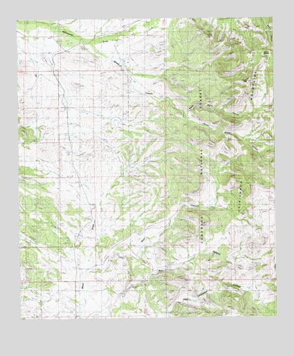
Bruno Peak, AZ USGS Topographic Map
Click on map above to begin viewing in our Map Viewer.

This topographic map contains these locations and features:
Feature Name Type Latitude Longitude GNIS ID View Map
Bar Boot RanchLocaleN31.6420°W109.4378°1008View Map
Boot Stock TankReservoirN31.6590°W109.4445°21956View Map
Bower TankReservoirN31.6384°W109.3923°21957View Map
Bruno CanyonValleyN31.7415°W109.4645°2021View Map
Bruno PeakSummitN31.7237°W109.3890°2022View Map
Bruno SaddleGapN31.7351°W109.3806°1958047View Map
Bruno TankReservoirN31.7093°W109.4178°21965View Map
Devils Canyon 237TrailN31.7251°W109.3798°22019View Map
Devils Canyon TankReservoirN31.7418°W109.3770°22020View Map
Elfrida DivisionCivilN31.6702°W109.4282°1934939View Map
Glenn TankReservoirN31.6872°W109.4032°22060View Map
Hunt CanyonValleyN31.6451°W109.4659°6134View Map
J Bar A RanchLocaleN31.6709°W109.4042°6298View Map
Leslie Canyon National Wildlife RefugeParkN31.6370°W109.4816°2765370View Map
Lower Bruno TankReservoirN31.7239°W109.4435°22128View Map
North Bruno CanyonValleyN31.7093°W109.4212°8704View Map
OK RanchLocaleN31.7462°W109.4487°8837View Map
Rucker CemeteryCemeteryN31.7342°W109.4887°10579View Map
Rucker SchoolSchoolN31.7437°W109.4806°10583View Map
South Bruno CanyonValleyN31.7093°W109.4212°11574View Map
Warner TankReservoirN31.6993°W109.3840°22281View Map
Willcox TankReservoirN31.6583°W109.3996°22296View Map
Winkler TankReservoirN31.7449°W109.3863°22298View Map

Note: Coordinates in the location and feature list above are referenced to NAD83 datum.


Copyright (C) 2008-2024 Ryan Niemi / Sunset Dynamics ... All Rights Reserved