TopoQuest Logo
Do you find TopoQuest useful?
Help keep TopoQuest running and adding new maps/features by donating!
Bitcoin:  19c7KJd3qBynnjoSw5npx9KScwjBe4ifkT
Litecoin:  LXs6TkuXGGXo1vDsWCkWVdjQX94eUKd6ui
Home View Maps Find Maps Find Places Resources & Links


Brownfield, Maine Topographic Map

USGS Map Title: Brownfield, ME
USGS Map MRC: 43070H8
DRG (GeoTIFF) Download: o43070h8.tif


Neighboring USGS Topographic Map Quads:


  North Conway East, NH  
44071A1
 

  Fryeburg, ME  
44070A8
 

  Pleasant Mountain, ME  
44070A7
 

  Conway, NH  
43071H1
 

  Brownfield, ME  
43070H8
 

  Hiram, ME  
43070H7
 

  Freedom, NH  
43071G1
 

  Kezar Falls, ME  
43070G8
 

  Cornish, ME  
43070G7


Map MRC Location:

N44°
W71°
N44°
W70°
H8 H7 H6 H5 H4 H3 H2 H1
G8 G7 G6 G5 G4 G3 G2 G1
F8 F7 F6 F5 F4 F3 F2 F1
E8 E7 E6 E5 E4 E3 E2 E1
D8 D7 D6 D5 D4 D3 D2 D1
C8 C7 C6 C5 C4 C3 C2 C1
B8 B7 B6 B5 B4 B3 B2 B1
A8 A7 A6 A5 A4 A3 A2 A1
N43°
W71°
N43°
W70°

Brownfield, ME USGS 1:24K Topographic Map Preview:
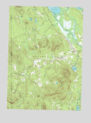
Brownfield, ME USGS Topographic Map
Click on map above to begin viewing in our Map Viewer.

This topographic map contains these locations and features:
Feature Name Type Latitude Longitude GNIS ID View Map
Bald PeakSummitN43.9798°W70.9701°561535View Map
Beaver BrookStreamN43.9976°W70.8773°561919View Map
Billy BrookStreamN43.9370°W70.9245°562275View Map
Black PondLakeN43.9843°W70.9628°562493View Map
Blake CemeteryCemeteryN43.9063°W70.9513°562547View Map
Brown CemeteryCemeteryN43.9162°W70.9615°563042View Map
BrownfieldPopulated PlaceN43.9381°W70.9087°563068View Map
Brownfield Community ChurchChurchN43.9548°W70.9081°1907939View Map
Brownfield Consolidated SchoolSchoolN43.9417°W70.8951°1907940View Map
Brownfield Mennonite SchoolSchoolN43.9155°W70.9795°2738199View Map
Brownfield Post OfficePost OfficeN43.9413°W70.8971°1907942View Map
Brownfield Public LibraryBuildingN43.9384°W70.9071°1907943View Map
Brownfield Volunteer Fire StationBuildingN43.9384°W70.9067°2553211View Map
Burnt Meadow CemeteryCemeteryN43.9459°W70.8840°563258View Map
Burnt Meadow MountainsRidgeN43.9026°W70.9101°563259View Map
Burnt Meadow PondReservoirN43.9258°W70.8877°563260View Map
Burnt Meadow Pond DamDamN43.9291°W70.8873°1774502View Map
Clays PondLakeN43.9824°W70.9540°564066View Map
Clemons PondLakeN43.8761°W70.8806°564089View Map
Cole BrookStreamN43.9201°W70.9706°564206View Map
Cole CemeteryCemeteryN43.8953°W70.9765°564209View Map
Durgin BrookStreamN43.9229°W70.8853°565430View Map
Dyer PondLakeN43.8955°W70.8964°565477View Map
East BrownfieldPopulated PlaceN43.9448°W70.8884°565586View Map
Eastern Slopes Regional AirportAirportN43.9893°W70.9480°582151View Map
Frost MountainSummitN43.9528°W70.9173°566621View Map
Greenlaw CemeteryCemeteryN43.9265°W70.9673°567285View Map
Haley BrookStreamN43.9659°W70.9606°567442View Map
Haley PondLakeN43.9875°W70.9803°567450View Map
Linscott BrookStreamN43.9131°W70.9712°569639View Map
Linscott CemeteryCemeteryN43.8978°W70.9881°569640View Map
Little Saco RiverStreamN43.9831°W70.9170°570038View Map
Long HillSummitN43.9947°W70.9801°570209View Map
Marston CemeteryCemeteryN43.9665°W70.9534°570830View Map
Merrill CemeteryCemeteryN43.9284°W70.9420°571160View Map
Merrill CornerPopulated PlaceN43.9265°W70.9453°579519View Map
New BostonPopulated PlaceN43.8942°W70.9770°579551View Map
Paine BrookStreamN43.9659°W70.9606°572926View Map
Peary MountainSummitN43.9541°W70.9346°573114View Map
Peat PondLakeN43.9726°W70.9571°573124View Map
Pine Grove CemeteryCemeteryN43.9376°W70.9037°573354View Map
Pine HillSummitN43.8783°W70.9362°573370View Map
Pine IslandIslandN43.9995°W70.9190°573379View Map
PorterfieldPopulated PlaceN43.8762°W70.9128°579634View Map
Quint BrookStreamN43.9176°W70.9695°573946View Map
Round PondLakeN43.9963°W70.9575°574494View Map
Shepards RiverStreamN43.9684°W70.8962°575375View Map
Stone MountainSummitN43.9104°W70.9089°576385View Map
SugarloafSummitN43.8912°W70.9469°576504View Map
Tibbetts MountainSummitN43.9489°W70.9586°577093View Map
Town of BrownfieldCivilN43.9330°W70.9167°582373View Map
Walker Rounds CemeteryCemeteryN43.8908°W70.9767°2724810View Map
Wentworth CemeteryCemeteryN43.9315°W70.9551°578004View Map
West Branch Tenmile RiverStreamN43.8751°W70.9276°578097View Map
West BrownfieldPopulated PlaceN43.9176°W70.9787°579810View Map
Whales BackSummitN43.8829°W70.9916°578300View Map

Note: Coordinates in the location and feature list above are referenced to NAD83 datum.


Copyright (C) 2008-2024 Ryan Niemi / Sunset Dynamics ... All Rights Reserved