TopoQuest Logo
Do you find TopoQuest useful?
Help keep TopoQuest running and adding new maps/features by donating!
Bitcoin:  19c7KJd3qBynnjoSw5npx9KScwjBe4ifkT
Litecoin:  LXs6TkuXGGXo1vDsWCkWVdjQX94eUKd6ui
Home View Maps Find Maps Find Places Resources & Links


Brisben, New York Topographic Map

USGS Map Title: Brisben, NY
USGS Map MRC: 42075C6
DRG (GeoTIFF) Download: o42075c6.tif


Neighboring USGS Topographic Map Quads:


  Smithville Flats, NY  
42075D7
 

  Tyner, NY  
42075D6
 

  Oxford, NY  
42075D5
 

  Greene, NY  
42075C7
 

  Brisben, NY  
42075C6
 

  West Bainbridge, NY  
42075C5
 

  Chenango Forks, NY  
42075B7
 

  Belden, NY  
42075B6
 

  Afton, NY  
42075B5


Map MRC Location:

N43°
W76°
N43°
W75°
H8 H7 H6 H5 H4 H3 H2 H1
G8 G7 G6 G5 G4 G3 G2 G1
F8 F7 F6 F5 F4 F3 F2 F1
E8 E7 E6 E5 E4 E3 E2 E1
D8 D7 D6 D5 D4 D3 D2 D1
C8 C7 C6 C5 C4 C3 C2 C1
B8 B7 B6 B5 B4 B3 B2 B1
A8 A7 A6 A5 A4 A3 A2 A1
N42°
W76°
N42°
W75°

Brisben, NY USGS 1:24K Topographic Map Preview:
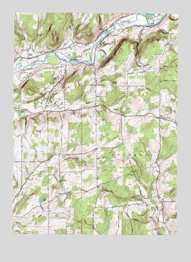
Brisben, NY USGS Topographic Map
Click on map above to begin viewing in our Map Viewer.

This topographic map contains these locations and features:
Feature Name Type Latitude Longitude GNIS ID View Map
Bobell HillSummitN42.2740°W75.6807°944375View Map
Borden PondLakeN42.3574°W75.6826°944456View Map
BrisbenPopulated PlaceN42.3651°W75.6816°944762View Map
Brisben Baptist ChurchChurchN42.3667°W75.6792°2091932View Map
Brisben Baptist Church CemeteryCemeteryN42.3665°W75.6794°2091931View Map
Brisben Fire Department HouseBuildingN42.3656°W75.6791°2718564View Map
Buck HillSummitN42.3351°W75.7016°945019View Map
Chapel CemeteryCemeteryN42.2840°W75.6580°959262View Map
Chenango Valley RanchLocaleN42.3208°W75.6847°2517025View Map
Cohoon HillSummitN42.3354°W75.6732°947010View Map
CoventryPopulated PlaceN42.3159°W75.6385°947574View Map
Coventry Union CemeteryCemeteryN42.3151°W75.6341°2559177View Map
Coventry Volunteer Fire CompanyBuildingN42.3169°W75.6389°2718511View Map
Glen Road BrookStreamN42.3692°W75.6485°951192View Map
Greene Assembly of GodChurchN42.2955°W75.7135°2616439View Map
Harbor HillSummitN42.3642°W75.7196°952188View Map
Johnson CornersLocaleN42.2726°W75.7091°954110View Map
Little White ChurchChurchN42.2801°W75.7144°955729View Map
Mill BrookStreamN42.3559°W75.7366°957203View Map
Sacketts HarborLocaleN42.3509°W75.7391°963170View Map
School Number 13 (historical)SchoolN42.3534°W75.7396°975049View Map
School Number 24 (historical)SchoolN42.2731°W75.7099°975226View Map
Shadyside FarmLocaleN42.3644°W75.6294°2556823View Map
Spring BrookStreamN42.3479°W75.7310°966058View Map
Tillotson CreekStreamN42.3531°W75.7191°967525View Map
Town of CoventryCivilN42.2937°W75.6255°978873View Map
Truitt PondLakeN42.2690°W75.7281°967909View Map
Upper Page Brook CemeteryCemeteryN42.2946°W75.7124°968289View Map
Van Valkenburgh PondLakeN42.3181°W75.7445°968432View Map
Warn LakeLakeN42.3746°W75.6463°968799View Map
Watrous HillSummitN42.3076°W75.7307°968922View Map
Wheeler BrookStreamN42.3473°W75.7096°970996View Map
Wylie CemeteryCemeteryN42.2858°W75.6383°971777View Map

Note: Coordinates in the location and feature list above are referenced to NAD83 datum.


Copyright (C) 2008-2024 Ryan Niemi / Sunset Dynamics ... All Rights Reserved