TopoQuest Logo
Do you find TopoQuest useful?
Help keep TopoQuest running and adding new maps/features by donating!
Bitcoin:  19c7KJd3qBynnjoSw5npx9KScwjBe4ifkT
Litecoin:  LXs6TkuXGGXo1vDsWCkWVdjQX94eUKd6ui
Home View Maps Find Maps Find Places Resources & Links


Braham, Minnesota Topographic Map

USGS Map Title: Braham, MN
USGS Map MRC: 45093F2
DRG (GeoTIFF) Download: o45093f2.tif


Neighboring USGS Topographic Map Quads:


  Mora South, MN  
45093G3
 

  Grasston, MN  
45093G2
 

  Henriette, MN  
45093G1
 

  Springvale, MN  
45093F3
 

  Braham, MN  
45093F2
 

  Rush Lake, MN  
45093F1
 

  Bradford, MN  
45093E3
 

  Cambridge, MN  
45093E2
 

  Stark, MN  
45093E1


Map MRC Location:

N46°
W94°
N46°
W93°
H8 H7 H6 H5 H4 H3 H2 H1
G8 G7 G6 G5 G4 G3 G2 G1
F8 F7 F6 F5 F4 F3 F2 F1
E8 E7 E6 E5 E4 E3 E2 E1
D8 D7 D6 D5 D4 D3 D2 D1
C8 C7 C6 C5 C4 C3 C2 C1
B8 B7 B6 B5 B4 B3 B2 B1
A8 A7 A6 A5 A4 A3 A2 A1
N45°
W94°
N45°
W93°

Braham, MN USGS 1:24K Topographic Map Preview:
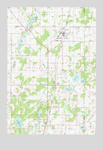
Braham, MN USGS Topographic Map
Click on map above to begin viewing in our Map Viewer.

This topographic map contains these locations and features:
Feature Name Type Latitude Longitude GNIS ID View Map
Adams LakeLakeN45.6619°W93.2428°639205View Map
Adventist CemeteryCemeteryN45.6349°W93.1723°2069238View Map
AndreePopulated PlaceN45.7283°W93.2238°654569View Map
Andree Post Office (historical)Post OfficeN45.7283°W93.2236°2069224View Map
BrahamPopulated PlaceN45.7227°W93.1708°640423View Map
BrahamLocaleN45.7222°W93.1700°2069329View Map
Braham City HallBuildingN45.7239°W93.1722°2069343View Map
Braham Evangelical Covenant ChurchChurchN45.7297°W93.1714°2069338View Map
Braham Evangelical Lutheran ChurchChurchN45.7261°W93.1794°2069337View Map
Braham Fire DepartmentBuildingN45.7237°W93.1721°2069342View Map
Braham Mobile Home ParkPopulated PlaceN45.7297°W93.1806°2069333View Map
Braham Police DepartmentBuildingN45.7237°W93.1722°2069341View Map
Braham Post OfficePost OfficeN45.7236°W93.1717°2069336View Map
City of BrahamCivilN45.7222°W93.1717°2394236View Map
Danewood CemeteryCemeteryN45.7167°W93.1344°642619View Map
Elm Park CemeteryCemeteryN45.6581°W93.2029°2069279View Map
Freedom ParkParkN45.7222°W93.1708°2069335View Map
GrandyPopulated PlaceN45.6352°W93.1952°644344View Map
GrandyLocaleN45.6353°W93.1933°2069328View Map
Grandy ChurchChurchN45.6353°W93.1950°2069237View Map
Grandy Golf CourseLocaleN45.6258°W93.2433°1814976View Map
Grandy Pines Golf CourseLocaleN45.6556°W93.2139°2069278View Map
Grandy Post OfficePost OfficeN45.6379°W93.1945°2069327View Map
Grandy SchoolSchoolN45.6353°W93.1950°2069236View Map
Hidden ParkParkN45.7278°W93.1653°2069334View Map
Krans LakeLakeN45.6316°W93.1441°646246View Map
Linderman LakeLakeN45.6773°W93.1437°1814977View Map
Little Stanchfield LakeLakeN45.6350°W93.2330°646936View Map
Long LakeLakeN45.6371°W93.2070°647063View Map
Lower Stanchfield BranchStreamN45.6372°W93.2308°1814978View Map
Mission CemeteryCemeteryN45.7310°W93.1850°1814981View Map
Purple Hawk Golf CourseLocaleN45.6277°W93.2044°1814975View Map
Rice Creek State Wildlife Management AreaParkN45.7389°W93.2141°1815013View Map
Rice LakeLakeN45.7381°W93.2151°649997View Map
Rice Lake CemeteryCemeteryN45.7282°W93.2177°650045View Map
Saint Peter and Paul Catholic ChurchChurchN45.7125°W93.1797°2069339View Map
Saint Stephen's Lutheran ChurchChurchN45.7169°W93.1664°2069340View Map
Section LakeLakeN45.6805°W93.1533°651831View Map
Seventeen LakeLakeN45.6937°W93.2402°1814982View Map
Southview SchoolSchoolN45.7175°W93.1794°1814979View Map
StanchfieldPopulated PlaceN45.6733°W93.1833°652540View Map
StanchfieldLocaleN45.6731°W93.1833°2069324View Map
Stanchfield Baptist CemeteryCemeteryN45.6715°W93.1855°2069280View Map
Stanchfield Baptist ChurchChurchN45.6733°W93.1831°2069325View Map
Stanchfield Census Designated PlaceCensusN45.6649°W93.1816°2628695View Map
Stanchfield CornerPopulated PlaceN45.6736°W93.1930°654959View Map
Stanchfield Post OfficePost OfficeN45.6733°W93.1831°2069326View Map
Township of StanchfieldCivilN45.6860°W93.2051°665692View Map
Trollin LakeLakeN45.6694°W93.1632°653328View Map
Upper Rice LakeLakeN45.7172°W93.2292°653562View Map
Westview High SchoolSchoolN45.7197°W93.1772°1814980View Map

Note: Coordinates in the location and feature list above are referenced to NAD83 datum.


Copyright (C) 2008-2024 Ryan Niemi / Sunset Dynamics ... All Rights Reserved