TopoQuest Logo
Do you find TopoQuest useful?
Help keep TopoQuest running and adding new maps/features by donating!
Bitcoin:  19c7KJd3qBynnjoSw5npx9KScwjBe4ifkT
Litecoin:  LXs6TkuXGGXo1vDsWCkWVdjQX94eUKd6ui
Home View Maps Find Maps Find Places Resources & Links


Boylston Center, New York Topographic Map

USGS Map Title: Boylston Center, NY
USGS Map MRC: 43075F8
DRG (GeoTIFF) Download: o43075f8.tif


Neighboring USGS Topographic Map Quads:


  Adams, NY  
43076G1
 

  Rodman, NY  
43075G8
 

  Barnes Corners, NY  
43075G7
 

  Sandy Creek, NY  
43076F1
 

  Boylston Center, NY  
43075F8
 

  Worth Center, NY  
43075F7
 

  Richland, NY  
43076E1
 

  Orwell, NY  
43075E8
 

  Redfield, NY  
43075E7


Map MRC Location:

N44°
W76°
N44°
W75°
H8 H7 H6 H5 H4 H3 H2 H1
G8 G7 G6 G5 G4 G3 G2 G1
F8 F7 F6 F5 F4 F3 F2 F1
E8 E7 E6 E5 E4 E3 E2 E1
D8 D7 D6 D5 D4 D3 D2 D1
C8 C7 C6 C5 C4 C3 C2 C1
B8 B7 B6 B5 B4 B3 B2 B1
A8 A7 A6 A5 A4 A3 A2 A1
N43°
W76°
N43°
W75°

Boylston Center, NY USGS 1:24K Topographic Map Preview:
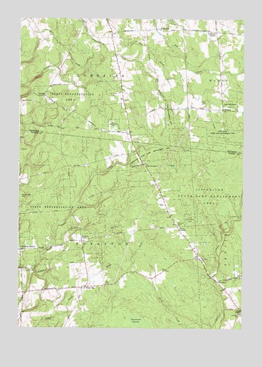
Boylston Center, NY USGS Topographic Map
Click on map above to begin viewing in our Map Viewer.

This topographic map contains these locations and features:
Feature Name Type Latitude Longitude GNIS ID View Map
Boylston CenterPopulated PlaceN43.6603°W75.9646°972253View Map
DiamondLocaleN43.7134°W75.8863°948405View Map
East BoylstonPopulated PlaceN43.6906°W75.9296°972411View Map
Frederick CornersLocaleN43.7445°W75.8908°950648View Map
GreenboroPopulated PlaceN43.6440°W75.8888°972562View Map
Greenboro CemeteryCemeteryN43.6305°W75.8759°951735View Map
Hemlock DistrictPopulated PlaceN43.6565°W75.9985°952558View Map
Littlejohn State Game Management AreaParkN43.6784°W75.8941°970310View Map
Phelps CemeteryCemeteryN43.6750°W75.9185°960281View Map
Plantz CornersPopulated PlaceN43.6662°W75.9113°960675View Map
Saint Josephs CemeteryCemeteryN43.6529°W75.8992°963736View Map
Schjool Number 9 (historical)SchoolN43.7186°W75.9861°2097007View Map
School Number 10 (historical)SchoolN43.6497°W75.9150°2101005View Map
School Number 12 (historical)SchoolN43.7322°W75.9456°2097008View Map
School Number 13 (historical)SchoolN43.7133°W75.9136°2097009View Map
School Number 4 (historical)SchoolN43.6561°W75.9983°2101000View Map
School Number 4 (historical)SchoolN43.7497°W75.9653°2097003View Map
School Number 5 (historical)SchoolN43.6747°W75.9181°2101001View Map
School Number 5 (historical)SchoolN43.7133°W75.8867°2097004View Map
School Number 7 (historical)SchoolN43.7042°W75.9383°2097005View Map
School Number 8 (historical)SchoolN43.6317°W75.8753°2101002View Map
School Number 8 (historical)SchoolN43.6600°W75.9647°2101003View Map
School Number 8 (historical)SchoolN43.7458°W75.9217°2097006View Map
School Number 9 (historical)SchoolN43.6414°W75.9625°2101004View Map
SmartvillePopulated PlaceN43.6415°W75.9624°973077View Map
Stinson CreekStreamN43.6592°W75.9805°966454View Map
Town of BoylstonCivilN43.6553°W75.9605°978746View Map
Town of LorraineCivilN43.7497°W75.9683°979169View Map
Union ChurchChurchN43.6320°W75.8760°968182View Map
WatervillePopulated PlaceN43.7456°W75.9221°973209View Map
WinonaPopulated PlaceN43.7190°W75.9860°973278View Map

Note: Coordinates in the location and feature list above are referenced to NAD83 datum.


Copyright (C) 2008-2024 Ryan Niemi / Sunset Dynamics ... All Rights Reserved