TopoQuest Logo
Do you find TopoQuest useful?
Help keep TopoQuest running and adding new maps/features by donating!
Bitcoin:  19c7KJd3qBynnjoSw5npx9KScwjBe4ifkT
Litecoin:  LXs6TkuXGGXo1vDsWCkWVdjQX94eUKd6ui
Home View Maps Find Maps Find Places Resources & Links


Boyer Creek, Illinois Topographic Map

USGS Map Title: Boyer Creek, IL
USGS Map MRC: 39090B4
DRG (GeoTIFF) Download: o39090b4.tif


Neighboring USGS Topographic Map Quads:


  Kampsville, IL  
39090C5
 

  Carrollton, IL  
39090C4
 

  Daum, IL  
39090C3
 

  Hardin, IL  
39090B5
 

  Boyer Creek, IL  
39090B4
 

  Jerseyville North, IL  
39090B3
 

  Nutwood, IL  
39090A5
 

  Otterville, IL  
39090A4
 

  Jerseyville South, IL  
39090A3


Map MRC Location:

N40°
W91°
N40°
W90°
H8 H7 H6 H5 H4 H3 H2 H1
G8 G7 G6 G5 G4 G3 G2 G1
F8 F7 F6 F5 F4 F3 F2 F1
E8 E7 E6 E5 E4 E3 E2 E1
D8 D7 D6 D5 D4 D3 D2 D1
C8 C7 C6 C5 C4 C3 C2 C1
B8 B7 B6 B5 B4 B3 B2 B1
A8 A7 A6 A5 A4 A3 A2 A1
N39°
W91°
N39°
W90°

Boyer Creek, IL USGS 1:24K Topographic Map Preview:
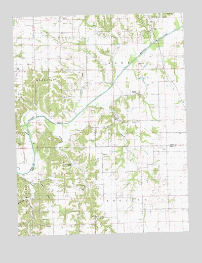
Boyer Creek, IL USGS Topographic Map
Click on map above to begin viewing in our Map Viewer.

This topographic map contains these locations and features:
Feature Name Type Latitude Longitude GNIS ID View Map
Belt Salem CemeteryCemeteryN39.1348°W90.4401°1747799View Map
Bethany Baptist ChurchChurchN39.1706°W90.4368°404253View Map
Borlin CemeteryCemeteryN39.2206°W90.4951°1748345View Map
Boyer CreekStreamN39.1889°W90.4701°404762View Map
Bryan School (historical)SchoolN39.1795°W90.4737°405075View Map
Busch CemeteryCemeteryN39.1773°W90.4959°1748348View Map
Cannedy CemeteryCemeteryN39.2495°W90.3826°1748349View Map
Central School (historical)SchoolN39.1306°W90.4273°405884View Map
Conwayville (historical)Populated PlaceN39.2362°W90.3993°1811014View Map
Dark HollowValleyN39.1552°W90.4836°406953View Map
Dobson HollowValleyN39.2047°W90.4099°407267View Map
Dodson SpringSpringN39.2046°W90.4105°1748356View Map
Drapper BranchStreamN39.1937°W90.4551°407383View Map
Dry BranchStreamN39.2142°W90.4243°407411View Map
Erwin CemeteryCemeteryN39.2414°W90.3973°1748360View Map
Fremont School (historical)SchoolN39.1703°W90.3934°408735View Map
Fry CemeteryCemeteryN39.2337°W90.4851°1748364View Map
Haushalter CreekStreamN39.1478°W90.4887°424526View Map
Haushalter HollowValleyN39.1464°W90.4911°409928View Map
Hetzel CemeteryCemeteryN39.1342°W90.4826°1747821View Map
Hickory Log School (historical)SchoolN39.1592°W90.4376°410175View Map
Houseman CemeteryCemeteryN39.1581°W90.4715°1773474View Map
Jersey County Farm (historical)LocaleN39.1417°W90.4393°1747824View Map
John Dunham SpringSpringN39.1653°W90.4598°1747826View Map
Lax CemeteryCemeteryN39.1442°W90.4168°1747830View Map
Mid City (historical)Populated PlaceN39.2220°W90.3915°422975View Map
Mills CemeteryCemeteryN39.2228°W90.4904°1748388View Map
Mount Gilead CemeteryCemeteryN39.2487°W90.4640°1748390View Map
Mount Gilead ChurchChurchN39.2403°W90.4654°1748391View Map
Mount Gilead School (historical)SchoolN39.2406°W90.4654°413963View Map
Newbury School (historical)SchoolN39.2253°W90.3771°414484View Map
Parker CemeteryCemeteryN39.2217°W90.4040°1748400View Map
Pleasant Grove School (historical)SchoolN39.1978°W90.4998°415800View Map
Reynolds CemeteryCemeteryN39.2253°W90.4573°1748409View Map
Rusk CemeteryCemeteryN39.1303°W90.4796°1747852View Map
Shakerag School (historical)SchoolN39.1450°W90.3901°418272View Map
Shanks HillSummitN39.1887°W90.4118°418283View Map
Sunnyview School (historical)SchoolN39.2070°W90.4610°419403View Map
Sunrise School (historical)SchoolN39.1887°W90.4187°419406View Map
Thompson CemeteryCemeteryN39.1823°W90.3962°1748429View Map
Township of EnglishCivilN39.1308°W90.4273°428973View Map
Township of KaneCivilN39.2171°W90.3828°429193View Map
Washington School (historical)SchoolN39.1384°W90.4693°420582View Map
West Lake Country Club LakeReservoirN39.1267°W90.4751°1691797View Map
West Lake Country Club Lake DamDamN39.1267°W90.4751°1691796View Map
Wines BranchStreamN39.1973°W90.4373°421323View Map

Note: Coordinates in the location and feature list above are referenced to NAD83 datum.


Copyright (C) 2008-2024 Ryan Niemi / Sunset Dynamics ... All Rights Reserved