TopoQuest Logo
Do you find TopoQuest useful?
Help keep TopoQuest running and adding new maps/features by donating!
Bitcoin:  19c7KJd3qBynnjoSw5npx9KScwjBe4ifkT
Litecoin:  LXs6TkuXGGXo1vDsWCkWVdjQX94eUKd6ui
Home View Maps Find Maps Find Places Resources & Links


Bowie, Colorado Topographic Map

USGS Map Title: Bowie, CO
USGS Map MRC: 38107H5
DRG (GeoTIFF) Download: o38107h5.tif


Neighboring USGS Topographic Map Quads:


  Chalk Mountain, CO  
39107A6
 

  Electric Mountain, CO  
39107A5
 

  Bull Mountain, CO  
39107A4
 

  Gray Reservoir, CO  
38107H6
 

  Bowie, CO  
38107H5
 

  Somerset, CO  
38107H4
 

  Hotchkiss, CO  
38107G6
 

  Paonia, CO  
38107G5
 

  Minnesota Pass, CO  
38107G4


Map MRC Location:

N39°
W108°
N39°
W107°
H8 H7 H6 H5 H4 H3 H2 H1
G8 G7 G6 G5 G4 G3 G2 G1
F8 F7 F6 F5 F4 F3 F2 F1
E8 E7 E6 E5 E4 E3 E2 E1
D8 D7 D6 D5 D4 D3 D2 D1
C8 C7 C6 C5 C4 C3 C2 C1
B8 B7 B6 B5 B4 B3 B2 B1
A8 A7 A6 A5 A4 A3 A2 A1
N38°
W108°
N38°
W107°

Bowie, CO USGS 1:24K Topographic Map Preview:
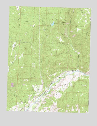
Bowie, CO USGS Topographic Map
Click on map above to begin viewing in our Map Viewer.

This topographic map contains these locations and features:
Feature Name Type Latitude Longitude GNIS ID View Map
Alder CreekStreamN38.9894°W107.5309°175452View Map
Betty ParkFlatN38.9978°W107.6123°202304View Map
Blue Ribbon MineMineN38.9542°W107.5259°186345View Map
BowiePopulated PlaceN38.9214°W107.5401°204744View Map
Bowie MineMineN38.9283°W107.5381°186329View Map
Bruce Park DamDamN38.9800°W107.5623°198968View Map
Bruce Park ReservoirReservoirN38.9800°W107.5623°198969View Map
Bull ParkFlatN38.9780°W107.5873°186340View Map
Coal GulchValleyN38.8920°W107.5866°186326View Map
Converse MineMineN38.9061°W107.6151°186325View Map
Cottonwood StompFlatN38.9725°W107.5717°186334View Map
Dove GulchValleyN38.9637°W107.5336°186336View Map
East Fork Terror CreekStreamN38.9486°W107.5751°175457View Map
Farmers MineMineN38.9158°W107.5889°186327View Map
Freeman GulchValleyN38.9500°W107.5263°186332View Map
Garvin MesaSummitN38.9005°W107.5770°186324View Map
Hubbard CreekStreamN38.9255°W107.5184°175448View Map
Iron PointCliffN38.9847°W107.5412°186337View Map
Iron Point GulchValleyN38.9769°W107.5345°186338View Map
Juanita JunctionPopulated PlaceN38.9247°W107.5281°186328View Map
Julian Ditch CampLocaleN38.9900°W107.6059°186342View Map
Jumbo MountainSummitN38.8889°W107.5256°186319View Map
Lennox MesaSummitN38.9028°W107.5420°186320View Map
Minnesota CreekStreamN38.8753°W107.5953°186322View Map
Morrell Cow CampLocaleN38.9511°W107.6187°186343View Map
Orchard Valley MineMineN38.9050°W107.5053°1745529View Map
Paonia DivisionCivilN38.9812°W107.5928°1935542View Map
Paonia High SchoolSchoolN38.8760°W107.6002°1795180View Map
Pitkin MesaSummitN38.8833°W107.6081°203213View Map
Redtop PeakSummitN38.8872°W107.5678°186321View Map
Sheep Corral GulchValleyN38.9566°W107.5308°186333View Map
Spruce StompFlatN38.9625°W107.5912°186339View Map
Stevens GulchValleyN38.8800°W107.5980°186304View Map
Terror CreekStreamN38.9069°W107.5617°186331View Map
Terror Creek ReservoirReservoirN38.9800°W107.5583°186335View Map
Terror DitchStreamN38.9822°W107.5570°197374View Map
West Fork Terror CreekStreamN38.9483°W107.5751°186316View Map
Windy PointCliffN38.9764°W107.6103°186341View Map

Note: Coordinates in the location and feature list above are referenced to NAD83 datum.


Copyright (C) 2008-2024 Ryan Niemi / Sunset Dynamics ... All Rights Reserved