TopoQuest Logo
Do you find TopoQuest useful?
Help keep TopoQuest running and adding new maps/features by donating!
Bitcoin:  19c7KJd3qBynnjoSw5npx9KScwjBe4ifkT
Litecoin:  LXs6TkuXGGXo1vDsWCkWVdjQX94eUKd6ui
Home View Maps Find Maps Find Places Resources & Links


Bowen Valley, Oregon Topographic Map

USGS Map Title: Bowen Valley, OR
USGS Map MRC: 44117F7
DRG (GeoTIFF) Download: o44117f7.tif


Neighboring USGS Topographic Map Quads:


  Wingville, OR  
44117G8
 

  Baker City, OR  
44117G7
 

  Virtue Flat, OR  
44117G6
 

  Blue Canyon, OR  
44117F8
 

  Bowen Valley, OR  
44117F7
 

  Encina, OR  
44117F6
 

  Brannan Gulch, OR  
44117E8
 

  Dooley Mountain, OR  
44117E7
 

  French Gulch, OR  
44117E6


Map MRC Location:

N45°
W118°
N45°
W117°
H8 H7 H6 H5 H4 H3 H2 H1
G8 G7 G6 G5 G4 G3 G2 G1
F8 F7 F6 F5 F4 F3 F2 F1
E8 E7 E6 E5 E4 E3 E2 E1
D8 D7 D6 D5 D4 D3 D2 D1
C8 C7 C6 C5 C4 C3 C2 C1
B8 B7 B6 B5 B4 B3 B2 B1
A8 A7 A6 A5 A4 A3 A2 A1
N44°
W118°
N44°
W117°

Bowen Valley, OR USGS 1:24K Topographic Map Preview:
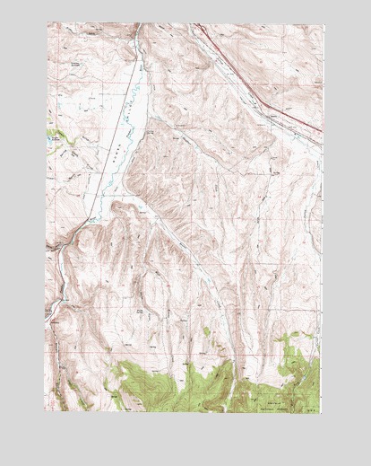
Bowen Valley, OR USGS Topographic Map
Click on map above to begin viewing in our Map Viewer.

This topographic map contains these locations and features:
Feature Name Type Latitude Longitude GNIS ID View Map
Baker City Sanitary LandfillLocaleN44.7040°W117.7761°1167627View Map
Beaver CreekStreamN44.6940°W117.8444°1117437View Map
Belgian GulchValleyN44.6402°W117.8677°1131969View Map
Bennehoff ReservoirReservoirN44.6907°W117.8324°1131471View Map
Blue CanyonValleyN44.6782°W117.8663°1117834View Map
Bowen (historical)LocaleN44.7338°W117.8386°1131470View Map
Bowen ValleyValleyN44.7399°W117.8338°1117993View Map
Currey SpringSpringN44.7148°W117.8302°1119636View Map
Ebell CreekStreamN44.7060°W117.7522°1120369View Map
Elk CreekStreamN44.7243°W117.8411°1120448View Map
Griffin GulchValleyN44.7452°W117.8361°1164102View Map
Juniper GulchValleyN44.7029°W117.8572°1122593View Map
Licklider DamDamN44.7365°W117.8593°1131291View Map
Licklider ReservoirReservoirN44.7364°W117.8597°1123076View Map
Nault ReservoirReservoirN44.6363°W117.7578°1638510View Map
Prowell ReservoirReservoirN44.6307°W117.7913°1638511View Map
QuartzLocaleN44.7196°W117.7752°1136662View Map
S V ReservoirReservoirN44.7224°W117.8604°1131472View Map
Salisbury (historical)LocaleN44.6532°W117.8733°1136726View Map
Salisbury Post Office (historical)Post OfficeN44.6532°W117.8733°1165909View Map
Shaffner CreekStreamN44.7218°W117.8302°1126782View Map
Shaw Stewart DitchCanalN44.6965°W117.8563°1126807View Map
Smith DitchCanalN44.7360°W117.8291°1164135View Map
South Baker (historical)LocaleN44.7435°W117.8386°1131469View Map
Spring Creek GulchValleyN44.7024°W117.8549°1127435View Map
Stewart School (historical)SchoolN44.7013°W117.8505°1127601View Map
Stices GulchValleyN44.6518°W117.8730°1127605View Map
Sutton (historical)LocaleN44.7168°W117.7680°1167828View Map
Timber GulchValleyN44.7088°W117.8502°1151243View Map
Trail CreekStreamN44.6407°W117.8691°1128189View Map
Vaughn DamDamN44.7129°W117.8736°1133698View Map
Vaughn ReservoirReservoirN44.7128°W117.8747°1128516View Map
Waldo GulchValleyN44.6715°W117.8308°1128580View Map
Waldo SpringSpringN44.6574°W117.8308°1128582View Map
West Beaver CreekStreamN44.6865°W117.8252°1128808View Map
West Fork Sutton CreekStreamN44.6435°W117.7527°1128871View Map

Note: Coordinates in the location and feature list above are referenced to NAD83 datum.


Copyright (C) 2008-2024 Ryan Niemi / Sunset Dynamics ... All Rights Reserved