TopoQuest Logo
Do you find TopoQuest useful?
Help keep TopoQuest running and adding new maps/features by donating!
Bitcoin:  19c7KJd3qBynnjoSw5npx9KScwjBe4ifkT
Litecoin:  LXs6TkuXGGXo1vDsWCkWVdjQX94eUKd6ui
Home View Maps Find Maps Find Places Resources & Links


Zetto, Georgia Topographic Map

USGS Map Title: Zetto, GA
USGS Map MRC: 31084E8
DRG (GeoTIFF) Download: o31084e8.tif


Neighboring USGS Topographic Map Quads:


  Fort Gaines NE, GA  
31085F1
 

  Coleman, GA  
31084F8
 

  Carnegie, GA  
31084F7
 

  Fort Gaines, GA  
31085E1
 

  Zetto, GA  
31084E8
 

  Bluffton, GA  
31084E7
 

  Columbia NE, GA  
31085D1
 

  Blakely North, GA  
31084D8
 

  Bancroft, GA  
31084D7


Map MRC Location:

N32°
W85°
N32°
W84°
H8 H7 H6 H5 H4 H3 H2 H1
G8 G7 G6 G5 G4 G3 G2 G1
F8 F7 F6 F5 F4 F3 F2 F1
E8 E7 E6 E5 E4 E3 E2 E1
D8 D7 D6 D5 D4 D3 D2 D1
C8 C7 C6 C5 C4 C3 C2 C1
B8 B7 B6 B5 B4 B3 B2 B1
A8 A7 A6 A5 A4 A3 A2 A1
N31°
W85°
N31°
W84°

Zetto, GA USGS 1:24K Topographic Map Preview:
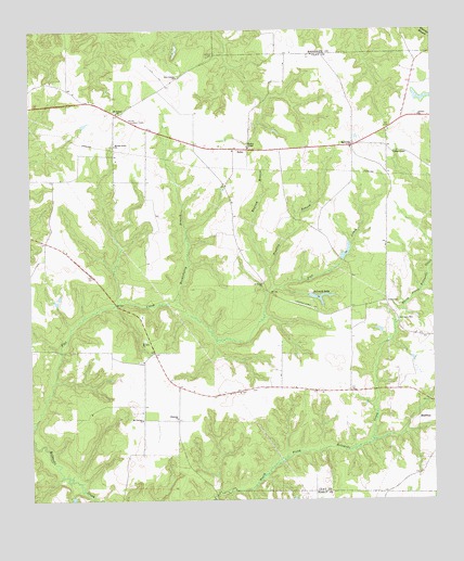
Zetto, GA USGS Topographic Map
Click on map above to begin viewing in our Map Viewer.

This topographic map contains these locations and features:
Feature Name Type Latitude Longitude GNIS ID View Map
Antioch ChurchChurchN31.6024°W84.8788°310566View Map
BellvillePopulated PlaceN31.5949°W84.8994°326179View Map
Bluffton DivisionCivilN31.5563°W84.9310°1936118View Map
Bryant-Neves CemeteryCemeteryN31.5296°W84.9308°344804View Map
Clay Lookout TowerTowerN31.6016°W84.9688°344211View Map
DeLoach LakeReservoirN31.5539°W84.9102°313376View Map
Deloach Lake DamDamN31.5568°W84.9133°341971View Map
Ebenezer ChurchChurchN31.5221°W84.9546°313821View Map
Engram BranchStreamN31.5618°W84.9263°313954View Map
Fendley BranchStreamN31.5563°W84.9246°314104View Map
Fendley LakeReservoirN31.5885°W84.9083°340845View Map
Fendley LakeReservoirN31.5702°W84.8983°341978View Map
Fendley Lake DamDamN31.5885°W84.9083°340844View Map
Fendley Lake DamDamN31.5702°W84.8983°341977View Map
Green ChapelChurchN31.5921°W84.8866°314830View Map
Harrisons MillPopulated PlaceN31.5482°W84.8858°356208View Map
Huckleberry BranchStreamN31.5538°W84.9544°315781View Map
Judson CemeteryCemeteryN31.6185°W84.9427°316294View Map
Mckemie LakeReservoirN31.5659°W84.9018°341974View Map
Mckemie Lake DamDamN31.5635°W84.9033°341973View Map
Mckemie Lake North DamDamN31.5685°W84.9216°341975View Map
Mckenie Lake NorthReservoirN31.5685°W84.9216°341976View Map
Mitchel Grove ChurchChurchN31.5949°W84.9735°318335View Map
Mount Calvary ChurchChurchN31.5218°W84.9655°318574View Map
Mount Vernon CemeteryCemeteryN31.6038°W84.9730°344827View Map
Mount Vernon ChurchChurchN31.6035°W84.9727°318900View Map
Mount Zion CemeteryCemeteryN31.5427°W84.9646°344828View Map
Mount Zion ChurchChurchN31.5424°W84.9652°318951View Map
New Judson ChurchChurchN31.6129°W84.9541°319455View Map
Saint Lukes ChurchChurchN31.5579°W84.9277°322155View Map
Wesley CemeteryCemeteryN31.5938°W84.9313°344839View Map
Wesley ChapelChurchN31.5941°W84.9324°325006View Map
ZettoPopulated PlaceN31.5935°W84.9369°326605View Map

Note: Coordinates in the location and feature list above are referenced to NAD83 datum.


Copyright (C) 2008-2024 Ryan Niemi / Sunset Dynamics ... All Rights Reserved