TopoQuest Logo
Do you find TopoQuest useful?
Help keep TopoQuest running and adding new maps/features by donating!
Bitcoin:  19c7KJd3qBynnjoSw5npx9KScwjBe4ifkT
Litecoin:  LXs6TkuXGGXo1vDsWCkWVdjQX94eUKd6ui
Home View Maps Find Maps Find Places Resources & Links


Yorkville, California Topographic Map

USGS Map Title: Yorkville, CA
USGS Map MRC: 38123H2
DRG (GeoTIFF) Download: o38123h2.tif


Neighboring USGS Topographic Map Quads:


  Boonville, CA  
39123A3
 

  Elledge Peak, CA  
39123A2
 

  Purdys Gardens, CA  
39123A1
 

  Ornbaun Valley, CA  
38123H3
 

  Yorkville, CA  
38123H2
 

  Hopland, CA  
38123H1
 

  Gube Mountain, CA  
38123G3
 

  Big Foot Mountain, CA  
38123G2
 

  Cloverdale, CA  
38123G1


Map MRC Location:

N39°
W124°
N39°
W123°
H8 H7 H6 H5 H4 H3 H2 H1
G8 G7 G6 G5 G4 G3 G2 G1
F8 F7 F6 F5 F4 F3 F2 F1
E8 E7 E6 E5 E4 E3 E2 E1
D8 D7 D6 D5 D4 D3 D2 D1
C8 C7 C6 C5 C4 C3 C2 C1
B8 B7 B6 B5 B4 B3 B2 B1
A8 A7 A6 A5 A4 A3 A2 A1
N38°
W124°
N38°
W123°

Yorkville, CA USGS 1:24K Topographic Map Preview:
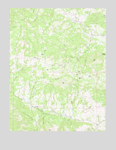
Yorkville, CA USGS Topographic Map
Click on map above to begin viewing in our Map Viewer.

This topographic map contains these locations and features:
Feature Name Type Latitude Longitude GNIS ID View Map
Anderson Valley Volunteer Fire Department Station 744BuildingN38.9068°W123.2339°2621998View Map
Burger RanchLocaleN38.9388°W123.1944°1652997View Map
Carlson RanchLocaleN38.8943°W123.1917°1653004View Map
Cory RanchLocaleN38.9713°W123.1581°1653010View Map
Crittendon (historical)Populated PlaceN38.9955°W123.1800°1653012View Map
Duncan CreekStreamN38.9713°W123.1403°222714View Map
Duncan PeakSummitN38.9466°W123.1389°222717View Map
Elkhorn CreekStreamN38.8924°W123.2028°223134View Map
Haehl RanchLocaleN38.8810°W123.1369°1653036View Map
Hilltop SpringSpringN38.9345°W123.1606°225344View Map
Hopper RanchLocaleN38.9727°W123.1356°1653047View Map
IngramPopulated PlaceN38.8902°W123.1719°1653048View Map
Ingram CreekStreamN38.8880°W123.1703°225930View Map
Jeep PeakSummitN38.9291°W123.1572°226159View Map
Johnson CreekStreamN38.9635°W123.1469°226298View Map
Johnson RanchLocaleN38.8868°W123.1506°1653053View Map
Lookout MountainSummitN38.9321°W123.1603°1659008View Map
Middle Fork Feliz CreekStreamN38.9846°W123.2289°228594View Map
Oak Ridge RanchLocaleN38.8896°W123.1272°1653080View Map
Pershaver RanchLocaleN38.9446°W123.1269°1653089View Map
Pregnant SpringSpringN38.9529°W123.2066°231032View Map
Saddle SpringSpringN38.9309°W123.1485°232107View Map
Sanel MountainSummitN38.9480°W123.2161°232526View Map
Snow MountainSummitN38.9371°W123.2000°253198View Map
The OaksPopulated PlaceN38.9046°W123.2261°1659985View Map
Ward MountainSummitN38.9241°W123.1786°237228View Map
YorkvillePopulated PlaceN38.8980°W123.2145°1660217View Map
Yorkville Post OfficePost OfficeN38.9067°W123.2338°2760065View Map
Young CreekStreamN38.9924°W123.2145°238281View Map

Note: Coordinates in the location and feature list above are referenced to NAD83 datum.


Copyright (C) 2008-2024 Ryan Niemi / Sunset Dynamics ... All Rights Reserved