TopoQuest Logo
Do you find TopoQuest useful?
Help keep TopoQuest running and adding new maps/features by donating!
Bitcoin:  19c7KJd3qBynnjoSw5npx9KScwjBe4ifkT
Litecoin:  LXs6TkuXGGXo1vDsWCkWVdjQX94eUKd6ui
Home View Maps Find Maps Find Places Resources & Links


Wynot, Nebraska Topographic Map

USGS Map Title: Wynot, NE
USGS Map MRC: 42097F2
DRG (GeoTIFF) Download: o42097f2.tif


Neighboring USGS Topographic Map Quads:


  Menominee, NE  
42097G3
 

  Saint Helena, NE  
42097G2
 

  Meckling, SD  
42097G1
 

  Fordyce, NE  
42097F3
 

  Wynot, NE  
42097F2
 

  Obert, NE  
42097F1
 

  Hartington, NE  
42097E3
 

  Coleridge, NE  
42097E2
 

  Coleridge SE, NE  
42097E1


Map MRC Location:

N43°
W98°
N43°
W97°
H8 H7 H6 H5 H4 H3 H2 H1
G8 G7 G6 G5 G4 G3 G2 G1
F8 F7 F6 F5 F4 F3 F2 F1
E8 E7 E6 E5 E4 E3 E2 E1
D8 D7 D6 D5 D4 D3 D2 D1
C8 C7 C6 C5 C4 C3 C2 C1
B8 B7 B6 B5 B4 B3 B2 B1
A8 A7 A6 A5 A4 A3 A2 A1
N42°
W98°
N42°
W97°

Wynot, NE USGS 1:24K Topographic Map Preview:
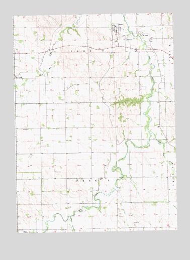
Wynot, NE USGS Topographic Map
Click on map above to begin viewing in our Map Viewer.

This topographic map contains these locations and features:
Feature Name Type Latitude Longitude GNIS ID View Map
Bow ValleyPopulated PlaceN42.7147°W97.2495°827580View Map
Bow Valley Post Office (historical)Post OfficeN42.7147°W97.2495°1874578View Map
Cedar County FairgroundLocaleN42.6256°W97.2476°1874577View Map
Dead CreekStreamN42.6342°W97.2084°828620View Map
East Bow CreekStreamN42.6808°W97.1448°828933View Map
Election Precinct 5CivilN42.7426°W97.1917°1929189View Map
Election Precinct 8CivilN42.6557°W97.1909°1929198View Map
Paragon CemeteryCemeteryN42.6555°W97.1856°831971View Map
Precinct EightCivilN42.6556°W97.1892°1874456View Map
Precinct FiveCivilN42.7417°W97.1920°1874454View Map
Saint Jamed Post Office (historical)Post OfficeN42.7381°W97.1509°1874520View Map
Saint JamesPopulated PlaceN42.7381°W97.1509°832871View Map
Village of WynotCivilN42.7398°W97.1697°2399747View Map
WynotPopulated PlaceN42.7403°W97.1692°834897View Map
Wynot (historical)LocaleN42.7389°W97.1670°1874535View Map
Wynot CemeteryCemeteryN42.7342°W97.1698°1874539View Map
Wynot City ParkParkN42.7394°W97.1684°1874538View Map
Wynot Emergency Medical Technician SquadBuildingN42.7394°W97.1709°2553699View Map
Wynot Fire DepartmentBuildingN42.7394°W97.1709°1874536View Map
Wynot Post OfficePost OfficeN42.7398°W97.1691°1874537View Map
Wynot Public SchoolsSchoolN42.7425°W97.1703°1874540View Map

Note: Coordinates in the location and feature list above are referenced to NAD83 datum.


Copyright (C) 2008-2024 Ryan Niemi / Sunset Dynamics ... All Rights Reserved