TopoQuest Logo
Do you find TopoQuest useful?
Help keep TopoQuest running and adding new maps/features by donating!
Bitcoin:  19c7KJd3qBynnjoSw5npx9KScwjBe4ifkT
Litecoin:  LXs6TkuXGGXo1vDsWCkWVdjQX94eUKd6ui
Home View Maps Find Maps Find Places Resources & Links


Worland, Wyoming Topographic Map

USGS Map Title: Worland, WY
USGS Map MRC: 44107A8
DRG (GeoTIFF) Download: o44107a8.tif


Neighboring USGS Topographic Map Quads:


  Schuster Flats NE, WY  
44108B1
 

  Rairden, WY  
44107B8
 

  McDermotts Butte, WY  
44107B7
 

  Schuster Flats SE, WY  
44108A1
 

  Worland, WY  
44107A8
 

  Worland SE, WY  
44107A7
 

  Neiber, WY  
43108H1
 

  Banjo Flats West, WY  
43107H8
 

  Banjo Flats East, WY  
43107H7


Map MRC Location:

N45°
W108°
N45°
W107°
H8 H7 H6 H5 H4 H3 H2 H1
G8 G7 G6 G5 G4 G3 G2 G1
F8 F7 F6 F5 F4 F3 F2 F1
E8 E7 E6 E5 E4 E3 E2 E1
D8 D7 D6 D5 D4 D3 D2 D1
C8 C7 C6 C5 C4 C3 C2 C1
B8 B7 B6 B5 B4 B3 B2 B1
A8 A7 A6 A5 A4 A3 A2 A1
N44°
W108°
N44°
W107°

Worland, WY USGS 1:24K Topographic Map Preview:
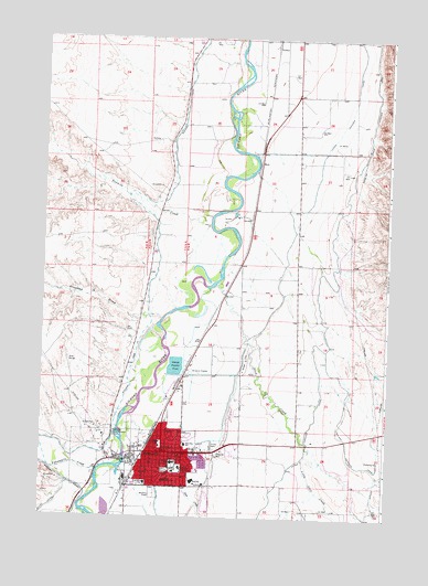
Worland, WY USGS Topographic Map
Click on map above to begin viewing in our Map Viewer.

This topographic map contains these locations and features:
Feature Name Type Latitude Longitude GNIS ID View Map
Bluff CanalCanalN44.0025°W107.9970°1585704View Map
City of WorlandCivilN44.0166°W107.9527°2412308View Map
Community Care of America at WorlandHospitalN44.0169°W107.9554°1794898View Map
Crooked DrawValleyN44.0519°W107.9559°1587244View Map
East Side Elementary SchoolSchoolN44.0188°W107.9474°1588135View Map
East Side SchoolSchoolN44.0169°W107.9554°1795664View Map
Evans Shopping CenterLocaleN44.0102°W107.9476°1764051View Map
Fifteenmile CreekStreamN44.0122°W107.9790°1588449View Map
Gee MineMineN44.0302°W107.9173°1704002View Map
Highland Hanover CanalCanalN44.0183°W107.8873°1589544View Map
KWOR-AM (Worland)TowerN44.0172°W107.9712°1608820View Map
Leithead DamDamN44.0516°W107.9790°1607592View Map
Leithead ReservoirReservoirN44.0516°W107.9790°1607593View Map
Little Slick CreekStreamN44.0172°W107.9012°1590878View Map
Lower Hanover CanalCanalN44.0694°W107.9112°1591087View Map
McCormac Pit Number One MineMineN44.0080°W107.9570°1726487View Map
North Side SchoolSchoolN44.0191°W107.9556°1592276View Map
Riverview Memorial GardensCemeteryN44.0218°W107.9754°1593493View Map
Sage CreekStreamN44.0122°W107.9712°1593750View Map
Saint Alban's Episcopal Church ColumbariumCemeteryN44.0169°W107.9342°2774503View Map
Saint Mary Magdalen SchoolSchoolN44.0094°W107.9548°1593791View Map
Sanders ParkParkN44.0122°W107.9543°1593926View Map
Slick CreekStreamN44.0613°W107.9356°1594453View Map
South Side Elementary SchoolSchoolN44.0119°W107.9518°1594735View Map
South Side SchoolSchoolN44.0169°W107.9554°1795665View Map
Tenmile CreekStreamN44.0763°W107.9390°1595356View Map
Washakie County Emergency Medical ServicesBuildingN44.0182°W107.9552°2673702View Map
Washakie Medical CenterHospitalN44.0127°W107.9494°1596054View Map
Washakie TenPopulated PlaceN44.0955°W107.9087°1853216View Map
Washakie Ten Census Designated PlaceCensusN44.0922°W107.9116°2409533View Map
West RiverPopulated PlaceN44.0986°W107.9534°1853218View Map
West River Census Designated PlaceCensusN44.0973°W107.9961°2409565View Map
West Side Elementary SchoolSchoolN44.0089°W107.9619°1596250View Map
West Side SchoolSchoolN44.0169°W107.9554°1795666View Map
WorlandPopulated PlaceN44.0169°W107.9554°1596624View Map
Worland High SchoolSchoolN44.0092°W107.9447°1795662View Map
Worland Middle SchoolSchoolN44.0108°W107.9416°1795663View Map
Worland Police DepartmentBuildingN44.0175°W107.9552°2752642View Map
Worland Post OfficePost OfficeN44.0176°W107.9604°2765619View Map
Worland Volunteer Fire DepartmentBuildingN44.0154°W107.9631°2673445View Map
Wyoming Highway Patrol District 5 Division GBuildingN44.0165°W107.9654°2752606View Map

Note: Coordinates in the location and feature list above are referenced to NAD83 datum.


Copyright (C) 2008-2024 Ryan Niemi / Sunset Dynamics ... All Rights Reserved