TopoQuest Logo
Do you find TopoQuest useful?
Help keep TopoQuest running and adding new maps/features by donating!
Bitcoin:  19c7KJd3qBynnjoSw5npx9KScwjBe4ifkT
Litecoin:  LXs6TkuXGGXo1vDsWCkWVdjQX94eUKd6ui
Home View Maps Find Maps Find Places Resources & Links


Boulder Peak, Montana Topographic Map

USGS Map Title: Boulder Peak, MT
USGS Map MRC: 45114G3
DRG (GeoTIFF) Download: o45114g3.tif


Neighboring USGS Topographic Map Quads:


  Tin Cup Lake, MT  
45114H4
 

  Trapper Peak, MT  
45114H3
 

  Burnt Ridge, MT  
45114H2
 

  Mount Jerusalem, MT  
45114G4
 

  Boulder Peak, MT  
45114G3
 

  Piquett Creek, MT  
45114G2
 

  Bare Cone, MT  
45114F4
 

  Painted Rocks Lake, MT  
45114F3
 

  Piquett Mountain, MT  
45114F2


Map MRC Location:

N46°
W115°
N46°
W114°
H8 H7 H6 H5 H4 H3 H2 H1
G8 G7 G6 G5 G4 G3 G2 G1
F8 F7 F6 F5 F4 F3 F2 F1
E8 E7 E6 E5 E4 E3 E2 E1
D8 D7 D6 D5 D4 D3 D2 D1
C8 C7 C6 C5 C4 C3 C2 C1
B8 B7 B6 B5 B4 B3 B2 B1
A8 A7 A6 A5 A4 A3 A2 A1
N45°
W115°
N45°
W114°

Boulder Peak, MT USGS 1:24K Topographic Map Preview:
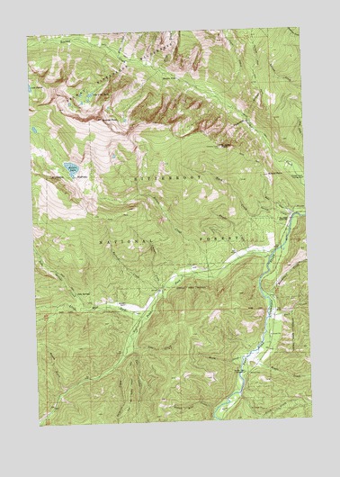
Boulder Peak, MT USGS Topographic Map
Click on map above to begin viewing in our Map Viewer.

This topographic map contains these locations and features:
Feature Name Type Latitude Longitude GNIS ID View Map
Barn DrawValleyN45.8158°W114.2568°779368View Map
Basin CreekStreamN45.7699°W114.2818°779403View Map
Beavertail CreekStreamN45.7888°W114.2706°779639View Map
Beetle GulchValleyN45.7610°W114.3631°779660View Map
Bonnie Blue CreekStreamN45.7535°W114.2948°780225View Map
Boulder FallsFallsN45.8598°W114.3080°780267View Map
Boulder PeakSummitN45.8469°W114.3426°780281View Map
Boulder PointSummitN45.8377°W114.2890°780282View Map
Brickley Stage Stop (historical)LocaleN45.7699°W114.2759°1803200View Map
Buck CreekStreamN45.7871°W114.2684°780506View Map
Crow CreekStreamN45.8533°W114.2906°781924View Map
Ditch CreekStreamN45.7591°W114.2831°782398View Map
Gemmell CreekStreamN45.7930°W114.3168°783881View Map
Halford CreekStreamN45.7919°W114.3179°784472View Map
Krueger RanchLocaleN45.7877°W114.3348°785853View Map
Lake of the RocksLakeN45.8553°W114.3477°789721View Map
Little West ForkStreamN45.7830°W114.3251°786395View Map
Little West Fork CampgroundLocaleN45.7838°W114.3298°794486View Map
Mink CreekStreamN45.8671°W114.3348°787479View Map
Nelson CreekStreamN45.7955°W114.2943°787942View Map
Nelson LakeLakeN45.8319°W114.3572°787946View Map
Nez Perce ForkStreamN45.8013°W114.2676°787980View Map
Old Nez Perce Indian TrailTrailN45.7610°W114.3334°788422View Map
One CreekStreamN45.7738°W114.3312°788462View Map
Rombo CemeteryCemeteryN45.7646°W114.2787°789752View Map
Rombo CreekStreamN45.7724°W114.2743°789753View Map
Rombo Creek CampgroundLocaleN45.7652°W114.2806°789754View Map
School PointSummitN45.8283°W114.2676°790126View Map
Sentimental CreekStreamN45.7879°W114.3657°806345View Map
Slide CreekStreamN45.8624°W114.3162°790658View Map
Soda SpringsSpringN45.7918°W114.3573°790827View Map
Soda Springs CreekStreamN45.7863°W114.3526°790828View Map
Surprise CreekStreamN45.7677°W114.3404°791736View Map
Swamp CreekStreamN45.8144°W114.2570°791757View Map
Trapper Peak TrailTrailN45.8744°W114.2729°792353View Map
Two CreekStreamN45.7824°W114.3273°792547View Map
Ward CreekStreamN45.8110°W114.2584°792810View Map
West Fork Ranger StationLocaleN45.8135°W114.2590°793065View Map
West Fork Volunteer Fire Department Station 2BuildingN45.8022°W114.2815°2546545View Map
Wheeler CreekStreamN45.8033°W114.2662°793156View Map

Note: Coordinates in the location and feature list above are referenced to NAD83 datum.


Copyright (C) 2008-2024 Ryan Niemi / Sunset Dynamics ... All Rights Reserved