TopoQuest Logo
Do you find TopoQuest useful?
Help keep TopoQuest running and adding new maps/features by donating!
Bitcoin:  19c7KJd3qBynnjoSw5npx9KScwjBe4ifkT
Litecoin:  LXs6TkuXGGXo1vDsWCkWVdjQX94eUKd6ui
Home View Maps Find Maps Find Places Resources & Links


Woodridge, New York Topographic Map

USGS Map Title: Woodridge, NY
USGS Map MRC: 41074F5
DRG (GeoTIFF) Download: o41074f5.tif


Neighboring USGS Topographic Map Quads:


  Liberty East, NY  
41074G6
 

  Grahamsville, NY  
41074G5
 

  Rondout Reservoir, NY  
41074G4
 

  Monticello, NY  
41074F6
 

  Woodridge, NY  
41074F5
 

  Ellenville, NY  
41074F4
 

  Hartwood, NY  
41074E6
 

  Yankee Lake, NY  
41074E5
 

  Wurtsboro, NY  
41074E4


Map MRC Location:

N42°
W75°
N42°
W74°
H8 H7 H6 H5 H4 H3 H2 H1
G8 G7 G6 G5 G4 G3 G2 G1
F8 F7 F6 F5 F4 F3 F2 F1
E8 E7 E6 E5 E4 E3 E2 E1
D8 D7 D6 D5 D4 D3 D2 D1
C8 C7 C6 C5 C4 C3 C2 C1
B8 B7 B6 B5 B4 B3 B2 B1
A8 A7 A6 A5 A4 A3 A2 A1
N41°
W75°
N41°
W74°

Woodridge, NY USGS 1:24K Topographic Map Preview:
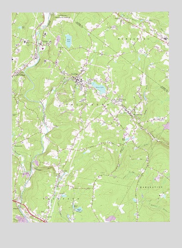
Woodridge, NY USGS Topographic Map
Click on map above to begin viewing in our Map Viewer.

This topographic map contains these locations and features:
Feature Name Type Latitude Longitude GNIS ID View Map
Beaver LakeLakeN41.6327°W74.5719°943391View Map
Benjamin Cosor Elementary SchoolSchoolN41.7283°W74.5999°2597979View Map
Bowers PondLakeN41.6344°W74.5762°944514View Map
Braden BrookStreamN41.6854°W74.5227°944567View Map
BridgevillePopulated PlaceN41.6343°W74.6190°944730View Map
DairylandPopulated PlaceN41.7470°W74.5374°947991View Map
East PondLakeN41.7333°W74.5797°949214View Map
FallsburgPopulated PlaceN41.7320°W74.6013°949896View Map
Fallsburg Junior - Senior High SchoolSchoolN41.7325°W74.6143°946227View Map
Fallsburg Post OfficePost OfficeN41.7308°W74.6048°2599231View Map
Fowlwood BrookStreamN41.6587°W74.6090°950551View Map
Glen WildPopulated PlaceN41.6540°W74.5868°951195View Map
Glen Wild Post OfficePost OfficeN41.6531°W74.5873°2599162View Map
Hillside CemeteryCemeteryN41.6713°W74.5372°952840View Map
Katz PondLakeN41.6743°W74.5335°954406View Map
Little Grove Holiness ChurchChurchN41.7113°W74.5759°2597992View Map
Mountain DalePopulated PlaceN41.6895°W74.5313°957939View Map
Mountain Dale Post OfficePost OfficeN41.6898°W74.5307°2599234View Map
Mountaindale Fire DistrictBuildingN41.6909°W74.5328°2718589View Map
Mountaindale Wastewater Treatment PlantLocaleN41.6849°W74.5330°2597266View Map
Neversink River BridgeBridgeN41.6776°W74.5982°2614959View Map
Neversink River BridgeBridgeN41.6776°W74.5982°2599189View Map
Rock HillPopulated PlaceN41.6259°W74.5977°962702View Map
Rock Hill Drive-In (historical)LocaleN41.6300°W74.6006°2557902View Map
Rock Hill Fire DepartmentBuildingN41.6303°W74.5973°2718328View Map
Saint Andrew Episcopal ChurchChurchN41.7146°W74.6198°2598319View Map
Sheldrake StreamStreamN41.6554°W74.6102°965024View Map
Silver LakeReservoirN41.7052°W74.5553°965265View Map
South Fallsburg Wastewater Treatment PlantLocaleN41.7155°W74.6153°2597190View Map
Sullivan Correctional FacilityBuildingN41.7430°W74.5899°2756202View Map
Sullivan Correctional Facility HeliportAirportN41.7206°W74.5810°978376View Map
Taylor BrookStreamN41.6748°W74.5118°967077View Map
The First Church of GodChurchN41.7200°W74.6116°2598001View Map
Town of FallsburgCivilN41.7391°W74.6038°978951View Map
Village of WoodridgeCivilN41.7126°W74.5741°2391225View Map
Wohl LakeLakeN41.7411°W74.6180°971535View Map
WoodridgePopulated PlaceN41.7106°W74.5743°971689View Map
Woodridge Post OfficePost OfficeN41.7080°W74.5708°2599236View Map
Woodridge Village Wastewater Treatment PlantLocaleN41.7020°W74.6073°2597259View Map
Woodridge Volunteer Fire DepartmentBuildingN41.7093°W74.5714°2735428View Map

Note: Coordinates in the location and feature list above are referenced to NAD83 datum.


Copyright (C) 2008-2024 Ryan Niemi / Sunset Dynamics ... All Rights Reserved