TopoQuest Logo
Do you find TopoQuest useful?
Help keep TopoQuest running and adding new maps/features by donating!
Bitcoin:  19c7KJd3qBynnjoSw5npx9KScwjBe4ifkT
Litecoin:  LXs6TkuXGGXo1vDsWCkWVdjQX94eUKd6ui
Home View Maps Find Maps Find Places Resources & Links


Boulder City NW, Nevada Topographic Map

USGS Map Title: Boulder City NW, NV
USGS Map MRC: 35114H8
DRG (GeoTIFF) Download: o35114h8.tif


Neighboring USGS Topographic Map Quads:


  Las Vegas SE, NV  
36115A1
 

  Henderson, NV  
36114A8
 

  Boulder Beach, NV  
36114A7
 

  Sloan NE, NV  
35115H1
 

  Boulder City NW, NV  
35114H8
 

  Boulder City, NV  
35114H7
 

  Sloan SE, NV  
35115G1
 

  Boulder City SW, NV  
35114G8
 

  Boulder City SE, NV  
35114G7


Map MRC Location:

N36°
W115°
N36°
W114°
H8 H7 H6 H5 H4 H3 H2 H1
G8 G7 G6 G5 G4 G3 G2 G1
F8 F7 F6 F5 F4 F3 F2 F1
E8 E7 E6 E5 E4 E3 E2 E1
D8 D7 D6 D5 D4 D3 D2 D1
C8 C7 C6 C5 C4 C3 C2 C1
B8 B7 B6 B5 B4 B3 B2 B1
A8 A7 A6 A5 A4 A3 A2 A1
N35°
W115°
N35°
W114°

Boulder City NW, NV USGS 1:24K Topographic Map Preview:
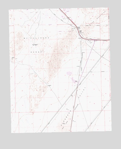
Boulder City NW, NV USGS Topographic Map
Click on map above to begin viewing in our Map Viewer.

This topographic map contains these locations and features:
Feature Name Type Latitude Longitude GNIS ID View Map
Alunite (historical)LocaleN35.9753°W114.9144°857890View Map
Alunite MineMineN35.9744°W114.9133°838430View Map
Alunite Mining DistrictCivilN35.9750°W114.9130°855028View Map
Black HillSummitN35.9564°W114.9444°855018View Map
Blue Quartz MineMineN35.9219°W114.9547°848503View Map
Dutchman PassGapN35.9644°W114.9728°847317View Map
Jack and Terry Mannion Middle SchoolSchoolN35.9899°W114.9800°2085594View Map
KGZA-AM (Boulder City)TowerN35.9833°W114.8911°865031View Map
Klinger SpringSpringN35.9680°W114.9083°851500View Map
KROL-AM (East Las Vegas)TowerN35.9761°W114.9508°865033View Map
Lucky Dutchman MineMineN35.9253°W114.9544°847555View Map
Marlan J Walker Elementary SchoolSchoolN35.9956°W114.9595°2084998View Map
Mission Hills ParkParkN35.9975°W114.9599°2473354View Map
Mount ScorpionSummitN35.9587°W114.9432°2771429View Map
Nevada State College Main CampusSchoolN35.9872°W114.9389°2087644View Map
Quail WashArroyoN35.9119°W114.9161°1738062View Map
Quo Vadis MineMineN35.9503°W114.9975°843042View Map
Railroad PassGapN35.9786°W114.9164°843059View Map
Spearhead MineMineN35.9750°W114.9130°855590View Map
Texas AcresPopulated PlaceN35.9750°W114.9130°847147View Map

Note: Coordinates in the location and feature list above are referenced to NAD83 datum.


Copyright (C) 2008-2024 Ryan Niemi / Sunset Dynamics ... All Rights Reserved