TopoQuest Logo
Do you find TopoQuest useful?
Help keep TopoQuest running and adding new maps/features by donating!
Bitcoin:  19c7KJd3qBynnjoSw5npx9KScwjBe4ifkT
Litecoin:  LXs6TkuXGGXo1vDsWCkWVdjQX94eUKd6ui
Home View Maps Find Maps Find Places Resources & Links


Wolf Hill, Texas Topographic Map

USGS Map Title: Wolf Hill, TX
USGS Map MRC: 31094A5
DRG (GeoTIFF) Download: o31094a5.tif


Neighboring USGS Topographic Map Quads:


  Bald Hill, TX  
31094B6
 

  Manning, TX  
31094B5
 

  Zavalla, TX  
31094B4
 

  Pluck, TX  
31094A6
 

  Wolf Hill, TX  
31094A5
 

  Rockland, TX  
31094A4
 

  Camden, TX  
30094H6
 

  Chester, TX  
30094H5
 

  Colmesneil, TX  
30094H4


Map MRC Location:

N32°
W95°
N32°
W94°
H8 H7 H6 H5 H4 H3 H2 H1
G8 G7 G6 G5 G4 G3 G2 G1
F8 F7 F6 F5 F4 F3 F2 F1
E8 E7 E6 E5 E4 E3 E2 E1
D8 D7 D6 D5 D4 D3 D2 D1
C8 C7 C6 C5 C4 C3 C2 C1
B8 B7 B6 B5 B4 B3 B2 B1
A8 A7 A6 A5 A4 A3 A2 A1
N31°
W95°
N31°
W94°

Wolf Hill, TX USGS 1:24K Topographic Map Preview:
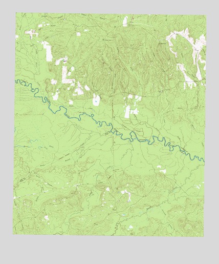
Wolf Hill, TX USGS Topographic Map
Click on map above to begin viewing in our Map Viewer.

This topographic map contains these locations and features:
Feature Name Type Latitude Longitude GNIS ID View Map
Banks CreekStreamN31.0682°W94.5694°1351482View Map
Barclay CemeteryCemeteryN31.0269°W94.5560°1351500View Map
Big BranchStreamN31.1077°W94.6138°1352030View Map
Biloxi CreekStreamN31.0777°W94.6052°1352202View Map
Buck CreekStreamN31.0905°W94.6083°1383672View Map
Buck CreekStreamN31.0907°W94.6121°1353126View Map
Burris CreekStreamN31.0446°W94.5019°1353382View Map
Caney CreekStreamN31.0541°W94.5491°1353736View Map
Clear CreekStreamN31.0491°W94.5158°1354617View Map
Crain CemeteryCemeteryN31.1216°W94.5930°1355304View Map
Dry CreekStreamN31.0916°W94.6113°1356326View Map
Fourmile BranchStreamN31.0177°W94.5294°1357639View Map
Futch CemeteryCemeteryN31.0180°W94.5363°1357809View Map
Gin CreekStreamN31.0694°W94.5666°1358035View Map
Havard CemeteryCemeteryN31.0819°W94.5288°1358900View Map
Howell CreekStreamN31.0474°W94.5983°1359743View Map
Johnson CreekStreamN31.0549°W94.5388°1360328View Map
Lambert ChapelChurchN31.1105°W94.5663°1360909View Map
Loggins CreekStreamN31.0555°W94.5308°1361618View Map
McDuffy BranchStreamN31.0316°W94.6071°1362436View Map
Page CemeteryCemeteryN31.1152°W94.5996°1364687View Map
Piney CreekStreamN31.0588°W94.5616°1365319View Map
Powell BranchStreamN31.0541°W94.5010°1365700View Map
Powell BranchStreamN31.0544°W94.5010°1383684View Map
Saline BranchStreamN31.0360°W94.6119°1367362View Map
Sandy BranchStreamN31.0577°W94.5599°1367691View Map
Wolf HillSummitN31.1088°W94.5299°1371851View Map
Wolf Hill Lookout TowerTowerN31.1194°W94.5510°1384710View Map

Note: Coordinates in the location and feature list above are referenced to NAD83 datum.


Copyright (C) 2008-2024 Ryan Niemi / Sunset Dynamics ... All Rights Reserved