TopoQuest Logo
Do you find TopoQuest useful?
Help keep TopoQuest running and adding new maps/features by donating!
Bitcoin:  19c7KJd3qBynnjoSw5npx9KScwjBe4ifkT
Litecoin:  LXs6TkuXGGXo1vDsWCkWVdjQX94eUKd6ui
Home View Maps Find Maps Find Places Resources & Links


Wittsburg, Arkansas Topographic Map

USGS Map Title: Wittsburg, AR
USGS Map MRC: 35090B6
DRG (GeoTIFF) Download: o35090b6.tif


Neighboring USGS Topographic Map Quads:


  Vanndale, AR  
35090C7
 

  Princedale, AR  
35090C6
 

  Parkin, AR  
35090C5
 

  Wynne, AR  
35090B7
 

  Wittsburg, AR  
35090B6
 

  Gieseck, AR  
35090B5
 

  Forrest City, AR  
35090A7
 

  Madison, AR  
35090A6
 

  Round Pond, AR  
35090A5


Map MRC Location:

N36°
W91°
N36°
W90°
H8 H7 H6 H5 H4 H3 H2 H1
G8 G7 G6 G5 G4 G3 G2 G1
F8 F7 F6 F5 F4 F3 F2 F1
E8 E7 E6 E5 E4 E3 E2 E1
D8 D7 D6 D5 D4 D3 D2 D1
C8 C7 C6 C5 C4 C3 C2 C1
B8 B7 B6 B5 B4 B3 B2 B1
A8 A7 A6 A5 A4 A3 A2 A1
N35°
W91°
N35°
W90°

Wittsburg, AR USGS 1:24K Topographic Map Preview:
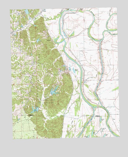
Wittsburg, AR USGS Topographic Map
Click on map above to begin viewing in our Map Viewer.

This topographic map contains these locations and features:
Feature Name Type Latitude Longitude GNIS ID View Map
Allens LakeLakeN35.1648°W90.6515°76161View Map
Antioch ChurchChurchN35.1706°W90.7304°45898View Map
Antioch School (historical)SchoolN35.1693°W90.7326°1730611View Map
Austelle BarBarN35.2206°W90.6832°45978View Map
Bay Ferry ChurchChurchN35.2256°W90.6687°46168View Map
Big Bear LakeLakeN35.1422°W90.6471°83076View Map
Block BendBendN35.2443°W90.6554°46721View Map
Budsmith (historical)Populated PlaceN35.2404°W90.7234°61628View Map
Bushy LakeLakeN35.1292°W90.6570°83096View Map
Clark Corner CutoffBendN35.1301°W90.6712°83102View Map
Copeland SloughStreamN35.2479°W90.6701°48025View Map
Copperas CreekStreamN35.2456°W90.6901°48031View Map
Dillon School (historical)SchoolN35.1262°W90.6409°1730619View Map
Elbow SloughStreamN35.2417°W90.6330°76864View Map
Filligrum BendBendN35.1318°W90.6371°83147View Map
Flag Lake CrossingPopulated PlaceN35.2237°W90.6432°57757View Map
Grassy LakeLakeN35.1840°W90.6454°77057View Map
Grassy LakeBendN35.1945°W90.6443°49574View Map
Harefarm CreekStreamN35.2481°W90.6848°45745View Map
Harris Chapel Baptist ChurchChurchN35.1998°W90.7237°77130View Map
Hidden Valley LakeReservoirN35.2201°W90.7218°79939View Map
Hidden Valley Lake DamDamN35.2201°W90.7218°79938View Map
Hunter Rest Club LakeReservoirN35.2479°W90.7303°79937View Map
Hunter Rest Club Lake DamDamN35.2468°W90.7284°79936View Map
Johnson BendBendN35.2190°W90.6523°72201View Map
Johnson ChapelChurchN35.1681°W90.6682°50688View Map
KintonPopulated PlaceN35.1423°W90.6337°83188View Map
KWYN-FM (Wynne)TowerN35.1998°W90.7232°85436View Map
Lake AustellReservoirN35.1528°W90.7235°59252View Map
Lake Austell DamDamN35.1540°W90.7196°81253View Map
Lake DunnReservoirN35.1705°W90.7009°59253View Map
Lake Dunn DamDamN35.1681°W90.7043°81252View Map
LevesquePopulated PlaceN35.2493°W90.7107°77480View Map
Levesque Assembly of God ChurchChurchN35.2434°W90.7121°61686View Map
Little Bear LakeLakeN35.1320°W90.6462°83197View Map
Morledge School (historical)SchoolN35.1593°W90.6707°1730613View Map
Morris BendBendN35.1515°W90.6407°52213View Map
Mussel BarBarN35.1556°W90.6551°52564View Map
New Hope Baptist ChurchChurchN35.1968°W90.7271°77824View Map
New Hope School (historical)SchoolN35.2073°W90.7321°1730614View Map
Rolfe SchoolSchoolN35.1806°W90.6509°54172View Map
Saint Francis BayStreamN35.2490°W90.6812°54323View Map
Saint Francis FloodwayFlatN35.1409°W90.6829°83264View Map
Saint James Baptist ChurchChurchN35.2098°W90.6551°78236View Map
Saint Marks CemeteryCemeteryN35.1992°W90.6887°1730616View Map
Saint Marks ChurchChurchN35.1987°W90.6904°54405View Map
Short BendBendN35.2243°W90.6293°54823View Map
Township of SmithCivilN35.2137°W90.6834°66479View Map
Turkey Roost DrainStreamN35.1779°W90.6698°55729View Map
Valley View Baptist ChurchChurchN35.2409°W90.7251°78644View Map
Village CreekStreamN35.1765°W90.6709°56414View Map
Village Creek State ParkParkN35.1612°W90.7084°82876View Map
Walters CemeteryCemeteryN35.1820°W90.6679°56025View Map
WittsburgPopulated PlaceN35.2190°W90.7018°58904View Map
Wittsburg Ferry (historical)CrossingN35.2181°W90.6979°1730617View Map
Wittsburg IslandFlatN35.2362°W90.6740°56472View Map
Wittsburg LakeLakeN35.1901°W90.6769°77322View Map
Yancopin LakeLakeN35.1843°W90.6384°77324View Map

Note: Coordinates in the location and feature list above are referenced to NAD83 datum.


Copyright (C) 2008-2024 Ryan Niemi / Sunset Dynamics ... All Rights Reserved